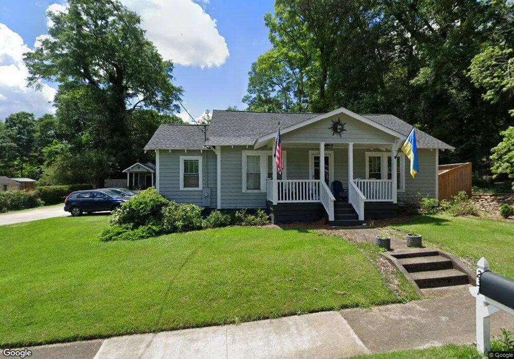
231 Brown St Carrollton, GA 30117
Estimated Value: $265,000 - $300,000
3
Beds
2
Baths
1,910
Sq Ft
$148/Sq Ft
Est. Value
About This Home
This home is located at 231 Brown St, Carrollton, GA 30117 and is currently estimated at $282,815, approximately $148 per square foot. 231 Brown St is a home located in Carroll County with nearby schools including Carrollton Elementary School, Carrollton Upper Elementary School, and Carrollton Middle School.
Ownership History
Date
Name
Owned For
Owner Type
Purchase Details
Closed on
Jun 18, 2007
Sold by
Campbell Jason A
Bought by
Delaney Bryce
Current Estimated Value
Home Financials for this Owner
Home Financials are based on the most recent Mortgage that was taken out on this home.
Original Mortgage
$80,000
Outstanding Balance
$48,397
Interest Rate
6.16%
Mortgage Type
New Conventional
Estimated Equity
$234,418
Purchase Details
Closed on
Jul 16, 2002
Sold by
Cardona Arlean Carol
Bought by
Campbell Jason A
Purchase Details
Closed on
Oct 28, 1996
Sold by
Cardona Rafael
Bought by
Cardona Arlean Carol
Purchase Details
Closed on
May 24, 1995
Sold by
Secretary Of Veteran
Bought by
Cardona Rafael
Purchase Details
Closed on
Dec 15, 1994
Sold by
Dept Of Veterans Aff
Bought by
Secretary Of Veteran
Purchase Details
Closed on
Oct 20, 1994
Sold by
Carollton Federal Ba
Bought by
Dept Of Veterans Aff
Purchase Details
Closed on
May 3, 1994
Bought by
Carollton Federal Ba
Create a Home Valuation Report for This Property
The Home Valuation Report is an in-depth analysis detailing your home's value as well as a comparison with similar homes in the area
Home Values in the Area
Average Home Value in this Area
Purchase History
| Date | Buyer | Sale Price | Title Company |
|---|---|---|---|
| Delaney Bryce | $95,000 | -- | |
| Campbell Jason A | $105,000 | -- | |
| Cardona Arlean Carol | -- | -- | |
| Cardona Rafael | $53,000 | -- | |
| Secretary Of Veteran | -- | -- | |
| Dept Of Veterans Aff | -- | -- | |
| Carollton Federal Ba | $42,100 | -- |
Source: Public Records
Mortgage History
| Date | Status | Borrower | Loan Amount |
|---|---|---|---|
| Open | Delaney Bryce | $80,000 |
Source: Public Records
Tax History Compared to Growth
Tax History
| Year | Tax Paid | Tax Assessment Tax Assessment Total Assessment is a certain percentage of the fair market value that is determined by local assessors to be the total taxable value of land and additions on the property. | Land | Improvement |
|---|---|---|---|---|
| 2025 | $659 | $107,378 | $32,562 | $74,816 |
| 2024 | $667 | $107,378 | $32,562 | $74,816 |
| 2023 | $651 | $100,697 | $32,563 | $68,134 |
| 2022 | $1,972 | $76,377 | $21,709 | $54,668 |
| 2021 | $1,667 | $63,119 | $16,080 | $47,039 |
| 2020 | $1,167 | $44,885 | $16,080 | $28,805 |
| 2019 | $1,130 | $42,840 | $16,080 | $26,760 |
| 2018 | $1,094 | $40,614 | $16,080 | $24,534 |
| 2017 | $1,100 | $40,614 | $16,080 | $24,534 |
| 2016 | $1,106 | $40,614 | $16,080 | $24,534 |
| 2015 | $1,098 | $39,550 | $9,600 | $29,950 |
| 2014 | $1,103 | $39,550 | $9,600 | $29,950 |
Source: Public Records
Map
Nearby Homes
- 301 Brown St
- 541 N White St Unit 12
- 541 N White St
- 201 Stewart St
- 322 Cedar St
- 501 Cedar St
- 777 College St
- 119 Oxford Square
- 103 W Chandler St
- 110 Town Walk Ln
- 123 Cedar Park Way
- 0 Ward St Unit 10390499
- 230 West Ave
- 230 West Ave Unit 5
- 205 Johnson Ave Unit 231
- 123 Autumn Glen Dr
- 108 Springwood Dr
- 405 N Park St
- TRACT1-7 Us Highway 27
- 209 Hill Dr