Estimated Value: $226,986 - $264,000
3
Beds
2
Baths
1,169
Sq Ft
$205/Sq Ft
Est. Value
About This Home
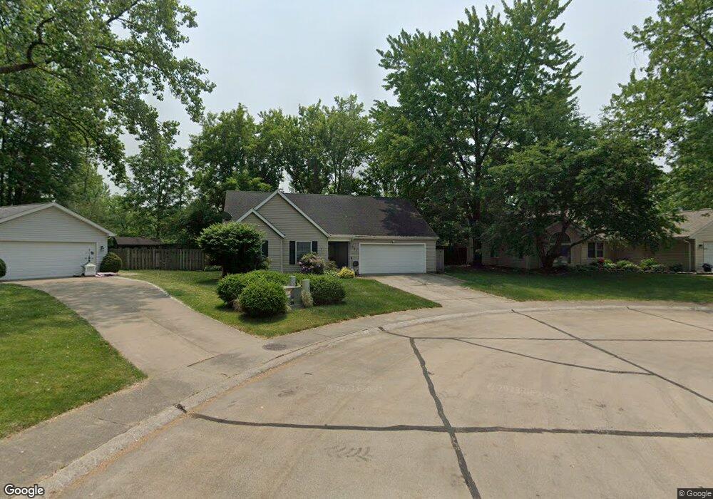
This home is located at 231 Butternut Ln, Berea, OH 44017 and is currently estimated at $239,747, approximately $205 per square foot. 231 Butternut Ln is a home located in Cuyahoga County with nearby schools including Grindstone Elementary School, Berea-Midpark Middle School, and Berea-Midpark High School.
Ownership History
Date
Name
Owned For
Owner Type
Purchase Details
Closed on
Nov 30, 1994
Sold by
Kay Rodney J
Bought by
Boone Roger W and Boone Susan M
Current Estimated Value
Home Financials for this Owner
Home Financials are based on the most recent Mortgage that was taken out on this home.
Original Mortgage
$106,300
Interest Rate
5.7%
Mortgage Type
New Conventional
Purchase Details
Closed on
Jan 1, 1993
Bought by
Kay Rodney J
Create a Home Valuation Report for This Property
The Home Valuation Report is an in-depth analysis detailing your home's value as well as a comparison with similar homes in the area
Home Values in the Area
Average Home Value in this Area
Purchase History
| Date | Buyer | Sale Price | Title Company |
|---|---|---|---|
| Boone Roger W | $111,900 | -- | |
| Kay Rodney J | -- | -- |
Source: Public Records
Mortgage History
| Date | Status | Borrower | Loan Amount |
|---|---|---|---|
| Closed | Boone Roger W | $106,300 |
Source: Public Records
Tax History
| Year | Tax Paid | Tax Assessment Tax Assessment Total Assessment is a certain percentage of the fair market value that is determined by local assessors to be the total taxable value of land and additions on the property. | Land | Improvement |
|---|---|---|---|---|
| 2024 | $4,357 | $75,285 | $11,935 | $63,350 |
| 2023 | $4,001 | $57,930 | $10,710 | $47,220 |
| 2022 | $3,976 | $57,930 | $10,710 | $47,220 |
| 2021 | $3,942 | $57,930 | $10,710 | $47,220 |
| 2020 | $3,765 | $49,070 | $9,070 | $40,010 |
| 2019 | $3,664 | $140,200 | $25,900 | $114,300 |
| 2018 | $3,914 | $49,070 | $9,070 | $40,010 |
| 2017 | $4,430 | $42,080 | $7,740 | $34,340 |
| 2016 | $4,500 | $42,080 | $7,740 | $34,340 |
| 2015 | $4,649 | $42,080 | $7,740 | $34,340 |
| 2014 | $4,649 | $44,280 | $8,160 | $36,120 |
Source: Public Records
Map
Nearby Homes
- 487 Karen Dr
- 146 Marian Ln
- 428 Park Place
- 379 Laurel Dr
- 445 Berea St
- 160 Marian Ln Unit 6A
- 404 Crescent Dr
- 628 Lindbergh Blvd
- 93 W 5th Ave
- 211 W Bridge St
- 216 Kraft St
- 209 Gibson St
- 300 West St
- 287 Edgewood Dr
- 41 W 5th Ave
- 446 Redwood Dr
- 725 Shakespeare Dr
- 388 Fairwood Cir
- 47 Prospect St
- 160 Stonepointe Dr
- 237 Butternut Ln
- 225 Butternut Ln
- 243 Butternut Ln
- 232 Butternut Ln
- 249 Butternut Ln
- 238 Butternut Ln
- 244 Butternut Ln
- 253 Butternut Ln
- 227 Savage St
- 205 Savage St
- 250 Butternut Ln
- 259 Butternut Ln
- 362 Butternut Ln
- 235 Savage St
- 215 Savage St
- 263 Butternut Ln
- 203 Savage St
- 243 Savage St
- 366 Fern Dr
- 239 Buckeye Dr
Your Personal Tour Guide
Ask me questions while you tour the home.