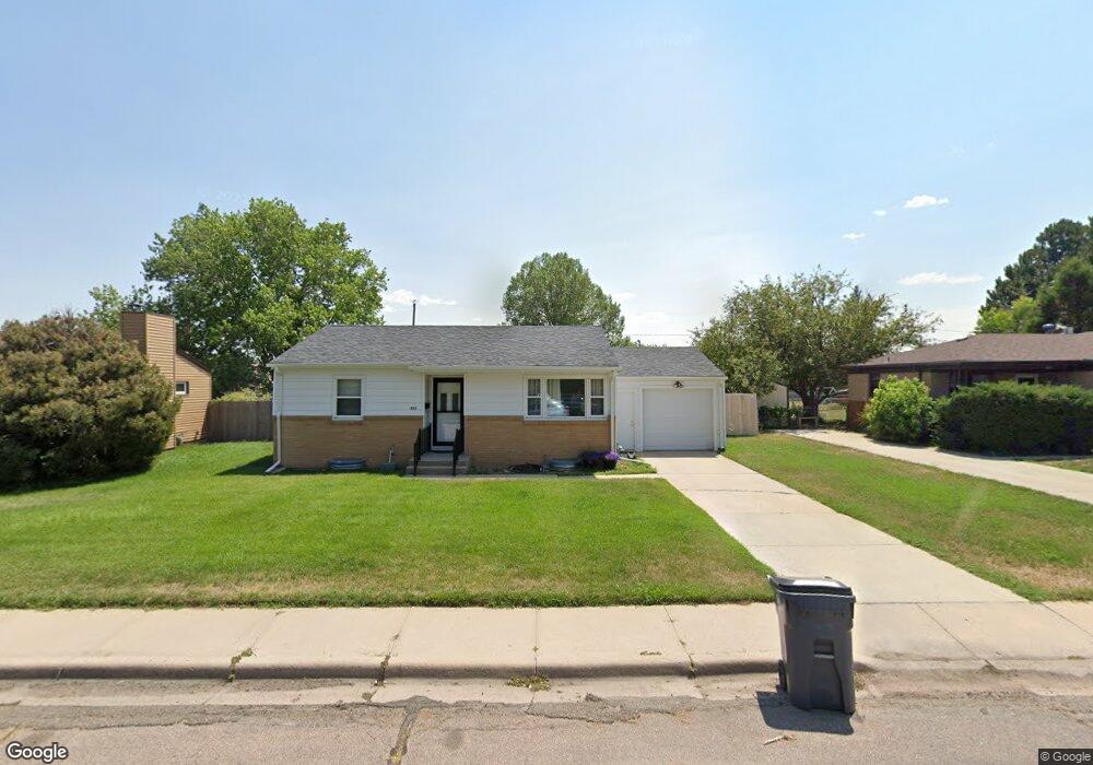
231 Carroll Ave Cheyenne, WY 82009
Estimated Value: $296,000 - $314,809
--
Bed
--
Bath
1,024
Sq Ft
$300/Sq Ft
Est. Value
About This Home
This home is located at 231 Carroll Ave, Cheyenne, WY 82009 and is currently estimated at $307,702, approximately $300 per square foot. 231 Carroll Ave is a home located in Laramie County with nearby schools including Hobbs Elementary School, McCormick Junior High School, and Central High School.
Ownership History
Date
Name
Owned For
Owner Type
Purchase Details
Closed on
Jan 13, 2020
Sold by
Carroll Diane W
Bought by
Carroll Diane W and Diane W Carroll Revocable Trust
Current Estimated Value
Purchase Details
Closed on
Apr 4, 2014
Sold by
Medley Rosella
Bought by
Carroll Diane W
Purchase Details
Closed on
Apr 3, 2014
Sold by
Medley John T
Bought by
Carroll Diane W
Purchase Details
Closed on
Jun 21, 2006
Sold by
Laub Kay and Laub Kay H
Bought by
Medley John
Home Financials for this Owner
Home Financials are based on the most recent Mortgage that was taken out on this home.
Original Mortgage
$103,000
Interest Rate
6.56%
Mortgage Type
New Conventional
Purchase Details
Closed on
Aug 6, 2004
Sold by
Bennett Richard E
Bought by
Laub Kay and Laub Kay H
Home Financials for this Owner
Home Financials are based on the most recent Mortgage that was taken out on this home.
Original Mortgage
$106,650
Interest Rate
6.26%
Mortgage Type
Purchase Money Mortgage
Purchase Details
Closed on
Feb 10, 2004
Sold by
Bennett Edward B
Bought by
Bennett Richard E
Create a Home Valuation Report for This Property
The Home Valuation Report is an in-depth analysis detailing your home's value as well as a comparison with similar homes in the area
Home Values in the Area
Average Home Value in this Area
Purchase History
| Date | Buyer | Sale Price | Title Company |
|---|---|---|---|
| Carroll Diane W | -- | None Available | |
| Carroll Diane W | -- | None Available | |
| Carroll Diane W | -- | None Available | |
| Medley John | -- | None Available | |
| Laub Kay | -- | -- | |
| Bennett Richard E | -- | -- |
Source: Public Records
Mortgage History
| Date | Status | Borrower | Loan Amount |
|---|---|---|---|
| Previous Owner | Medley John | $103,000 | |
| Previous Owner | Laub Kay | $106,650 |
Source: Public Records
Tax History Compared to Growth
Tax History
| Year | Tax Paid | Tax Assessment Tax Assessment Total Assessment is a certain percentage of the fair market value that is determined by local assessors to be the total taxable value of land and additions on the property. | Land | Improvement |
|---|---|---|---|---|
| 2025 | $1,607 | $11,730 | $2,154 | $9,576 |
| 2024 | $1,607 | $22,723 | $4,308 | $18,415 |
| 2023 | $1,557 | $22,015 | $4,308 | $17,707 |
| 2022 | $1,518 | $21,031 | $4,308 | $16,723 |
| 2021 | $1,336 | $18,474 | $4,308 | $14,166 |
| 2020 | $1,298 | $17,986 | $4,308 | $13,678 |
| 2019 | $1,195 | $16,551 | $4,308 | $12,243 |
| 2018 | $1,085 | $15,176 | $3,857 | $11,319 |
| 2017 | $1,097 | $15,194 | $3,857 | $11,337 |
| 2016 | $992 | $13,736 | $3,597 | $10,139 |
| 2015 | $954 | $13,204 | $3,597 | $9,607 |
| 2014 | $886 | $12,190 | $3,597 | $8,593 |
Source: Public Records
Map
Nearby Homes
- 5211 Fawn Pass
- 5211 Fishing Bridge
- 249 Shoshoni St
- 5413 Frederick Dr
- 5404 Sunset Dr
- 706 Mylar Park Dr
- 5620 Sunset Dr
- 722 Mylar Park Dr
- 5711 Townsend Place
- 707 Arapaho St
- 247 Miller Ln
- 234 Miller Ln Unit A
- TBD E Carlson St
- 245 Lakeshore Dr
- 5120 Syracuse Rd
- 148 Kornegay Ct Unit 2
- 5907 Townsend Place
- 485 Andra Ct
- 5503 Syracuse Rd
- 945 Melton St
- 237 Carroll Ave
- 227 Carroll Ave
- 245 Carroll Ave
- 219 Carroll Ave
- 232 Dell Range Blvd
- 226 Dell Range Blvd
- 234 Carroll Ave
- 238 Carroll Ave
- 249 Carroll Ave
- 213 Carroll Ave
- 220 Dell Range Blvd
- 246 Carroll Ave
- 220 Carroll Ave
- 252 Dell Range Blvd
- 214 Dell Range Blvd
- 253 Carroll Ave
- 207 Carroll Ave
- 250 Carroll Ave
- 214 Carroll Ave
- 208 Dell Range Blvd