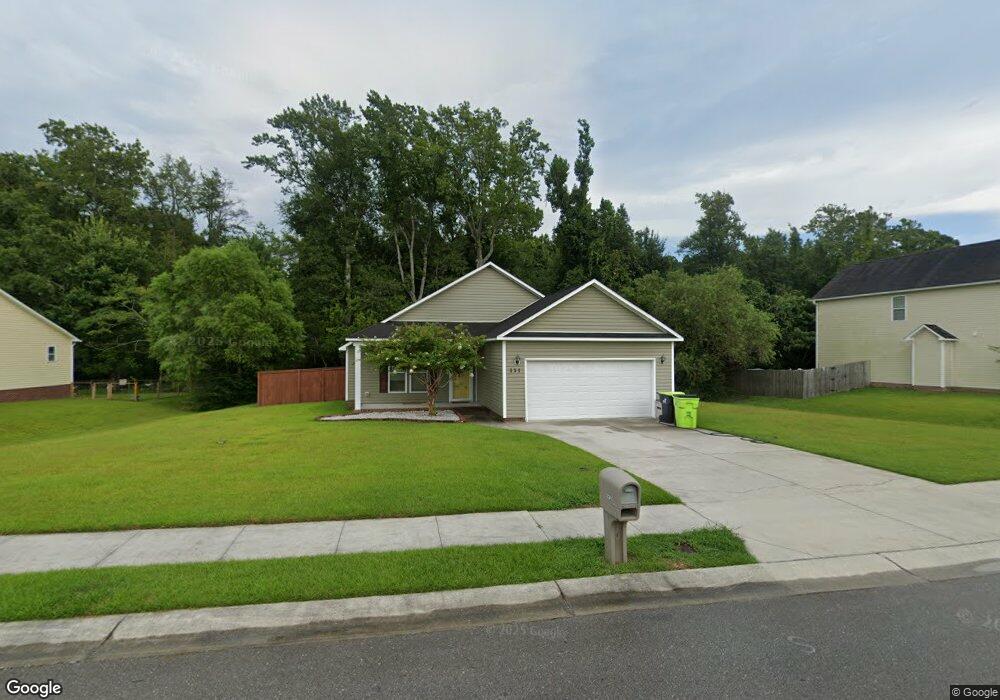
231 Channel Marker Loop Swansboro, NC 28584
Estimated Value: $293,733 - $332,000
3
Beds
2
Baths
1,419
Sq Ft
$224/Sq Ft
Est. Value
About This Home
This home is located at 231 Channel Marker Loop, Swansboro, NC 28584 and is currently estimated at $318,433, approximately $224 per square foot. 231 Channel Marker Loop is a home with nearby schools including Swansboro Elementary School, Swansboro Middle School, and Swansboro High School.
Ownership History
Date
Name
Owned For
Owner Type
Purchase Details
Closed on
Oct 9, 2018
Sold by
Patterson Anthony
Bought by
Patterson Anthony and Patterson Arline
Current Estimated Value
Purchase Details
Closed on
May 30, 2012
Sold by
Sine Properties Inc
Bought by
Patterson Anthony
Home Financials for this Owner
Home Financials are based on the most recent Mortgage that was taken out on this home.
Original Mortgage
$147,184
Interest Rate
3.7%
Mortgage Type
FHA
Purchase Details
Closed on
Mar 6, 2012
Sold by
Swannsborough Acres Llc
Bought by
Sine Properties Inc
Create a Home Valuation Report for This Property
The Home Valuation Report is an in-depth analysis detailing your home's value as well as a comparison with similar homes in the area
Home Values in the Area
Average Home Value in this Area
Purchase History
We collect this data history from publicly available records. To have your information removed, we recommend requesting removal directly through your county’s website.
| Date | Buyer | Sale Price | Title Company |
|---|---|---|---|
| Patterson Anthony | -- | None Available | |
| Patterson Anthony | $150,000 | None Available | |
| Sine Properties Inc | $190,000 | None Available |
Source: Public Records
Mortgage History
We collect this data history from publicly available records. To have your information removed, we recommend requesting removal directly through your county’s website.
| Date | Status | Borrower | Loan Amount |
|---|---|---|---|
| Previous Owner | Patterson Anthony | $147,184 |
Source: Public Records
Tax History
| Year | Tax Paid | Tax Assessment Tax Assessment Total Assessment is a certain percentage of the fair market value that is determined by local assessors to be the total taxable value of land and additions on the property. | Land | Improvement |
|---|---|---|---|---|
| 2025 | $2,151 | $213,984 | $45,000 | $168,984 |
| 2024 | $2,151 | $213,984 | $45,000 | $168,984 |
| 2023 | $2,151 | $213,984 | $45,000 | $168,984 |
| 2022 | $2,151 | $213,984 | $45,000 | $168,984 |
| 2021 | $1,730 | $164,020 | $36,000 | $128,020 |
| 2020 | $1,730 | $164,020 | $36,000 | $128,020 |
| 2019 | $1,730 | $164,020 | $36,000 | $128,020 |
| 2018 | $1,730 | $164,020 | $36,000 | $128,020 |
| 2017 | $1,660 | $161,940 | $38,000 | $123,940 |
| 2016 | $1,660 | $161,940 | $0 | $0 |
| 2015 | $1,660 | $161,940 | $0 | $0 |
| 2014 | $1,660 | $161,940 | $0 | $0 |
Source: Public Records
Map
Nearby Homes
- 253 Channel Marker Loop
- 102 Borough Nest Dr
- 161 Howard Ln
- 420 Patriots Point Ln
- 16 Outrigger Dr
- 6 Outrigger Dr
- 57 Outrigger Dr
- 21 Outrigger Dr
- 12 Catalina Cir
- 14 Catalina Cir
- 1223 W Corbett Ave
- 42 Catalina Cir
- 1 Portwest Townhouses Dr Unit D
- 109 Forest Ln
- 205 Brook Crossing Rd
- 83 Crush Ct
- 1476 W Corbett Ave
- 68 Crush Ct
- 120 Plantation Dr
- 34 Pirates Cove Dr
- 233 Channel Marker Loop
- 229 Channel Marker Loop
- 258 Channel Marker Loop
- 235 Channel Marker Loop
- 227 Channel Marker Loop
- 228 Channel Marker Loop
- 256 Channel Marker Loop
- 225 Channel Marker Loop
- 220 Channel Marker Loop
- 230 Channel Marker Loop
- 401 Nautical Ln
- 254 Channel Marker Loop
- 403 Nautical Ln
- 505 Casting Net Way
- 218 Channel Marker Loop
- 232 Channel Marker Loop
- 223 Channel Marker Loop
- 504 Casting Net Way
- 113 Borough Nest Dr
- 252 Channel Marker Loop
Your Personal Tour Guide
Ask me questions while you tour the home.