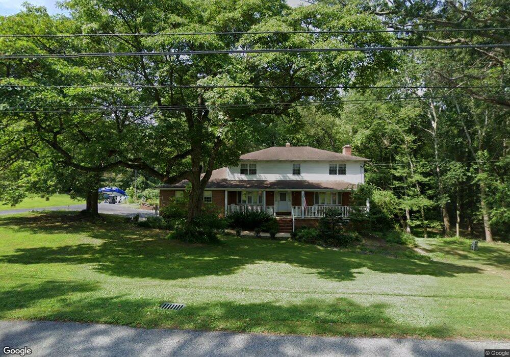
231 Delaplane Ave Newark, DE 19711
Estimated Value: $496,000 - $621,575
4
Beds
3
Baths
2,850
Sq Ft
$195/Sq Ft
Est. Value
About This Home
This home is located at 231 Delaplane Ave, Newark, DE 19711 and is currently estimated at $556,144, approximately $195 per square foot. 231 Delaplane Ave is a home located in New Castle County with nearby schools including R. Elisabeth Maclary Elementary School, Shue-Medill Middle School, and Newark High School.
Ownership History
Date
Name
Owned For
Owner Type
Purchase Details
Closed on
Oct 26, 2021
Sold by
Spence Walter R and Spence Lucy A
Bought by
Spence Walter R
Current Estimated Value
Home Financials for this Owner
Home Financials are based on the most recent Mortgage that was taken out on this home.
Original Mortgage
$185,000
Outstanding Balance
$166,709
Interest Rate
2.88%
Mortgage Type
New Conventional
Estimated Equity
$389,435
Purchase Details
Closed on
Aug 1, 1973
Bought by
Spence Walter R and Spence Lucy
Create a Home Valuation Report for This Property
The Home Valuation Report is an in-depth analysis detailing your home's value as well as a comparison with similar homes in the area
Home Values in the Area
Average Home Value in this Area
Purchase History
We collect this data history from publicly available records. To have your information removed, we recommend requesting removal directly through your county’s website.
| Date | Buyer | Sale Price | Title Company |
|---|---|---|---|
| Spence Walter R | -- | None Available | |
| Spence Walter R | $16,000 | -- |
Source: Public Records
Mortgage History
We collect this data history from publicly available records. To have your information removed, we recommend requesting removal directly through your county’s website.
| Date | Status | Borrower | Loan Amount |
|---|---|---|---|
| Open | Spence Walter R | $185,000 |
Source: Public Records
Tax History
| Year | Tax Paid | Tax Assessment Tax Assessment Total Assessment is a certain percentage of the fair market value that is determined by local assessors to be the total taxable value of land and additions on the property. | Land | Improvement |
|---|---|---|---|---|
| 2025 | $3,807 | $529,100 | $123,800 | $405,300 |
| 2024 | $4,976 | $128,600 | $17,300 | $111,300 |
| 2023 | $4,826 | $128,600 | $17,300 | $111,300 |
| 2022 | $4,814 | $128,600 | $17,300 | $111,300 |
| 2021 | $4,801 | $128,600 | $17,300 | $111,300 |
| 2020 | $4,666 | $128,600 | $17,300 | $111,300 |
| 2019 | $4,784 | $128,600 | $17,300 | $111,300 |
| 2018 | $3,960 | $128,600 | $17,300 | $111,300 |
| 2017 | $3,805 | $128,600 | $17,300 | $111,300 |
| 2016 | $3,695 | $128,600 | $17,300 | $111,300 |
| 2015 | $3,321 | $128,600 | $17,300 | $111,300 |
| 2014 | $3,820 | $128,600 | $17,300 | $111,300 |
Source: Public Records
Map
Nearby Homes
- 274 Birch St
- 106 N Dillwyn Rd
- 7 Aronimink Dr
- 13 Chapel Hill Dr
- 105 Chapel Hill Dr
- 4 Pinedale Rd
- 122 Chapel Hill Dr
- 91 Old Red Mill Rd
- 2 Magnolia Cir
- 16 Longview Dr
- 214 Darwin Dr
- 3 Adelene Dr
- 410 Woodlawn Ave
- 395 Saint Regis Dr
- 124 Decker Dr
- 8 Glen View Place
- 305 Poplar Ave
- 221 Cullen Way
- 418 Vanier Dr
- 204 Michelle Ct Unit 100
- 209 Delaplane Ave
- 220 Delaplane Ave
- 230 Delaplane Ave
- 210 Delaplane Ave
- 100 North Place
- 104 North Place
- 251 Delaplane Ave
- 240 Delaplane Ave
- 6 North Place
- 12 North Place
- 10 North Place
- 250 Delaplane Ave
- 234 Delaplane Ave
- 8 North Place
- 255 Delaplane Ave
- 4 North Place
- 117 Ridge Ave
- 113 Delaplane Ave
- 113 Delaplane Ave Unit A
- 114 Ridge Ave
Your Personal Tour Guide
Ask me questions while you tour the home.