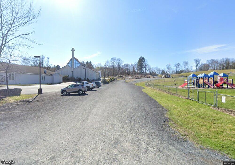
231 Gravity Rd Lake Ariel, PA 18436
Estimated Value: $310,000 - $376,000
3
Beds
2
Baths
1,413
Sq Ft
$239/Sq Ft
Est. Value
About This Home
This home is located at 231 Gravity Rd, Lake Ariel, PA 18436 and is currently estimated at $338,152, approximately $239 per square foot. 231 Gravity Rd is a home located in Wayne County with nearby schools including Western Wayne High School.
Ownership History
Date
Name
Owned For
Owner Type
Purchase Details
Closed on
Sep 26, 2014
Sold by
Black Seth T
Bought by
Barcinkevich Brianna M and Black Brianna M
Current Estimated Value
Purchase Details
Closed on
Sep 30, 2010
Sold by
Turouski Aldona M and Mele Roseann M
Bought by
Marcinkevich Brianna M and Black Sett T
Home Financials for this Owner
Home Financials are based on the most recent Mortgage that was taken out on this home.
Original Mortgage
$138,139
Outstanding Balance
$91,850
Interest Rate
4.5%
Mortgage Type
FHA
Estimated Equity
$246,302
Create a Home Valuation Report for This Property
The Home Valuation Report is an in-depth analysis detailing your home's value as well as a comparison with similar homes in the area
Home Values in the Area
Average Home Value in this Area
Purchase History
| Date | Buyer | Sale Price | Title Company |
|---|---|---|---|
| Barcinkevich Brianna M | -- | None Available | |
| Marcinkevich Brianna M | $140,000 | None Available |
Source: Public Records
Mortgage History
| Date | Status | Borrower | Loan Amount |
|---|---|---|---|
| Open | Marcinkevich Brianna M | $138,139 |
Source: Public Records
Tax History Compared to Growth
Tax History
| Year | Tax Paid | Tax Assessment Tax Assessment Total Assessment is a certain percentage of the fair market value that is determined by local assessors to be the total taxable value of land and additions on the property. | Land | Improvement |
|---|---|---|---|---|
| 2025 | $3,290 | $203,300 | $73,900 | $129,400 |
| 2024 | $3,128 | $203,300 | $73,900 | $129,400 |
| 2023 | $4,429 | $203,300 | $73,900 | $129,400 |
| 2022 | $3,136 | $133,100 | $40,600 | $92,500 |
| 2021 | $3,058 | $133,100 | $40,600 | $92,500 |
| 2020 | $3,024 | $133,100 | $40,600 | $92,500 |
| 2019 | $2,857 | $133,100 | $40,600 | $92,500 |
| 2018 | $2,841 | $133,100 | $40,600 | $92,500 |
| 2017 | $580 | $133,100 | $40,600 | $92,500 |
| 2016 | $2,751 | $133,100 | $40,600 | $92,500 |
| 2014 | -- | $133,100 | $40,600 | $92,500 |
Source: Public Records
Map
Nearby Homes
- 66 Boulder Rd
- 2745 Boulder Rd Unit 143
- 79 Rockway Rd
- 77 Rockway Rd
- 108 Rockway Rd
- 152 Boulder Rd
- 157 Boulder Rd
- 166 Boulder Rd
- 344 Northgate Rd
- 186 Northgate Rd
- 60 Northgate Rd
- 506 Northgate Rd
- 3212 Northgate Rd
- 340 Northgate Rd
- 514 Northgate Rd Unit Lot 3308
- 441 Northgate Rd
- 15 Laurel Point
- 120 Rockway Rd
- 2721 Pebble Ct
- 69 Northwood Terrace
- 2637 Boulder Rd
- 112 Boulder Rd
- 2694 Boulder Rd
- 128 Boulder Rd
- 2695 Boulder Rd
- 2635 Boulder Rd
- 2638 Boulder Rd
- 2639 Boulder Rd
- 1524 Boulder Rd
- 2754 Boulder Rd
- 2640 Boulder Rd
- 2752 Boulder Rd
- 2642 Boulder Rd
- 2751 Boulder Rd
- 2671 Rockway Rd
- 2756 Rockway Rd
- 2757 Rockway Rd
- 2700 Boulder Rd
- 2644 Boulder Rd
- 2630 Boulder Rd
