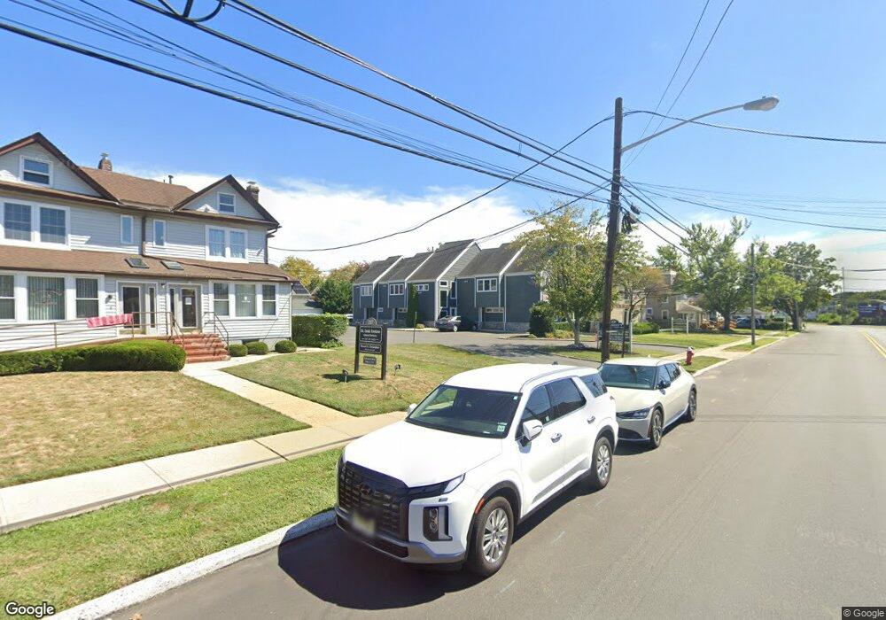
231 Maple Ave Red Bank, NJ 07701
Estimated Value: $618,829 - $816,000
--
Bed
--
Bath
--
Sq Ft
0.26
Acres
About This Home
This home is located at 231 Maple Ave, Red Bank, NJ 07701 and is currently estimated at $717,415. 231 Maple Ave is a home located in Monmouth County with nearby schools including Red Bank Primary School, Red Bank Middle School, and Red Bank Reg High School.
Ownership History
Date
Name
Owned For
Owner Type
Purchase Details
Closed on
Sep 26, 2012
Sold by
231 Maple Pa
Bought by
231 Maple Ave Llc
Current Estimated Value
Purchase Details
Closed on
Aug 30, 2012
Sold by
231 Maple Pa
Bought by
231 Maple Ave Llc
Purchase Details
Closed on
Dec 14, 2010
Sold by
Cinnamon Elaine and Simon Jason W
Bought by
231 Maple Partnership
Purchase Details
Closed on
Feb 2, 1999
Sold by
Rudnick Martin
Bought by
Simone Lester
Purchase Details
Closed on
Mar 4, 1998
Sold by
Waldman Daniel
Bought by
Simon Lester
Create a Home Valuation Report for This Property
The Home Valuation Report is an in-depth analysis detailing your home's value as well as a comparison with similar homes in the area
Home Values in the Area
Average Home Value in this Area
Purchase History
| Date | Buyer | Sale Price | Title Company |
|---|---|---|---|
| 231 Maple Ave Llc | $775,000 | Coastal Title Ag Inc | |
| 231 Maple Ave Llc | $775,000 | Coastal Title Ag Inc | |
| 231 Maple Partnership | -- | None Available | |
| Simone Lester | $76,316 | -- | |
| Simon Lester | $75,400 | -- |
Source: Public Records
Tax History Compared to Growth
Tax History
| Year | Tax Paid | Tax Assessment Tax Assessment Total Assessment is a certain percentage of the fair market value that is determined by local assessors to be the total taxable value of land and additions on the property. | Land | Improvement |
|---|---|---|---|---|
| 2025 | $4,033 | $234,800 | $183,000 | $51,800 |
| 2024 | $4,055 | $213,500 | $163,800 | $49,700 |
| 2023 | $4,055 | $212,200 | $163,800 | $48,400 |
| 2022 | $3,781 | $198,600 | $152,300 | $46,300 |
| 2021 | $3,781 | $169,000 | $126,900 | $42,100 |
| 2020 | $3,758 | $165,400 | $126,900 | $38,500 |
| 2019 | $3,630 | $164,200 | $126,900 | $37,300 |
| 2018 | $3,560 | $162,800 | $126,900 | $35,900 |
| 2017 | $3,431 | $162,600 | $126,900 | $35,700 |
| 2016 | $3,407 | $161,700 | $126,900 | $34,800 |
| 2015 | $2,251 | $110,700 | $76,200 | $34,500 |
| 2014 | $2,118 | $110,700 | $76,200 | $34,500 |
Source: Public Records
Map
Nearby Homes
- 205 Maple Ave
- 27 Irving Place
- 44 Waverly Place
- 253 Pearl St S
- 232 S Pearl St
- 137 E Bergen Place
- 17 Leroy Place Unit 3B
- 17 Leroy Place Unit 1C
- 26 Pinckney Rd Unit C
- 3 Cedar Crossing
- 23 Cedar Crossing
- 24 Cedar Crossing
- 24 River St
- 42 Chestnut St
- 195 Bridge Ave
- 244 S Bridge Ave
- 132 Trafford St
- 19 Sunset Ave E
- 82 Linden Place
- 23 Wallace St Unit 207
- 227 Maple Ave Unit 229
- 227 Maple Ave
- 241 Maple Ave Unit 5
- 241 Maple Ave
- 223 Maple Ave Unit 3
- 223 Maple Ave Unit 2
- 223 Maple Ave Unit 3
- 24 Arthur Place
- 28 Arthur Place
- 219 Maple Ave
- 30 Arthur Place
- 20 Arthur Place
- 32 Arthur Place
- 16 Arthur Place
- 36 Arthur Place
- 249 Maple Ave
- 215 Maple Ave
- 14 Arthur Place
- 222 E Bergen Place
- 40 Arthur Place
