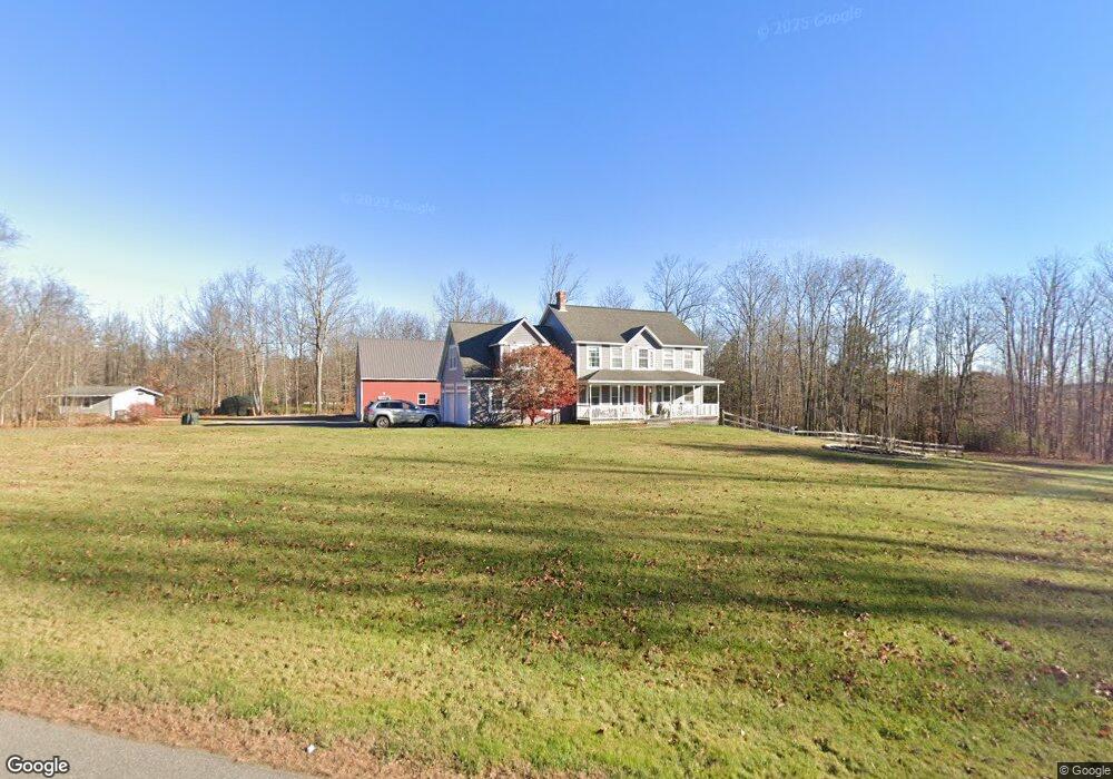
231 Ossipee Trail Gorham, ME 04038
Estimated Value: $643,000 - $805,000
4
Beds
3
Baths
2,403
Sq Ft
$299/Sq Ft
Est. Value
About This Home
This home is located at 231 Ossipee Trail, Gorham, ME 04038 and is currently estimated at $718,890, approximately $299 per square foot. 231 Ossipee Trail is a home with nearby schools including Village Elementary School, Gorham Middle School, and Gorham High School.
Create a Home Valuation Report for This Property
The Home Valuation Report is an in-depth analysis detailing your home's value as well as a comparison with similar homes in the area
Home Values in the Area
Average Home Value in this Area
Tax History
| Year | Tax Paid | Tax Assessment Tax Assessment Total Assessment is a certain percentage of the fair market value that is determined by local assessors to be the total taxable value of land and additions on the property. | Land | Improvement |
|---|---|---|---|---|
| 2025 | $8,491 | $573,700 | $82,500 | $491,200 |
| 2024 | $8,408 | $572,000 | $82,500 | $489,500 |
| 2023 | $7,728 | $562,000 | $82,500 | $479,500 |
| 2022 | $7,222 | $562,000 | $82,500 | $479,500 |
| 2021 | $5,911 | $304,700 | $69,700 | $235,000 |
| 2020 | $5,789 | $304,700 | $69,700 | $235,000 |
| 2019 | $5,774 | $304,700 | $69,700 | $235,000 |
| 2018 | $5,546 | $304,700 | $69,700 | $235,000 |
| 2017 | $4,980 | $291,200 | $69,700 | $221,500 |
| 2016 | $4,893 | $287,800 | $69,700 | $218,100 |
| 2015 | $4,691 | $287,800 | $69,700 | $218,100 |
| 2014 | $4,460 | $256,300 | $63,900 | $192,400 |
| 2013 | $4,434 | $256,300 | $63,900 | $192,400 |
Source: Public Records
Map
Nearby Homes
- 4 Musket Dr
- 16 Daniel St
- 35 Rust Rd
- 866 Parker Farm Rd Unit A
- 866 Parker Farm Rd Unit B
- 866 Parker Farm Lot B Rd
- 866 Parker Farm Lot A Rd
- 16 Norway Rd
- 555 Fort Hill Rd
- 116 Dingley Spring Rd
- 8 Martin Dr
- 42 Brandons Way
- 127 Falcon Crest Dr Unit 4
- 182 Falcon Crest Dr Unit 56
- 187 Falcon Crest Dr Unit 30
- 188 Falcon Crest Dr Unit 58
- 189 Falcon Crest Dr Unit 31
- 191 Falcon Crest Dr Unit 32
- 192 Falcon Crest Dr Unit 59
- 193 Falcon Crest Dr Unit 33
Your Personal Tour Guide
Ask me questions while you tour the home.