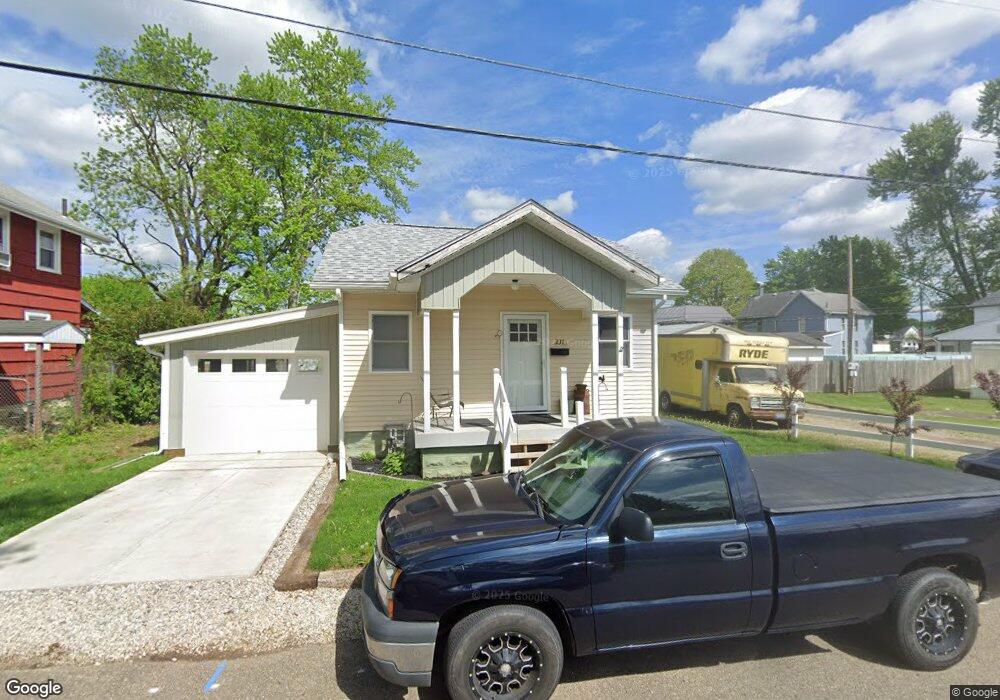
231 Spaulding Ave Newcomerstown, OH 43832
Estimated Value: $64,000 - $105,000
1
Bed
2
Baths
616
Sq Ft
$143/Sq Ft
Est. Value
About This Home
This home is located at 231 Spaulding Ave, Newcomerstown, OH 43832 and is currently estimated at $88,386, approximately $143 per square foot. 231 Spaulding Ave is a home located in Tuscarawas County with nearby schools including West Elementary School, East Elementary School, and Newcomerstown Middle School.
Ownership History
Date
Name
Owned For
Owner Type
Purchase Details
Closed on
Feb 5, 2016
Sold by
Provident Holdings Llc
Bought by
Hickman David W and Hickman Cynthia M
Current Estimated Value
Purchase Details
Closed on
Nov 14, 2013
Sold by
Ianniello Brenda K and Ianniello Brenda K
Bought by
Provident Holdings Llc
Purchase Details
Closed on
Aug 5, 1993
Sold by
Quillen Dora Ann
Bought by
Hickman Cynthia M
Purchase Details
Closed on
Nov 16, 1987
Sold by
Baker John I
Bought by
Hickman Cynthia M
Create a Home Valuation Report for This Property
The Home Valuation Report is an in-depth analysis detailing your home's value as well as a comparison with similar homes in the area
Home Values in the Area
Average Home Value in this Area
Purchase History
| Date | Buyer | Sale Price | Title Company |
|---|---|---|---|
| Hickman David W | $10,000 | None Available | |
| Provident Holdings Llc | -- | None Available | |
| Hickman Cynthia M | $14,500 | -- | |
| Hickman Cynthia M | $16,500 | -- |
Source: Public Records
Tax History Compared to Growth
Tax History
| Year | Tax Paid | Tax Assessment Tax Assessment Total Assessment is a certain percentage of the fair market value that is determined by local assessors to be the total taxable value of land and additions on the property. | Land | Improvement |
|---|---|---|---|---|
| 2024 | $622 | $16,440 | $2,990 | $13,450 |
| 2023 | $622 | $46,980 | $8,550 | $38,430 |
| 2022 | $596 | $16,443 | $2,993 | $13,451 |
| 2021 | $521 | $13,262 | $2,944 | $10,318 |
| 2020 | $527 | $13,262 | $2,944 | $10,318 |
| 2019 | $534 | $13,262 | $2,944 | $10,318 |
| 2018 | $493 | $11,810 | $2,620 | $9,190 |
| 2017 | $493 | $11,810 | $2,620 | $9,190 |
| 2016 | $489 | $11,810 | $2,620 | $9,190 |
| 2014 | $483 | $11,730 | $2,610 | $9,120 |
| 2013 | $490 | $11,730 | $2,610 | $9,120 |
Source: Public Records
Map
Nearby Homes
- 429 Spaulding Ave
- 439 Tuscarawas Ave
- 465 Spaulding Ave
- 303 Beaver St
- 435 Oxford Ave
- 460 Barnett Ave
- 60949 County Road 9
- 621 Tuscarawas Ave
- 598 Martin Luther King Dr
- 465 Martin Luther King Dr
- 540 Mulvane St
- 516 Mulvane St
- 0 Johnson Hill Rd
- 100 Crestview Dr
- 579 Chestnut St
- 241 N College St
- 279 E Canal St
- 21277 County Road 106
- 541 E Canal St
- 137 Downs Ave
- 227 Spaulding Ave
- 640 W State St
- 220 Spaulding Ave
- 648 W State St
- 706 Mill Alley Unit C
- 632 W State St
- 628 W State St
- 704 W State St
- 704 W State St
- 618 W State St
- 716 W State St
- 716 W State St
- 612 W State St
- 326 Mckinley Ave
- 701 W State St
- 707 W State St
- 320 Mckinley Ave
- 713 W State St
- 602 W State St
- 623 W State St