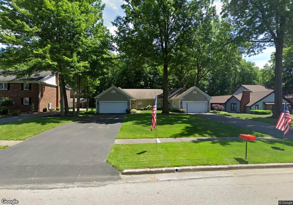
231 Talsman Dr Unit 4B Canfield, OH 44406
Estimated Value: $247,180 - $283,000
2
Beds
2
Baths
1,603
Sq Ft
$166/Sq Ft
Est. Value
About This Home
This home is located at 231 Talsman Dr Unit 4B, Canfield, OH 44406 and is currently estimated at $266,045, approximately $165 per square foot. 231 Talsman Dr Unit 4B is a home located in Mahoning County with nearby schools including Canfield Village Middle School, Canfield High School, and St Charles Elementary School.
Ownership History
Date
Name
Owned For
Owner Type
Purchase Details
Closed on
Jun 2, 2021
Bought by
James P Cestary
Current Estimated Value
Home Financials for this Owner
Home Financials are based on the most recent Mortgage that was taken out on this home.
Interest Rate
2.95%
Purchase Details
Closed on
Jun 28, 2002
Sold by
Kish William J and Kish Robert A
Bought by
Sullivan Patricia M
Home Financials for this Owner
Home Financials are based on the most recent Mortgage that was taken out on this home.
Original Mortgage
$80,000
Interest Rate
6.91%
Mortgage Type
Purchase Money Mortgage
Purchase Details
Closed on
Oct 14, 1992
Bought by
Kish Margaret L
Create a Home Valuation Report for This Property
The Home Valuation Report is an in-depth analysis detailing your home's value as well as a comparison with similar homes in the area
Home Values in the Area
Average Home Value in this Area
Purchase History
| Date | Buyer | Sale Price | Title Company |
|---|---|---|---|
| James P Cestary | $140,000 | -- | |
| Sullivan Patricia M | $145,000 | -- | |
| Kish Margaret L | $119,000 | -- |
Source: Public Records
Mortgage History
| Date | Status | Borrower | Loan Amount |
|---|---|---|---|
| Closed | James P Cestary | -- | |
| Previous Owner | Sullivan Patricia M | $80,000 |
Source: Public Records
Tax History Compared to Growth
Tax History
| Year | Tax Paid | Tax Assessment Tax Assessment Total Assessment is a certain percentage of the fair market value that is determined by local assessors to be the total taxable value of land and additions on the property. | Land | Improvement |
|---|---|---|---|---|
| 2024 | $2,485 | $67,440 | $6,200 | $61,240 |
| 2023 | $2,861 | $67,440 | $6,200 | $61,240 |
| 2022 | $2,767 | $51,890 | $6,200 | $45,690 |
| 2021 | $2,233 | $51,890 | $6,200 | $45,690 |
| 2020 | $2,242 | $51,890 | $6,200 | $45,690 |
| 2019 | $2,018 | $43,970 | $5,250 | $38,720 |
| 2018 | $1,993 | $43,970 | $5,250 | $38,720 |
| 2017 | $1,982 | $43,970 | $5,250 | $38,720 |
| 2016 | $1,973 | $44,310 | $5,250 | $39,060 |
| 2015 | $1,930 | $44,310 | $5,250 | $39,060 |
| 2014 | $1,937 | $44,310 | $5,250 | $39,060 |
| 2013 | $1,867 | $44,310 | $5,250 | $39,060 |
Source: Public Records
Map
Nearby Homes
- 147 Talsman Dr
- 50 Montgomery Dr Unit 2
- 231 Chapel Ln
- 65 Winona Ave
- 435 S Hillside Dr
- 4032 Saint Andrews Ct Unit 1
- 125 Callahan Rd
- 5034 Macy Ln
- 5025 Macy Ln
- 5269 S Raccoon Rd
- 6916 S Raccoon Rd
- 4052 Saint Andrews Ct Unit 3
- 6845 Abbey Rd
- 6843 Abbey Rd
- 6837 Abbey Rd S
- 4112 Fairway Dr
- 36 Hilltop Blvd
- 6152 Southern Hills Ct
- 0 Shields Rd Unit 5162190
- 395 N Broad St
- 231 Talsman Dr Unit 4A
- 231 Talsman Dr
- 221 Talsman Dr Unit 1D
- 221 Talsman Dr Unit 1C
- 221 Talsman Dr Unit 1B
- 221 Talsman Dr Unit 1A
- 221 Talsman Dr Unit C
- 221 Talsman Dr Unit D
- 221 Talsman Dr Unit A
- 211 Talsman Dr Unit 4
- 211 Talsman Dr Unit 3
- 211 Talsman Dr Unit 2
- 211 Talsman Dr
- 251 Talsman Dr Unit 2
- 251 Talsman Dr Unit 1
- 251 Talsman Dr
- 230 Talsman Dr Unit 3A
- 220 Talsman Dr Unit 3B
- 210 Talsman Dr
- 373 Hilltop Blvd