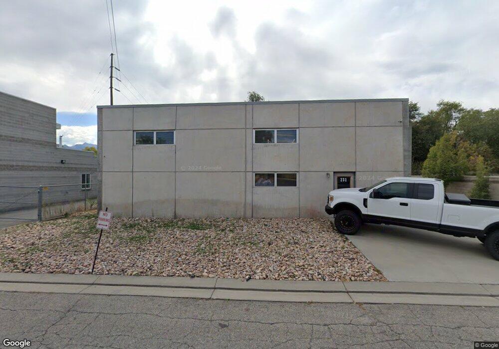
231 W 4860 S Salt Lake City, UT 84107
Estimated Value: $898,964
--
Bed
--
Bath
2,925
Sq Ft
$307/Sq Ft
Est. Value
About This Home
This home is located at 231 W 4860 S, Salt Lake City, UT 84107 and is currently estimated at $898,964, approximately $307 per square foot. 231 W 4860 S is a home located in Salt Lake County with nearby schools including Horizon Elementary School, Hillcrest Junior High School, and Murray High School.
Ownership History
Date
Name
Owned For
Owner Type
Purchase Details
Closed on
Mar 6, 2020
Sold by
Dunn Holli L and Estate Of Paul J Dunn
Bought by
Dunn Holli and Holli Dunn Revocable Trust
Current Estimated Value
Purchase Details
Closed on
Jan 25, 2018
Sold by
Dorwart Marc
Bought by
Dunn Paul
Purchase Details
Closed on
Mar 5, 2008
Sold by
Woodward Industrial Park Enterprises Lc
Bought by
Dorwart Marc
Home Financials for this Owner
Home Financials are based on the most recent Mortgage that was taken out on this home.
Original Mortgage
$75,000
Interest Rate
5.41%
Mortgage Type
Seller Take Back
Purchase Details
Closed on
Dec 6, 1999
Sold by
Knapp Jeff
Bought by
Woodward Industrial Park Enterprises Lc
Purchase Details
Closed on
Jul 9, 1997
Sold by
Woodward Industrial Park Enterprises L C
Bought by
Knapp Jeff
Create a Home Valuation Report for This Property
The Home Valuation Report is an in-depth analysis detailing your home's value as well as a comparison with similar homes in the area
Home Values in the Area
Average Home Value in this Area
Purchase History
| Date | Buyer | Sale Price | Title Company |
|---|---|---|---|
| Dunn Holli | -- | None Available | |
| Dunn Paul | -- | Old Republic Title Draper | |
| Dorwart Marc | -- | Landmark Title | |
| Woodward Industrial Park Enterprises Lc | -- | Landmark Title | |
| Knapp Jeff | -- | -- |
Source: Public Records
Mortgage History
| Date | Status | Borrower | Loan Amount |
|---|---|---|---|
| Previous Owner | Dorwart Marc | $75,000 |
Source: Public Records
Tax History Compared to Growth
Tax History
| Year | Tax Paid | Tax Assessment Tax Assessment Total Assessment is a certain percentage of the fair market value that is determined by local assessors to be the total taxable value of land and additions on the property. | Land | Improvement |
|---|---|---|---|---|
| 2025 | $5,083 | $805,500 | $285,600 | $519,900 |
| 2024 | $5,083 | $620,000 | $267,300 | $352,700 |
| 2023 | $4,583 | $535,500 | $253,000 | $282,500 |
| 2022 | $4,507 | $500,600 | $202,400 | $298,200 |
| 2021 | $3,578 | $350,500 | $202,400 | $148,100 |
| 2020 | $3,494 | $323,900 | $244,600 | $79,300 |
| 2019 | $4,622 | $413,900 | $156,000 | $257,900 |
| 2018 | $0 | $400,700 | $156,000 | $244,700 |
| 2017 | $2,762 | $254,500 | $151,800 | $102,700 |
| 2016 | $2,236 | $198,900 | $147,600 | $51,300 |
| 2015 | $2,440 | $197,100 | $147,600 | $49,500 |
| 2014 | $2,029 | $162,600 | $120,600 | $42,000 |
Source: Public Records
Map
Nearby Homes
- 4784 S Huntly Dr
- 4753 S Falkirk Dr
- 4584 S Commerce Dr
- 4727 S Duftown Place
- 4950 Galleria Dr
- 4726 S Hillhouse Cove Unit 104
- 4730 S Box Elder St
- 4658 Box Elder St
- 6 W Miller St
- 486 Clover View Dr
- 149 E Vine St
- 155 E Vine St
- 4641 S Rainbow Dr
- 4661 S Mount Tuscarora Dr Unit 367
- 704 W Daisy Ln
- 4320 S Commerce Dr
- 313 Elm St
- 5235 S Glendon St Unit W3
- 5235 S Glendon St Unit Y4
- 774 Superior Peak Dr
- 233 4860 S
- 231 W 4860 S Unit 19
- 219 4860 S Unit 18
- 238 W 5th Ave
- 232 W 4860 S Unit 2
- 249 W 4860 S Unit 2291
- 249 W 4860 S
- 248 W 4860 S Unit 2
- 239 W 5th Ave
- 4835 S Commerce Dr
- 206 W 4860 S
- 209 5th Ave
- 4860 S Commerce Dr
- 4891 S 300 W
- 4882 S 300 W
- 197 W 4860 S
- 201 W 5th Ave
- 201 W 5th Ave Unit 4
- 682 5th Ave
- 617 5th Ave