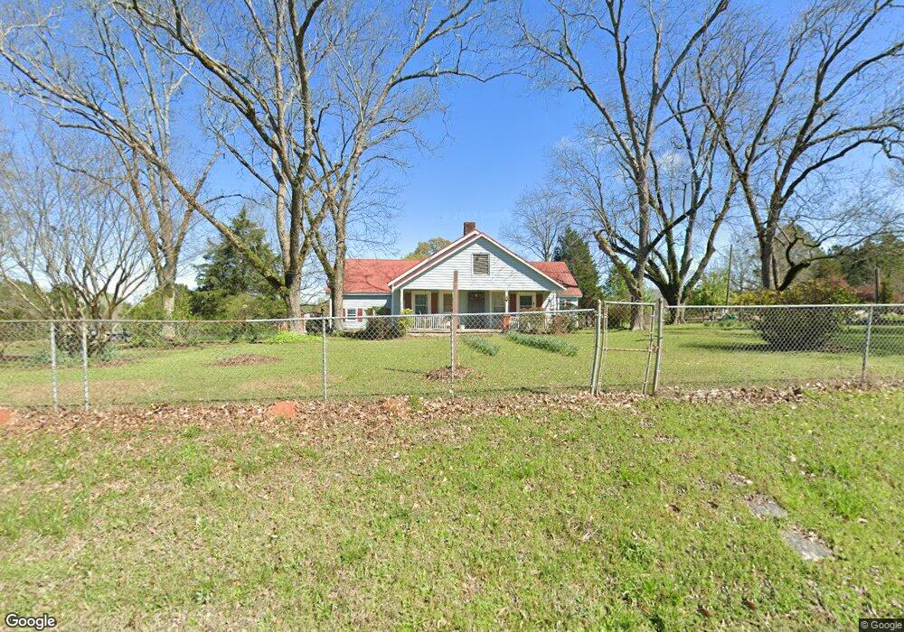
2310 Old Union Point Rd Greensboro, GA 30642
Estimated Value: $359,000 - $652,669
3
Beds
2
Baths
1,712
Sq Ft
$301/Sq Ft
Est. Value
About This Home
This home is located at 2310 Old Union Point Rd, Greensboro, GA 30642 and is currently estimated at $514,667, approximately $300 per square foot. 2310 Old Union Point Rd is a home located in Greene County with nearby schools including Greene County High School.
Ownership History
Date
Name
Owned For
Owner Type
Purchase Details
Closed on
Aug 30, 1991
Sold by
Sorrells Sorrells R and Sorrells Kathryn E
Bought by
Sorrells Sorrells R and Sorrells Kathryn E
Current Estimated Value
Purchase Details
Closed on
Aug 29, 1991
Sold by
Dispain Harold and Dispain Jacq
Bought by
Sorrells Sorrells R and Sorrells Kathryn E
Purchase Details
Closed on
Jan 1, 1982
Sold by
Dispain Harold and Dispain Jacqu
Bought by
Dispain Harold and Dispain Jacq
Purchase Details
Closed on
Jan 1, 1976
Sold by
Dispain Harold and Dispain Jacq
Bought by
Dispain Harold and Dispain Jacqu
Purchase Details
Closed on
Jan 1, 1972
Sold by
Angles Roy
Bought by
Dispain Harold and Dispain Jacq
Purchase Details
Closed on
Jan 1, 1970
Sold by
Torbert G C
Bought by
Angles Roy
Purchase Details
Closed on
Jan 1, 1944
Sold by
Torbert G C
Bought by
Torbert G C
Purchase Details
Closed on
Jan 1, 1921
Bought by
Torbert G C
Create a Home Valuation Report for This Property
The Home Valuation Report is an in-depth analysis detailing your home's value as well as a comparison with similar homes in the area
Home Values in the Area
Average Home Value in this Area
Purchase History
| Date | Buyer | Sale Price | Title Company |
|---|---|---|---|
| Sorrells Sorrells R | -- | -- | |
| Sorrells Sorrells R | $103,700 | -- | |
| Dispain Harold | -- | -- | |
| Dispain Harold | -- | -- | |
| Dispain Harold | -- | -- | |
| Angles Roy | -- | -- | |
| Torbert G C | -- | -- | |
| Torbert G C | -- | -- |
Source: Public Records
Tax History Compared to Growth
Tax History
| Year | Tax Paid | Tax Assessment Tax Assessment Total Assessment is a certain percentage of the fair market value that is determined by local assessors to be the total taxable value of land and additions on the property. | Land | Improvement |
|---|---|---|---|---|
| 2024 | $650 | $195,624 | $127,320 | $68,304 |
| 2023 | $421 | $126,544 | $94,080 | $32,464 |
| 2022 | $700 | $94,904 | $72,800 | $22,104 |
| 2021 | $726 | $93,064 | $72,800 | $20,264 |
| 2020 | $621 | $67,836 | $54,280 | $13,556 |
| 2019 | $629 | $67,836 | $54,280 | $13,556 |
| 2018 | $602 | $67,836 | $54,280 | $13,556 |
| 2017 | $562 | $67,620 | $54,289 | $13,331 |
| 2016 | $570 | $16,185 | $2,285 | $13,900 |
| 2015 | $540 | $16,185 | $2,285 | $13,900 |
| 2014 | $532 | $15,438 | $2,285 | $13,153 |
Source: Public Records
Map
Nearby Homes
- 0 Shady Side Ln
- 0 Cunningham Rd
- 2260 Cunningham Rd
- 0 Union Point Hwy Unit 69532
- 0 Union Point Hwy Unit 7607786
- 0 Union Point Hwy Unit 10555176
- 0 Old Union Point Rd Unit 1 10557753
- 1251 Brickhouse Rd
- 1251 Brick House Rd
- 1641 Bowden Pond Rd
- 1141 Planing Mill Rd
- 1131 Planing Mill Rd
- 1681 Sibley School Rd
- 1251 Adams Rd
- 1580 Bramlett Rd
- LOT 1 Penfield
- 3021 Penfield Rd
- 0 Washington Hwy Unit 7276060
- 0 S Rhodes St Unit 10618488
- 1241 Old Siloam Rd
- 3031 Union Point Hwy
- 3021 Union Point Hwy
- 2430 Old Union Point Rd
- 3051 Union Point Hwy
- 1861 Airport Rd
- 3061 Union Point Hwy
- 3011 Union Point Hwy
- 3091 Union Point Hwy
- 3081 Union Point Hwy
- 3081 Union Point Hwy
- 2460 Old Union Point Rd
- 2981 Union Point Hwy
- 3111 Union Point Hwy
- 1831 Airport Rd
- 2991 Union Point Hwy
- 2891 Union Point Hwy
- 2881 Union Point Hwy
- 1050 Shadyside Ln
- 1781 Airport Rd
- 2861 Union Point Hwy