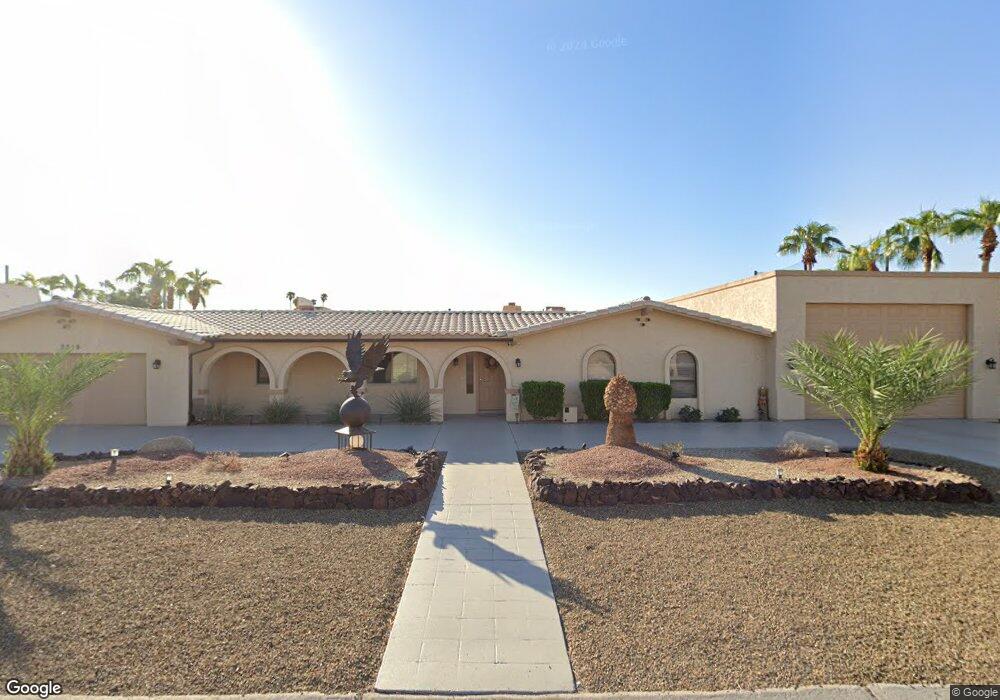
2310 Snead Dr Lake Havasu City, AZ 86406
Estimated Value: $775,000 - $864,000
4
Beds
1
Bath
2,002
Sq Ft
$402/Sq Ft
Est. Value
About This Home
This home is located at 2310 Snead Dr, Lake Havasu City, AZ 86406 and is currently estimated at $804,325, approximately $401 per square foot. 2310 Snead Dr is a home located in Mohave County with nearby schools including Starline Elementary School, Thunderbolt Middle School, and Lake Havasu High School.
Ownership History
Date
Name
Owned For
Owner Type
Purchase Details
Closed on
Jul 6, 2017
Sold by
Killeen Caroline P
Bought by
Grosso Gary R
Current Estimated Value
Purchase Details
Closed on
Oct 6, 2004
Sold by
Lieberman David and Lieberman Barbara A
Bought by
Killeen Gary and Killeen Caroline P
Home Financials for this Owner
Home Financials are based on the most recent Mortgage that was taken out on this home.
Original Mortgage
$115,000
Interest Rate
5.74%
Mortgage Type
Seller Take Back
Create a Home Valuation Report for This Property
The Home Valuation Report is an in-depth analysis detailing your home's value as well as a comparison with similar homes in the area
Home Values in the Area
Average Home Value in this Area
Purchase History
| Date | Buyer | Sale Price | Title Company |
|---|---|---|---|
| Grosso Gary R | -- | None Available | |
| Killeen Gary | $370,000 | First American Title Ins Co |
Source: Public Records
Mortgage History
| Date | Status | Borrower | Loan Amount |
|---|---|---|---|
| Previous Owner | Killeen Gary | $115,000 |
Source: Public Records
Tax History Compared to Growth
Tax History
| Year | Tax Paid | Tax Assessment Tax Assessment Total Assessment is a certain percentage of the fair market value that is determined by local assessors to be the total taxable value of land and additions on the property. | Land | Improvement |
|---|---|---|---|---|
| 2026 | $1,678 | -- | -- | -- |
| 2025 | $3,401 | $61,482 | $0 | $0 |
| 2024 | $3,401 | $65,739 | $0 | $0 |
| 2023 | $3,401 | $57,740 | $0 | $0 |
| 2022 | $3,254 | $42,159 | $0 | $0 |
| 2021 | $2,871 | $32,405 | $0 | $0 |
| 2019 | $2,723 | $27,337 | $0 | $0 |
| 2018 | $2,633 | $26,078 | $0 | $0 |
| 2017 | $2,646 | $25,239 | $0 | $0 |
| 2016 | $2,427 | $29,097 | $0 | $0 |
| 2015 | $2,322 | $29,666 | $0 | $0 |
Source: Public Records
Map
Nearby Homes
- 2288 Casper Ln
- 2220 Snead Dr
- 2405 Wood Ln
- 2207 Oliver Ln
- 2470 Wood Ln
- 2224 Littler Ln Unit 28
- 2224 Littler Ln Unit 23
- 2371 Stroke Dr
- 2190 Snead Dr
- 2175 Snead Dr Unit 4
- 2180 Snead Dr
- 2475 Saratoga Ave
- 2175 Palmer Dr
- 2280 Leonard Ln
- 470 Acoma Blvd S Unit 109
- 470 Acoma Blvd S Unit 122
- 470 Acoma Blvd S Unit 128
- 2390 Hogan Ln
- 420 Acoma Blvd S Unit 25
- 2190 Palmer Dr