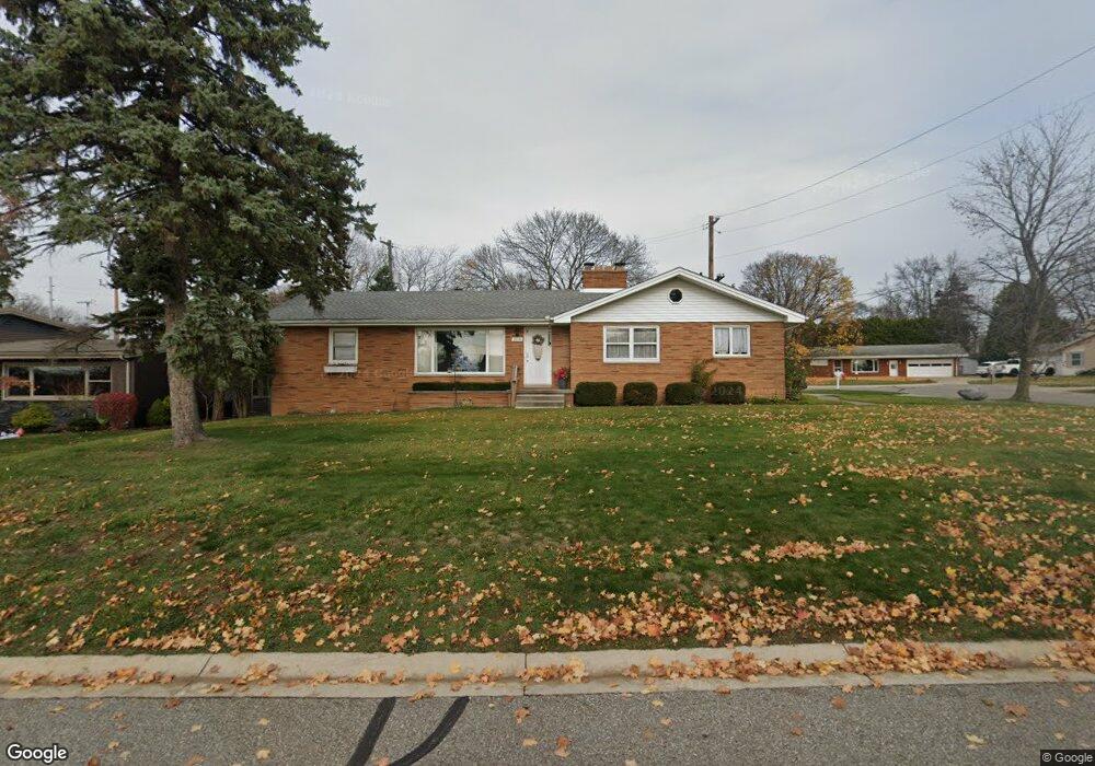
2310 Woodstock Dr Unit Bldg-Unit Port Huron, MI 48060
Estimated Value: $274,000 - $299,000
3
Beds
2
Baths
1,551
Sq Ft
$185/Sq Ft
Est. Value
About This Home
This home is located at 2310 Woodstock Dr Unit Bldg-Unit, Port Huron, MI 48060 and is currently estimated at $287,402, approximately $185 per square foot. 2310 Woodstock Dr Unit Bldg-Unit is a home located in St. Clair County with nearby schools including H.D. Crull Elementary School, Holland Woods Middle School, and Port Huron Northern High School.
Ownership History
Date
Name
Owned For
Owner Type
Purchase Details
Closed on
Jul 16, 2018
Sold by
Palmateer Gerald E
Bought by
Demink Beverly
Current Estimated Value
Purchase Details
Closed on
Feb 21, 2018
Sold by
Palmateer Gerald E and Jean Palmateer D
Bought by
Palmateer Daniel P
Create a Home Valuation Report for This Property
The Home Valuation Report is an in-depth analysis detailing your home's value as well as a comparison with similar homes in the area
Home Values in the Area
Average Home Value in this Area
Purchase History
| Date | Buyer | Sale Price | Title Company |
|---|---|---|---|
| Demink Beverly | $183,000 | Huron Title | |
| Palmateer Daniel P | -- | -- |
Source: Public Records
Tax History Compared to Growth
Tax History
| Year | Tax Paid | Tax Assessment Tax Assessment Total Assessment is a certain percentage of the fair market value that is determined by local assessors to be the total taxable value of land and additions on the property. | Land | Improvement |
|---|---|---|---|---|
| 2025 | $4,256 | $126,400 | $0 | $0 |
| 2024 | $3,733 | $116,900 | $0 | $0 |
| 2023 | $3,526 | $111,500 | $0 | $0 |
| 2022 | $3,836 | $99,600 | $0 | $0 |
| 2021 | $3,640 | $91,400 | $0 | $0 |
| 2020 | $3,681 | $86,500 | $86,500 | $0 |
| 2019 | $3,615 | $58,700 | $0 | $0 |
| 2018 | $2,350 | $58,700 | $0 | $0 |
| 2017 | $2,098 | $52,200 | $0 | $0 |
| 2016 | $1,802 | $52,200 | $0 | $0 |
| 2015 | $1,768 | $50,400 | $50,400 | $0 |
| 2014 | $1,768 | $50,800 | $50,800 | $0 |
| 2013 | -- | $49,700 | $0 | $0 |
Source: Public Records
Map
Nearby Homes
- 2838 Elmwood St
- 2549 Riverwood Dr
- 2806 Woodstock Dr
- 2215 Hancock St
- 0000 Water St
- 1907 Riverside Dr
- 1819 Riverside Dr
- V/L #4 Water St
- V/L #6 Water St
- V/L #5 Water St
- V/L #8 Water St
- V/L #3 Water St
- 0000 Campau Ave
- 2812 19th Ave
- 2857 Riverside Dr
- 2610 Strawberry Ln
- 1649 Whipple St
- 1620 McBrady St
- 0000 Manuel St
- 00 Campau Ave
- 2310 Woodstock Dr
- 2320 Woodstock Dr
- 2307 Woodstock Dr
- 2317 Woodstock Dr
- 2311 Scenic Ct
- 2330 Woodstock Dr
- 2255 Woodstock Dr
- 2317 Scenic Ct
- 2248 Woodstock Dr
- 2329 Woodstock Dr
- 2342 Woodstock Dr
- 2522 Elmwood St
- 2318 Scenic Ct
- 2314 Scenic Ct
- 2240 Woodstock Dr
- 2604 Elmwood St
- 2333 Woodstock Dr
- 2514 Elmwood St
- 2610 Elmwood St
- 2243 Woodstock Dr