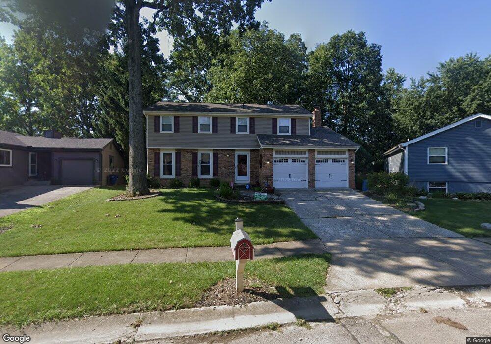
2311 Benning Dr Powell, OH 43065
Estimated Value: $384,000 - $433,000
4
Beds
3
Baths
2,040
Sq Ft
$202/Sq Ft
Est. Value
About This Home
This home is located at 2311 Benning Dr, Powell, OH 43065 and is currently estimated at $413,006, approximately $202 per square foot. 2311 Benning Dr is a home located in Franklin County with nearby schools including Liberty Elementary School, McCord Middle School, and Worthington Kilbourne High School.
Ownership History
Date
Name
Owned For
Owner Type
Purchase Details
Closed on
Sep 24, 2004
Sold by
Greenlee Claud T and Greenlee Susan A
Bought by
Rayburn Dawn M and Truesdale Shawn C
Current Estimated Value
Purchase Details
Closed on
May 31, 2000
Sold by
Oconnor Deborah L and Jory Michael T
Bought by
Greenlee Claud T and Greenlee Susan A
Home Financials for this Owner
Home Financials are based on the most recent Mortgage that was taken out on this home.
Original Mortgage
$141,411
Outstanding Balance
$46,815
Interest Rate
8.18%
Mortgage Type
FHA
Estimated Equity
$366,191
Purchase Details
Closed on
Oct 3, 1996
Sold by
Ellis Lisa M
Bought by
Deborah L O'Connor
Home Financials for this Owner
Home Financials are based on the most recent Mortgage that was taken out on this home.
Original Mortgage
$103,850
Interest Rate
8%
Mortgage Type
Balloon
Purchase Details
Closed on
Mar 7, 1994
Purchase Details
Closed on
Oct 19, 1988
Create a Home Valuation Report for This Property
The Home Valuation Report is an in-depth analysis detailing your home's value as well as a comparison with similar homes in the area
Home Values in the Area
Average Home Value in this Area
Purchase History
| Date | Buyer | Sale Price | Title Company |
|---|---|---|---|
| Rayburn Dawn M | $166,900 | Title First | |
| Greenlee Claud T | $141,500 | Warranty Title | |
| Deborah L O'Connor | $129,850 | -- | |
| -- | $119,500 | -- | |
| -- | $90,000 | -- |
Source: Public Records
Mortgage History
| Date | Status | Borrower | Loan Amount |
|---|---|---|---|
| Open | Greenlee Claud T | $141,411 | |
| Previous Owner | Deborah L O'Connor | $103,850 |
Source: Public Records
Tax History
| Year | Tax Paid | Tax Assessment Tax Assessment Total Assessment is a certain percentage of the fair market value that is determined by local assessors to be the total taxable value of land and additions on the property. | Land | Improvement |
|---|---|---|---|---|
| 2025 | $10,453 | $116,520 | $41,900 | $74,620 |
| 2024 | $10,453 | $116,520 | $41,900 | $74,620 |
| 2023 | $6,841 | $116,515 | $41,895 | $74,620 |
| 2022 | $5,307 | $71,720 | $18,410 | $53,310 |
| 2021 | $4,896 | $71,720 | $18,410 | $53,310 |
| 2020 | $4,716 | $71,720 | $18,410 | $53,310 |
| 2019 | $4,236 | $58,140 | $15,330 | $42,810 |
| 2018 | $4,140 | $57,230 | $15,330 | $41,900 |
| 2017 | $3,737 | $57,230 | $15,330 | $41,900 |
| 2016 | $4,239 | $59,710 | $14,420 | $45,290 |
| 2015 | $4,240 | $59,710 | $14,420 | $45,290 |
| 2014 | $4,238 | $59,710 | $14,420 | $45,290 |
| 2013 | $2,109 | $59,710 | $14,420 | $45,290 |
Source: Public Records
Map
Nearby Homes
- 2514 Tevis Ann Ct
- 2000 Dina Ct
- 3910 Summit View Rd
- 471 Commons Dr Unit 471
- 4933 Emerald Lakes Blvd Unit 4903
- 7844 Adare Ct Unit 5
- 10339 Sawmill Rd
- 1810 Calico Ct
- 7685 Starmont Ct
- 2744 Saltergate Dr
- 3827 Carberry Dr Unit 3827
- 8213 Longhorn Rd
- 8205 Longhorn Rd
- 8207 Copperfield Dr
- 8292 Breckenridge Way
- 424 Whitaker Ave S
- 8245 Markhaven Ct
- 7480 Gardenview Place
- 4552 N Hampton Dr
- 7735 Schoolway Ct
- 2315 Benning Dr
- 2305 Benning Dr
- 2297 Benning Dr
- 2322 Hartsdale Dr
- 2330 Hartsdale Dr
- 2300 Benning Dr
- 2314 Hartsdale Dr
- 2291 Benning Dr
- 2323 Benning Dr
- 2338 Hartsdale Dr
- 2306 Hartsdale Dr
- 8794 Greenburg Dr
- 8810 Greenburg Dr
- 2287 Benning Dr
- 2300 Hartsdale Dr
- 8818 Greenburg Dr
- 2281 Benning Dr
- 2322 Benning Dr
- 2290 Hartsdale Dr
- 2333 Hartsdale Dr
Your Personal Tour Guide
Ask me questions while you tour the home.