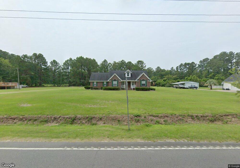
2311 Highway 548 Conway, SC 29527
Estimated Value: $608,185
3
Beds
3
Baths
3,150
Sq Ft
$193/Sq Ft
Est. Value
About This Home
This home is located at 2311 Highway 548, Conway, SC 29527 and is currently estimated at $608,185, approximately $193 per square foot. 2311 Highway 548 is a home located in Horry County with nearby schools including Pee Dee Elementary School, Whittemore Park Middle School, and Conway High School.
Ownership History
Date
Name
Owned For
Owner Type
Purchase Details
Closed on
Jul 15, 2015
Sold by
Jordan James T and Jordan Wanda B
Bought by
Gabriel Paul A
Current Estimated Value
Purchase Details
Closed on
Oct 10, 2008
Sold by
Gabriel Philomena
Bought by
Gabriel Angelo L
Purchase Details
Closed on
Oct 27, 2004
Sold by
Hardwick Earl
Bought by
Gabriel Angelo L and Gabriel Philomena
Home Financials for this Owner
Home Financials are based on the most recent Mortgage that was taken out on this home.
Original Mortgage
$45,980
Interest Rate
5.65%
Mortgage Type
Commercial
Create a Home Valuation Report for This Property
The Home Valuation Report is an in-depth analysis detailing your home's value as well as a comparison with similar homes in the area
Home Values in the Area
Average Home Value in this Area
Purchase History
| Date | Buyer | Sale Price | Title Company |
|---|---|---|---|
| Gabriel Paul A | $13,000 | -- | |
| Gabriel Angelo L | -- | -- | |
| Gabriel Angelo L | $229,900 | -- | |
| Hardwick Earl | -- | -- |
Source: Public Records
Mortgage History
| Date | Status | Borrower | Loan Amount |
|---|---|---|---|
| Previous Owner | Gabriel Angelo L | $45,980 | |
| Previous Owner | Gabriel Angelo L | $183,920 |
Source: Public Records
Tax History Compared to Growth
Tax History
| Year | Tax Paid | Tax Assessment Tax Assessment Total Assessment is a certain percentage of the fair market value that is determined by local assessors to be the total taxable value of land and additions on the property. | Land | Improvement |
|---|---|---|---|---|
| 2024 | $2,877 | $20,110 | $2,483 | $17,627 |
| 2023 | $2,877 | $7,752 | $1,179 | $6,573 |
| 2021 | $733 | $16,026 | $1,854 | $14,172 |
| 2020 | $594 | $16,026 | $1,854 | $14,172 |
| 2019 | $594 | $16,026 | $1,854 | $14,172 |
| 2018 | $519 | $10,112 | $1,538 | $8,574 |
| 2017 | $487 | $10,112 | $1,538 | $8,574 |
| 2016 | -- | $10,112 | $1,538 | $8,574 |
| 2015 | $487 | $6,742 | $1,026 | $15,005 |
| 2014 | $453 | $10,112 | $1,538 | $8,574 |
Source: Public Records
Map
Nearby Homes
- 2102 State Highway 548
- TBD Juniper Bay Rd
- Lot 1 Juniper Bay Rd
- Lot 3 Juniper Bay Rd
- TBD 2 Highway 548
- Lot 2 Juniper Bay Rd
- 3708 Faith Dr
- 4937 Bottle Branch Rd
- 114 Hampton Ridge Rd Unit 29527
- 4560 Bottle Branch Rd
- 3731 Love Ln
- 939 Grace Dr Unit Faith Hills
- TBD Hampton Rd
- 4805 Juniper Bay Rd
- 394 Acosta Cir
- 390 Acosta Cir
- 632 Anthem Ct
- 633 Anthem Ct
- 629 Anthem Ct
- 377 Acosta Cir
- 2299 Highway 548
- 2325 Highway 548
- 5536 Juniper Bay Rd
- 5486 Juniper Bay Rd
- 5519 Juniper Bay Rd
- 5535 Juniper Bay Rd
- 2250 Highway 548
- 5491 Juniper Bay Rd
- 5350 Bottle Branch Rd
- 5360 Bottle Branch Rd
- 5361 Bottle Branch Rd
- 5357 Bottle Branch Rd
- 2150 Highway 548
- 5460 Juniper Bay Rd
- 5320 Bottle Branch Rd
- 5305 Bottle Branch Rd
- 5451 Juniper Bay Rd
- 5451 Juniper Bay Rd
- 5295 Bottle Branch Rd
- 1976 Gemini Cir