Estimated Value: $525,000 - $651,000
5
Beds
3
Baths
2,105
Sq Ft
$276/Sq Ft
Est. Value
About This Home
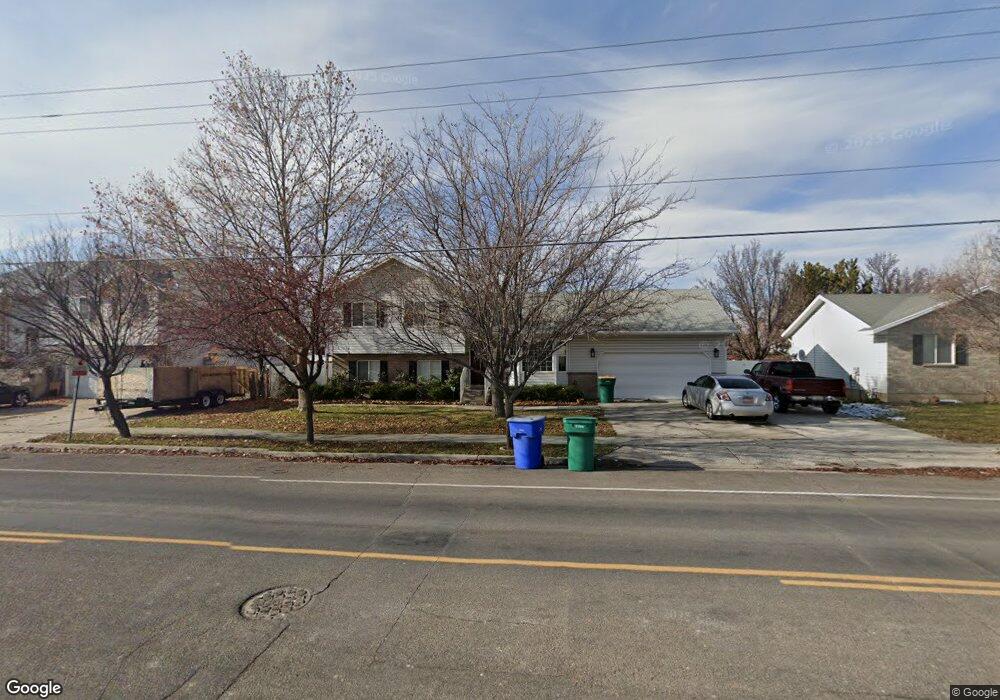
This home is located at 2311 N 1200 E, Lehi, UT 84043 and is currently estimated at $580,537, approximately $275 per square foot. 2311 N 1200 E is a home located in Utah County with nearby schools including Freedom Elementary School, Lehi Junior High School, and Skyridge High School.
Ownership History
Date
Name
Owned For
Owner Type
Purchase Details
Closed on
Aug 5, 2010
Sold by
Cook Lamar R and Cook Elaine H
Bought by
Sturm Ann Marie
Current Estimated Value
Home Financials for this Owner
Home Financials are based on the most recent Mortgage that was taken out on this home.
Original Mortgage
$186,488
Outstanding Balance
$122,222
Interest Rate
4.37%
Mortgage Type
FHA
Estimated Equity
$458,315
Purchase Details
Closed on
Apr 30, 2001
Sold by
Wahlquist Gary F
Bought by
Cook Lamar R and Cook Elaine H
Home Financials for this Owner
Home Financials are based on the most recent Mortgage that was taken out on this home.
Original Mortgage
$135,000
Interest Rate
6.92%
Purchase Details
Closed on
Nov 1, 1999
Sold by
Neeley Jeff D and Neeley Stefani Ann
Bought by
Wahlquist Gary F
Create a Home Valuation Report for This Property
The Home Valuation Report is an in-depth analysis detailing your home's value as well as a comparison with similar homes in the area
Home Values in the Area
Average Home Value in this Area
Purchase History
| Date | Buyer | Sale Price | Title Company |
|---|---|---|---|
| Sturm Ann Marie | -- | First American American F | |
| Cook Lamar R | -- | Pro Title & Escrow Inc | |
| Wahlquist Gary F | -- | Old Republic Title Company |
Source: Public Records
Mortgage History
| Date | Status | Borrower | Loan Amount |
|---|---|---|---|
| Open | Sturm Ann Marie | $186,488 | |
| Previous Owner | Cook Lamar R | $135,000 |
Source: Public Records
Tax History Compared to Growth
Tax History
| Year | Tax Paid | Tax Assessment Tax Assessment Total Assessment is a certain percentage of the fair market value that is determined by local assessors to be the total taxable value of land and additions on the property. | Land | Improvement |
|---|---|---|---|---|
| 2025 | $2,129 | $284,240 | $208,500 | $308,300 |
| 2024 | $2,129 | $249,205 | $0 | $0 |
| 2023 | $1,966 | $249,755 | $0 | $0 |
| 2022 | $2,151 | $264,990 | $0 | $0 |
| 2021 | $1,912 | $356,000 | $120,700 | $235,300 |
| 2020 | $1,802 | $331,700 | $111,800 | $219,900 |
| 2019 | $1,583 | $303,000 | $111,800 | $191,200 |
| 2018 | $1,510 | $273,200 | $106,900 | $166,300 |
| 2017 | $1,464 | $140,800 | $0 | $0 |
| 2016 | $1,493 | $133,210 | $0 | $0 |
| 2015 | $1,499 | $126,940 | $0 | $0 |
| 2014 | $1,416 | $119,240 | $0 | $0 |
Source: Public Records
Map
Nearby Homes
- 975 E 2125 N
- 2208 N 825 E
- 859 E 2125 N
- 975 E 2850 N
- 9967 N 6670 W
- 192 E 2200 N
- 2539 N 300 E
- 6692 W 9770 N
- 9924 N 6630 W Unit 9
- 1602 E Center Pointe Dr
- 1602 E Center Pointe Dr Unit 1
- 1610 E Center Pointe Dr
- 4333 N Baiken Ridge Dr Unit 1020
- 3368 N 700 E
- 565 E 3375 N
- 629 E 3420 N
- 6399 W 10150 N
- 2159 N Banbury Ct
- 10434 N 6400 W
- 9435 N Aspen Hollow Cir