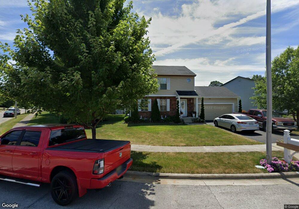
2311 Rolling Rock Dr Columbus, OH 43229
Forest Park East NeighborhoodEstimated Value: $221,000 - $298,000
About This Home
This home is located at 2311 Rolling Rock Dr, Columbus, OH 43229 and is currently estimated at $271,810, approximately $197 per square foot. 2311 Rolling Rock Dr is a home located in Franklin County with nearby schools including Avalon Elementary School, Northgate Intermediate, and Woodward Park Middle School.
Ownership History
We collect this data history from publicly available records. To have your information removed, we recommend requesting removal directly through your county’s website.
Purchase Details
Home Financials for this Owner
Home Financials are based on the most recent Mortgage that was taken out on this home.Purchase Details
Purchase Details
Purchase Details
Home Financials for this Owner
Home Financials are based on the most recent Mortgage that was taken out on this home.Home Values in the Area
Average Home Value in this Area
Purchase History
We collect this data history from publicly available records. To have your information removed, we recommend requesting removal directly through your county’s website.
| Date | Buyer | Sale Price | Title Company |
|---|---|---|---|
| $90,000 | Great Ameri | ||
| -- | Independent | ||
| $78,000 | None Available | ||
| $112,000 | Preferred Title Agency Inc |
Mortgage History
We collect this data history from publicly available records. To have your information removed, we recommend requesting removal directly through your county’s website.
| Date | Status | Borrower | Loan Amount |
|---|---|---|---|
| Open | $91,257 | ||
| Previous Owner | $111,100 |
Tax History
We collect this data history from publicly available records. To have your information removed, we recommend requesting removal directly through your county’s website.
| Year | Tax Paid | Tax Assessment Tax Assessment Total Assessment is a certain percentage of the fair market value that is determined by local assessors to be the total taxable value of land and additions on the property. | Land | Improvement |
|---|---|---|---|---|
| 2025 | $3,263 | $72,700 | $22,750 | $49,950 |
| 2024 | $3,263 | $72,700 | $22,750 | $49,950 |
| 2023 | $3,221 | $72,700 | $22,750 | $49,950 |
| 2022 | $2,881 | $55,550 | $12,390 | $43,160 |
| 2021 | $2,886 | $55,550 | $12,390 | $43,160 |
| 2020 | $2,890 | $55,550 | $12,390 | $43,160 |
| 2019 | $2,516 | $41,480 | $9,210 | $32,270 |
| 2018 | $2,268 | $41,480 | $9,210 | $32,270 |
| 2017 | $2,515 | $41,480 | $9,210 | $32,270 |
| 2016 | $2,231 | $33,680 | $8,090 | $25,590 |
| 2015 | $2,025 | $33,680 | $8,090 | $25,590 |
| 2014 | $2,030 | $33,680 | $8,090 | $25,590 |
| 2013 | $1,053 | $35,420 | $8,505 | $26,915 |
Map
- 5090 Avalon Ave
- 2392 Minerva Park Place
- 5151 Avalon Ave
- 2405 Strimple Ave
- 2166 Blackoak Ave
- 2224 Kilbourne Ave
- 2229 Waldorf Rd
- 2294 Teakwood Dr
- 4730 Edinburgh Ln
- 5330 Torchwood Loop W
- 4710 Larkhall Ln
- 0 Chester Rd
- 1944 Coghill Dr
- 5480 Cedarbush Rd
- 0 Abington Rd Unit 224031704
- 1859 Tamarack Ct S
- 2127 Shawbury Ct E
- 5377 Park Lane Ct
- 1862 Torchwood Dr
- 2093 Tupsfield Rd
- 2295 Rolling Rock Dr
- 5071 Rolling Rock Ct
- 5063 Rolling Rock Ct
- 2278 Rolling Rock Dr
- 2262 Rolling Rock Dr
- 2283 Rolling Rock Dr
- 2237 Rolling Rock Dr
- 5055 Rolling Rock Ct
- 2246 Rolling Rock Dr
- 2324 Rolling Rock Dr
- 2332 Rolling Rock Dr
- 2284 Rolling Rock Dr
- 2316 Rolling Rock Dr
- 2300 Rolling Rock Dr
- 2340 Rolling Rock Dr
- 2229 Rolling Rock Dr
- 5047 Rolling Rock Ct
- 2214 Rolling Rock Dr
- 2222 Rolling Rock Dr
- 2276 Rolling Rock Dr
Ask me questions while you tour the home.