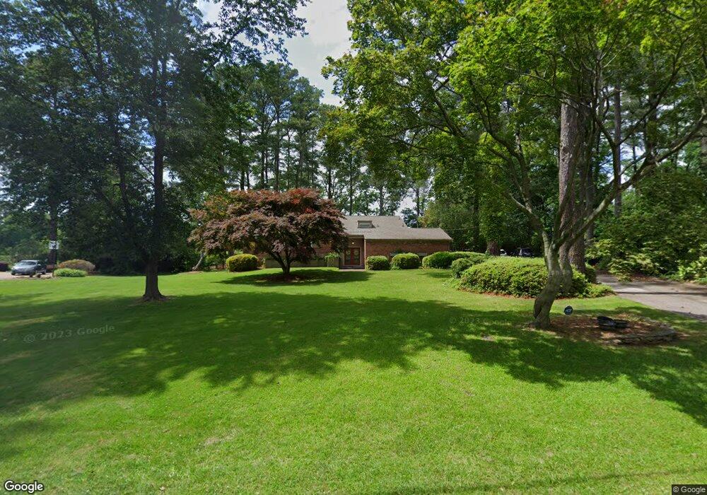
2312 Sterling Point Dr Portsmouth, VA 23703
Churchland NeighborhoodEstimated Value: $530,000 - $691,068
4
Beds
3
Baths
3,139
Sq Ft
$198/Sq Ft
Est. Value
About This Home
This home is located at 2312 Sterling Point Dr, Portsmouth, VA 23703 and is currently estimated at $620,267, approximately $197 per square foot. 2312 Sterling Point Dr is a home located in Portsmouth City with nearby schools including Churchland Elementary School, Churchland Academy Elementary School, and Churchland Middle School.
Ownership History
Date
Name
Owned For
Owner Type
Purchase Details
Closed on
Sep 28, 2007
Sold by
Parr Andrew R
Bought by
Davis Richard J
Current Estimated Value
Home Financials for this Owner
Home Financials are based on the most recent Mortgage that was taken out on this home.
Original Mortgage
$554,400
Outstanding Balance
$348,318
Interest Rate
6.51%
Mortgage Type
New Conventional
Estimated Equity
$271,949
Purchase Details
Closed on
Feb 2, 2004
Sold by
Phipps Kenneth
Bought by
Parr Andrew
Home Financials for this Owner
Home Financials are based on the most recent Mortgage that was taken out on this home.
Original Mortgage
$282,200
Interest Rate
5.82%
Mortgage Type
New Conventional
Create a Home Valuation Report for This Property
The Home Valuation Report is an in-depth analysis detailing your home's value as well as a comparison with similar homes in the area
Home Values in the Area
Average Home Value in this Area
Purchase History
| Date | Buyer | Sale Price | Title Company |
|---|---|---|---|
| Davis Richard J | $693,000 | -- | |
| Parr Andrew | $332,000 | -- |
Source: Public Records
Mortgage History
| Date | Status | Borrower | Loan Amount |
|---|---|---|---|
| Open | Davis Richard J | $554,400 | |
| Previous Owner | Parr Andrew | $282,200 |
Source: Public Records
Tax History Compared to Growth
Tax History
| Year | Tax Paid | Tax Assessment Tax Assessment Total Assessment is a certain percentage of the fair market value that is determined by local assessors to be the total taxable value of land and additions on the property. | Land | Improvement |
|---|---|---|---|---|
| 2025 | $8,235 | $667,500 | $327,470 | $340,030 |
| 2024 | $8,235 | $655,610 | $327,470 | $328,140 |
| 2023 | $7,720 | $617,560 | $327,470 | $290,090 |
| 2022 | $7,801 | $600,090 | $324,270 | $275,820 |
| 2021 | $7,462 | $573,990 | $314,820 | $259,170 |
| 2020 | $7,205 | $554,240 | $299,830 | $254,410 |
| 2019 | $7,174 | $551,870 | $299,830 | $252,040 |
| 2018 | $7,174 | $551,870 | $299,830 | $252,040 |
| 2017 | $7,174 | $551,870 | $299,830 | $252,040 |
| 2016 | $7,174 | $551,870 | $299,830 | $252,040 |
| 2015 | $7,165 | $551,130 | $299,830 | $251,300 |
| 2014 | $6,999 | $551,130 | $299,830 | $251,300 |
Source: Public Records
Map
Nearby Homes
- 3000 Ferguson Dr
- 4011 Reese Dr S
- 5111 Sweetbriar Cir
- 3130 Sterling Point Dr
- 3128 Sterling Point Dr
- 5221 High St W
- 5006 High St W
- 3205 Clover Hill Dr
- 3233 Clover Hill Dr
- 2805 Acres Rd
- 3917 Oak Dr E
- 4412 Gannon Rd
- 5302 High St W
- 4417 Gannon Rd
- 3101 Laurel Ln
- 5304 High St W
- 5220 Clover Hill Dr
- 4305 Manchester Rd
- 3200 Westwood Crescent
- 4707 High St W
- 2308 Sterling Point Dr
- 2316 Sterling Point Dr
- 2305 Sterling Point Dr
- 2309 Sterling Point Dr
- 2304 Sterling Point Dr
- 2301 Sterling Point Dr
- 2300 Sterling Point Dr
- 2300 Bidgood Dr
- 2313 Sterling Point Dr
- 2320 Sterling Point Dr
- 2216 Sterling Point Dr
- 4029 Reese Dr S
- 2213 Sterling Point Dr
- 4031 Reese Dr S
- 4033 Reese Dr S
- 2212 Sterling Point Dr
- 2301 Bidgood Dr
- 2308 Bidgood Dr
- 4027 Reese Dr S
- 4025 Reese Dr S