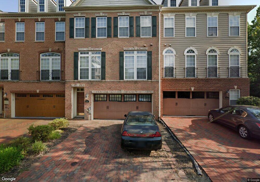
2313 Barnstable Dr Upper Marlboro, MD 20774
Estimated Value: $566,000
3
Beds
3
Baths
2,304
Sq Ft
$246/Sq Ft
Est. Value
About This Home
This home is located at 2313 Barnstable Dr, Upper Marlboro, MD 20774 and is currently priced at $566,000, approximately $245 per square foot. 2313 Barnstable Dr is a home located in Prince George's County with nearby schools including Patuxent Elementary School, James Madison Middle School, and Dr. Henry A. Wise Jr. High School.
Ownership History
Date
Name
Owned For
Owner Type
Purchase Details
Closed on
May 10, 2022
Sold by
Gore Anthony Barrett
Bought by
Gore Anthony Barrett
Current Estimated Value
Purchase Details
Closed on
Mar 21, 2014
Sold by
Gore Anthony Barrett
Bought by
Gore Anthony Barrett and Gore Samia Latia
Home Financials for this Owner
Home Financials are based on the most recent Mortgage that was taken out on this home.
Original Mortgage
$306,100
Interest Rate
3.5%
Mortgage Type
Adjustable Rate Mortgage/ARM
Purchase Details
Closed on
Dec 18, 2009
Sold by
Hicks Sheryl
Bought by
Gore Anthony B
Home Financials for this Owner
Home Financials are based on the most recent Mortgage that was taken out on this home.
Original Mortgage
$320,000
Interest Rate
4.85%
Mortgage Type
VA
Purchase Details
Closed on
Sep 29, 2005
Sold by
V O B Limited Partnership
Bought by
Nvr Inc and 280 Suite
Create a Home Valuation Report for This Property
The Home Valuation Report is an in-depth analysis detailing your home's value as well as a comparison with similar homes in the area
Home Values in the Area
Average Home Value in this Area
Purchase History
| Date | Buyer | Sale Price | Title Company |
|---|---|---|---|
| Gore Anthony Barrett | -- | None Listed On Document | |
| Gore Anthony Barrett | -- | Lsi Title Agency | |
| Gore Anthony B | $320,000 | -- | |
| Nvr Inc | $265,000 | -- |
Source: Public Records
Mortgage History
| Date | Status | Borrower | Loan Amount |
|---|---|---|---|
| Previous Owner | Gore Anthony Barrett | $306,100 | |
| Previous Owner | Gore Anthony B | $320,000 |
Source: Public Records
Tax History
| Year | Tax Paid | Tax Assessment Tax Assessment Total Assessment is a certain percentage of the fair market value that is determined by local assessors to be the total taxable value of land and additions on the property. | Land | Improvement |
|---|---|---|---|---|
| 2025 | $7,074 | $506,700 | $150,000 | $356,700 |
| 2024 | $7,074 | $462,267 | -- | -- |
| 2023 | $6,431 | $417,833 | $0 | $0 |
| 2022 | $5,790 | $373,400 | $100,000 | $273,400 |
| 2021 | $5,790 | $373,400 | $100,000 | $273,400 |
| 2020 | $5,790 | $373,400 | $100,000 | $273,400 |
| 2019 | $5,905 | $381,400 | $100,000 | $281,400 |
| 2018 | $5,745 | $370,300 | $0 | $0 |
| 2017 | $5,585 | $359,200 | $0 | $0 |
| 2016 | -- | $348,100 | $0 | $0 |
| 2015 | $4,620 | $334,600 | $0 | $0 |
| 2014 | $4,620 | $321,100 | $0 | $0 |
Source: Public Records
Map
Nearby Homes
- 15706 Copper Beech Dr
- 8300 Hook Ln
- 2116 Turleygreen Place
- 15305 Torcross Way
- 15612 Bibury Aly
- 15608 Bibury Aly
- 2814 Medstead Ln
- 15606 Beech Tree Pkwy
- 15301 Kettlebaston Ln
- 16502 Golden Crown Dr
- 16503 Rolling Knolls Ln
- 15701 Norus St
- 3617 Pentland Hills Dr
- 16502 Rolling Knolls Ln
- 3715 Halloway N
- 3807 Pentland Hills Dr
- 1002 Marshalls Dr
- 14608 Goldcrest Foxglove Dr Unit LO-22
- 14701 Sweet Pepperbush Place
- 1314 Leeland Forest Rd
- 2315 Barnstable Dr
- 2311 Barnstable Dr
- 2317 Barnstable Dr
- 2305 Moores Plains Blvd
- 2304 Barnstable Dr
- 2303 Moores Plains Blvd
- 2302 Barnstable Dr
- 2300 Barnstable Dr
- 15807 Buxton Place
- 15809 Buxton Place
- 15805 Buxton Place
- 15811 Buxton Place
- 15803 Buxton Place
- 15801 Buxton Place
- 0 Buxton Place
- 2223 Barnstable Dr
- 2221 Barnstable Dr
- 15806 Buxton Place
- 15808 Buxton Place
Your Personal Tour Guide
Ask me questions while you tour the home.