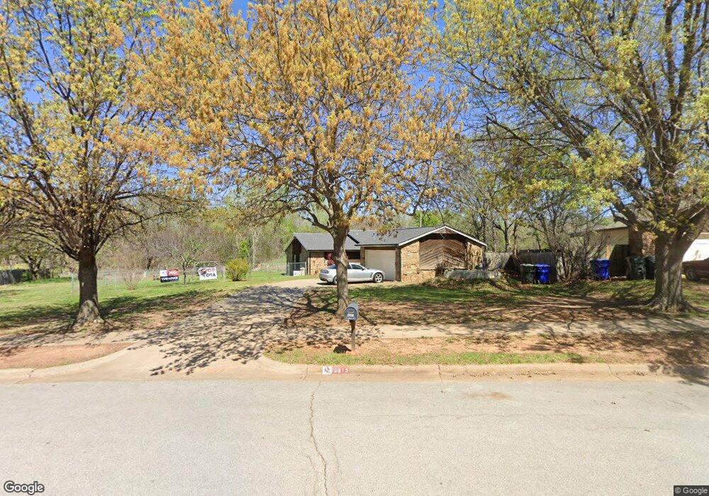
2313 Tahoe Dr Norman, OK 73071
Southeast Norman NeighborhoodEstimated Value: $173,000 - $199,000
3
Beds
2
Baths
1,308
Sq Ft
$144/Sq Ft
Est. Value
About This Home
This home is located at 2313 Tahoe Dr, Norman, OK 73071 and is currently estimated at $188,821, approximately $144 per square foot. 2313 Tahoe Dr is a home located in Cleveland County with nearby schools including Ronald Reagan Elementary School, Irving Middle School, and Norman High School.
Ownership History
Date
Name
Owned For
Owner Type
Purchase Details
Closed on
Dec 13, 2010
Sold by
Kane Jason Michael and Kane Jocelin
Bought by
Vaughn Allis C
Current Estimated Value
Home Financials for this Owner
Home Financials are based on the most recent Mortgage that was taken out on this home.
Original Mortgage
$75,750
Outstanding Balance
$50,097
Interest Rate
4.24%
Mortgage Type
FHA
Estimated Equity
$138,724
Purchase Details
Closed on
Aug 27, 2003
Sold by
Harvell Harold K and Harvell Shirley H
Bought by
Kane Jason Michael
Purchase Details
Closed on
Jun 17, 2003
Sold by
American General Finance Inc
Bought by
Harvell Harold K and Harvell Shirley H
Purchase Details
Closed on
May 22, 2002
Sold by
Lewis Gregory Jay
Bought by
American General Finance Inc
Create a Home Valuation Report for This Property
The Home Valuation Report is an in-depth analysis detailing your home's value as well as a comparison with similar homes in the area
Home Values in the Area
Average Home Value in this Area
Purchase History
| Date | Buyer | Sale Price | Title Company |
|---|---|---|---|
| Vaughn Allis C | $88,500 | Fa | |
| Kane Jason Michael | $58,000 | -- | |
| Harvell Harold K | $50,000 | -- | |
| American General Finance Inc | -- | -- |
Source: Public Records
Mortgage History
| Date | Status | Borrower | Loan Amount |
|---|---|---|---|
| Open | Vaughn Allis C | $75,750 |
Source: Public Records
Tax History Compared to Growth
Tax History
| Year | Tax Paid | Tax Assessment Tax Assessment Total Assessment is a certain percentage of the fair market value that is determined by local assessors to be the total taxable value of land and additions on the property. | Land | Improvement |
|---|---|---|---|---|
| 2024 | $1,193 | $10,959 | $2,004 | $8,955 |
| 2023 | $1,157 | $10,640 | $2,125 | $8,515 |
| 2022 | $1,074 | $10,330 | $1,800 | $8,530 |
| 2021 | $1,132 | $10,330 | $1,800 | $8,530 |
| 2020 | $1,108 | $10,330 | $1,800 | $8,530 |
| 2019 | $1,127 | $10,330 | $1,800 | $8,530 |
| 2018 | $1,092 | $10,330 | $1,800 | $8,530 |
| 2017 | $1,105 | $10,330 | $0 | $0 |
| 2016 | $1,123 | $10,330 | $1,800 | $8,530 |
| 2015 | $1,114 | $10,538 | $1,800 | $8,738 |
| 2014 | $1,165 | $10,881 | $1,640 | $9,241 |
Source: Public Records
Map
Nearby Homes
- 1900 Twin Tree Dr
- 1603 Oakcrest Ave
- 2361 Heatherfield Ln
- 1600 Rolling Stone Dr
- 1908 Frost Ln
- 1812 Ridgewood Dr
- 821 Mount Irving Way
- 2018 Oakmeadows Dr
- 1833 Parkridge Dr
- 1848 Parkridge Dr
- 1301 Whippoorwill Dr
- Hayes Plan at The Villages
- Rincon Plan at The Villages
- Canelo Plan at The Villages
- Aubrey Plan at The Villages
- 2223 Wolford Way
- 2023 Delphine Dr
- 2124 Oakside Dr
- 1633 Creekside Ln
- 1301 Briar Patch Way
- 2309 Tahoe Dr
- 2317 Tahoe Dr
- 1801 Twin Tree Dr
- 2305 Tahoe Dr
- 2321 Tahoe Dr
- 1721 Rolling Stone Dr
- 1805 Twin Tree Dr
- 2323 Tahoe Dr
- 2327 Tahoe Dr
- 2312 Tahoe Dr
- 2301 Tahoe Dr
- 1717 Rolling Stone Dr
- 1713 Rolling Stone Dr
- 1800 Twin Tree Dr
- 1725 Rolling Stone Dr
- 1809 Twin Tree Dr
- 2329 Tahoe Dr
- 1804 Twin Tree Dr
- 1709 Rolling Stone Dr
- 2219 Tahoe Dr