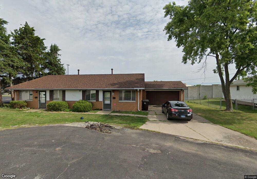
2313 W Westport Rd Peoria, IL 61615
North Peoria NeighborhoodEstimated Value: $156,000 - $190,000
4
Beds
2
Baths
2,000
Sq Ft
$86/Sq Ft
Est. Value
About This Home
This home is located at 2313 W Westport Rd, Peoria, IL 61615 and is currently estimated at $171,074, approximately $85 per square foot. 2313 W Westport Rd is a home with nearby schools including Dr Maude A Sanders Primary School, Sterling Middle School, and Peoria High School.
Ownership History
Date
Name
Owned For
Owner Type
Purchase Details
Closed on
Sep 15, 2020
Sold by
Glm Properties Llc
Bought by
Glm Real Estate Holdings Llc S
Current Estimated Value
Purchase Details
Closed on
Jan 24, 2018
Sold by
Reising Ronald G
Bought by
Glm Properties Llc
Purchase Details
Closed on
Jan 22, 2018
Sold by
Reising Ronald G
Bought by
Glm Properties Llc
Purchase Details
Closed on
Mar 1, 1987
Bought by
Reising Ronald G
Create a Home Valuation Report for This Property
The Home Valuation Report is an in-depth analysis detailing your home's value as well as a comparison with similar homes in the area
Home Values in the Area
Average Home Value in this Area
Purchase History
| Date | Buyer | Sale Price | Title Company |
|---|---|---|---|
| Glm Real Estate Holdings Llc S | -- | William C Connor Attorney At L | |
| Glm Properties Llc | -- | Attorneys Title Guaranty Fund | |
| Glm Properties Llc | -- | Attorneys Title Guaranty Fund | |
| Reising Ronald G | $40,000 | -- |
Source: Public Records
Tax History Compared to Growth
Tax History
| Year | Tax Paid | Tax Assessment Tax Assessment Total Assessment is a certain percentage of the fair market value that is determined by local assessors to be the total taxable value of land and additions on the property. | Land | Improvement |
|---|---|---|---|---|
| 2024 | $3,745 | $41,400 | $6,410 | $34,990 |
| 2023 | $3,573 | $37,980 | $5,880 | $32,100 |
| 2022 | $3,618 | $37,510 | $5,580 | $31,930 |
| 2021 | $3,551 | $35,720 | $5,310 | $30,410 |
| 2020 | $3,544 | $35,370 | $5,260 | $30,110 |
| 2019 | $3,595 | $36,090 | $5,370 | $30,720 |
| 2018 | $3,550 | $36,450 | $5,430 | $31,020 |
| 2017 | $3,549 | $36,810 | $5,480 | $31,330 |
| 2016 | $3,450 | $36,810 | $5,480 | $31,330 |
| 2015 | $3,320 | $36,090 | $5,370 | $30,720 |
| 2014 | $3,320 | $36,070 | $5,350 | $30,720 |
| 2013 | -- | $36,500 | $5,410 | $31,090 |
Source: Public Records
Map
Nearby Homes
- 4011 N Sterling Ave
- 2214 W Bainter Ln
- 2705 W Millbrook Ct
- 3720 N Saint Michael Ave
- 3623 N Sterling Ave Unit b-17
- 3808 N Walround Ln
- 2910 W Westport Rd
- 3423 N El Vista Ave
- 4426 N Wilco Dr
- 2922 W Larchmont Ln
- 2724 W Scenic Dr
- 2221 W Tripp Ave
- 3010 W Brookside Dr
- 2011 W Richwoods Blvd
- 4036 N Westport Ct
- 2036 W Richwoods Blvd
- 2627 Eugenie Ave
- 2318 W Albany Ave
- 2315 W Hudson St
- 4212 N Keenland Ave
- 2307 W Westport Rd
- 2303 W Westport Rd
- 2306 W Westport Rd
- 2233 W Westport Rd
- 2300 W Westport Rd
- 2228 W Westport Rd
- 2325 W Bainter Ln
- 2321 W Bainter Ln
- 2401 W Bainter Ln
- 2224 W Westport Rd
- 2315 W Bainter Ln
- 2221 W Westport Rd
- 2221 W Westport Rd Unit 2
- 2311 W Bainter Ln
- 2217 W Westport Rd
- 2222 W Westport Rd
- 2307 W Bainter Ln
- 2213 W Westport Rd
- 2213 W Westport Rd
- 2303 W Bainter Ln