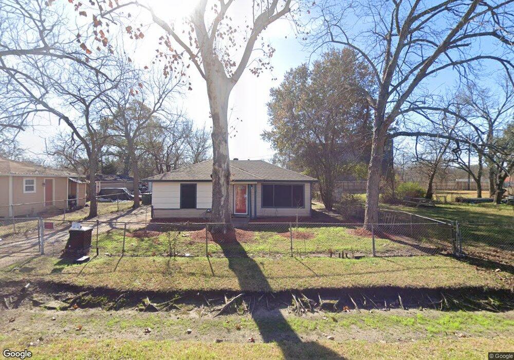
2314 Moreau St Houston, TX 77093
Eastex-Jensen NeighborhoodEstimated Value: $165,000 - $194,000
2
Beds
2
Baths
1,216
Sq Ft
$147/Sq Ft
Est. Value
About This Home
This home is located at 2314 Moreau St, Houston, TX 77093 and is currently estimated at $179,208, approximately $147 per square foot. 2314 Moreau St is a home located in Harris County with nearby schools including Coop Elementary School, Patrick Henry Middle School, and Sam Houston Math, Science & Technology Center.
Ownership History
Date
Name
Owned For
Owner Type
Purchase Details
Closed on
Sep 28, 2021
Sold by
Jones Kevin Demetrious and Jones Dessie
Bought by
Jones Paul and Jones Petra Mojica
Current Estimated Value
Home Financials for this Owner
Home Financials are based on the most recent Mortgage that was taken out on this home.
Original Mortgage
$102,400
Interest Rate
2.8%
Mortgage Type
New Conventional
Create a Home Valuation Report for This Property
The Home Valuation Report is an in-depth analysis detailing your home's value as well as a comparison with similar homes in the area
Home Values in the Area
Average Home Value in this Area
Purchase History
| Date | Buyer | Sale Price | Title Company |
|---|---|---|---|
| Jones Paul | -- | The Title Co |
Source: Public Records
Mortgage History
| Date | Status | Borrower | Loan Amount |
|---|---|---|---|
| Closed | Jones Paul | $102,400 |
Source: Public Records
Tax History Compared to Growth
Tax History
| Year | Tax Paid | Tax Assessment Tax Assessment Total Assessment is a certain percentage of the fair market value that is determined by local assessors to be the total taxable value of land and additions on the property. | Land | Improvement |
|---|---|---|---|---|
| 2025 | $1,217 | $127,472 | $70,008 | $57,464 |
| 2024 | $1,217 | $150,766 | $65,568 | $85,198 |
| 2023 | $1,217 | $123,949 | $51,225 | $72,724 |
| 2022 | $2,254 | $102,384 | $42,688 | $59,696 |
| 2021 | $1,911 | $81,999 | $30,735 | $51,264 |
| 2020 | $1,899 | $78,409 | $30,735 | $47,674 |
| 2019 | $1,984 | $78,409 | $30,735 | $47,674 |
| 2018 | $1,387 | $54,802 | $23,564 | $31,238 |
| 2017 | $1,386 | $54,802 | $23,564 | $31,238 |
| 2016 | $1,386 | $54,802 | $23,564 | $31,238 |
| 2015 | $1,258 | $48,953 | $18,783 | $30,170 |
| 2014 | $1,258 | $48,953 | $18,783 | $30,170 |
Source: Public Records
Map
Nearby Homes
- 2332 Margaret St
- 2415 Goodloe St
- 2315 Langley Rd
- 2318 Cresline St
- 10512 Exeter St
- 10514 Exeter St
- 1829 Skinner Rd
- 2633 Hollis St
- 1908 Little York Rd
- 1728 Little York Rd
- 2636 Lone Oak Rd
- 3202 Parker Rd
- 1731 Schilder Dr
- 2122 Kowis St
- 1904 Little York Rd
- 2629 Kowis St
- 2152 William Tell St
- 9910 E Hardy Rd
- 9634 Burden St
- 4918 Langley Rd
- 2318 Moreau St
- 10440 Aldine Westfield Rd
- 2322 Moreau St
- 2317 Goodloe St
- 2319 Goodloe St
- 10432 Aldine Westfield Rd
- 10421 Aldine Westfield Rd
- 2326 Moreau St
- 2323 Goodloe St
- 2323 Moreau St
- 2327 Goodloe St
- 2327 Moreau St
- 2331 Goodloe St
- 2331 Moreau St
- 2336 Moreau St
- 10451 Aldine Westfield Rd
- 2335 Goodloe St
- 2314 Margaret St
- 2320 Margaret St
- 10453 Aldine Westfield Rd