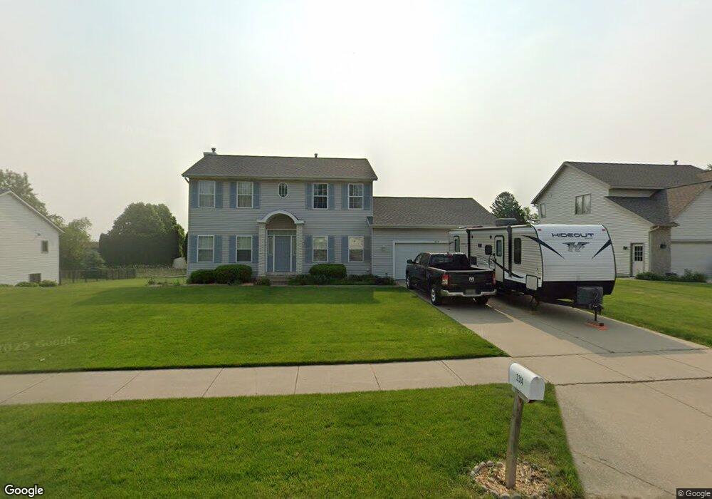
2314 Randall Ave NW Grand Rapids, MI 49534
Estimated Value: $426,282 - $552,000
4
Beds
3
Baths
2,448
Sq Ft
$196/Sq Ft
Est. Value
About This Home
This home is located at 2314 Randall Ave NW, Grand Rapids, MI 49534 and is currently estimated at $479,571, approximately $195 per square foot. 2314 Randall Ave NW is a home located in Kent County with nearby schools including Kenowa Hills Central Elementary School, Kenowa Hills Middle School, and Kenowa Hills High School.
Ownership History
Date
Name
Owned For
Owner Type
Purchase Details
Closed on
Feb 5, 2001
Sold by
Ferguson Thomas J
Bought by
Bowe Gregory A and Bowe Kippi J
Current Estimated Value
Home Financials for this Owner
Home Financials are based on the most recent Mortgage that was taken out on this home.
Original Mortgage
$162,000
Outstanding Balance
$58,429
Interest Rate
7.06%
Estimated Equity
$421,142
Purchase Details
Closed on
Apr 23, 1998
Bought by
Ferguson Thomas J and Bowe Gregory A
Create a Home Valuation Report for This Property
The Home Valuation Report is an in-depth analysis detailing your home's value as well as a comparison with similar homes in the area
Home Values in the Area
Average Home Value in this Area
Purchase History
| Date | Buyer | Sale Price | Title Company |
|---|---|---|---|
| Bowe Gregory A | $192,000 | -- | |
| Ferguson Thomas J | $170,000 | -- |
Source: Public Records
Mortgage History
| Date | Status | Borrower | Loan Amount |
|---|---|---|---|
| Open | Bowe Gregory A | $162,000 |
Source: Public Records
Tax History Compared to Growth
Tax History
| Year | Tax Paid | Tax Assessment Tax Assessment Total Assessment is a certain percentage of the fair market value that is determined by local assessors to be the total taxable value of land and additions on the property. | Land | Improvement |
|---|---|---|---|---|
| 2025 | $2,963 | $190,000 | $0 | $0 |
| 2024 | $2,963 | $173,200 | $0 | $0 |
| 2023 | $2,834 | $158,300 | $0 | $0 |
| 2022 | $3,000 | $139,900 | $0 | $0 |
| 2021 | $2,923 | $137,800 | $0 | $0 |
| 2020 | $2,565 | $134,900 | $0 | $0 |
| 2019 | $4,769 | $121,400 | $0 | $0 |
| 2018 | $2,743 | $115,900 | $0 | $0 |
| 2017 | $2,666 | $107,600 | $0 | $0 |
| 2016 | $2,562 | $97,700 | $0 | $0 |
| 2015 | $2,420 | $97,700 | $0 | $0 |
| 2013 | -- | $90,300 | $0 | $0 |
Source: Public Records
Map
Nearby Homes
- 2551 Kinney Ave NW
- 2486 Falcon Pointe Dr NW
- 2558 Meadow Ridge Dr
- 2549 Meadow Ridge Dr Unit 51
- 4417 Remembrance Rd NW
- 3560 Richmond St NW
- 1839 Stratford Ln NW
- 1883 Stratford Ln NW
- 1844 Stratford Ln NW
- 1869 Wilson Ave NW
- 1734 Blaketon Dr
- 1537 Browning Dr
- 1728 Blaketon Dr
- 1524 Stark Ave NW
- 1845 Kenowa Ave NW
- 1513 Browning Dr
- 1781 Mullins Ave NW
- 3511 3 Mile Rd NW
- 1596 Geddes Ave NW
- 3405 3 Mile Rd NW
- 2300 Randall Ave NW
- 2328 Randall Ave NW
- 2286 Randall Ave NW
- 2301 Kinney Ave NW
- 2342 Randall Ave NW
- 2291 Kinney Ave NW
- 2329 Kinney Ave NW
- 2327 Randall Ave NW
- 2299 Randall Ave NW
- 2272 Randall Ave NW
- 2283 Kinney Ave NW
- 2343 Kinney Ave NW
- 2341 Randall Ave NW
- 2285 Randall Ave NW
- 2356 Randall Ave NW
- 2357 Kinney Ave NW
- 2275 Kinney Ave NW
- 2271 Randall Ave NW
- 2258 Randall Ave NW
- 2355 Randall Ave NW