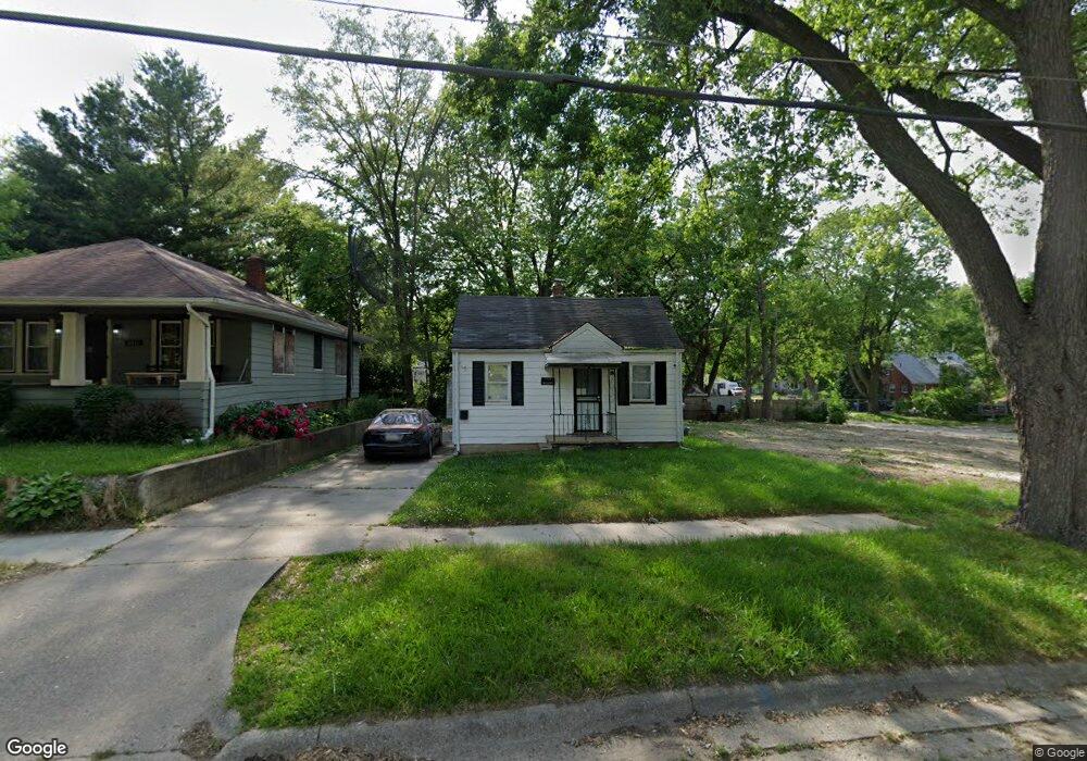
2315 Burns St Flint, MI 48506
Eastside NeighborhoodEstimated Value: $20,000 - $52,000
2
Beds
1
Bath
750
Sq Ft
$52/Sq Ft
Est. Value
About This Home
This home is located at 2315 Burns St, Flint, MI 48506 and is currently estimated at $39,333, approximately $52 per square foot. 2315 Burns St is a home located in Genesee County with nearby schools including Potter School, Flint Cultural Center Academy, and Richfield Public School Academy.
Ownership History
Date
Name
Owned For
Owner Type
Purchase Details
Closed on
Apr 25, 2017
Sold by
Alarthy Leri
Bought by
Groves Shawn J
Current Estimated Value
Purchase Details
Closed on
May 31, 2016
Sold by
Hoosein Shakir and Hoosein Shahan
Bought by
Abernathy Lori Ann
Purchase Details
Closed on
Sep 24, 2015
Sold by
Hoosein Shakir and Hoosein Husna S
Bought by
Hoosein Shahan
Purchase Details
Closed on
Nov 28, 2012
Sold by
Hoosein Shakir
Bought by
Hoosein Shakir and Hoosein Husna S
Purchase Details
Closed on
Jan 13, 2010
Sold by
Church Allen B and Church Stacy M
Bought by
Federal National Mortgage Association
Create a Home Valuation Report for This Property
The Home Valuation Report is an in-depth analysis detailing your home's value as well as a comparison with similar homes in the area
Home Values in the Area
Average Home Value in this Area
Purchase History
| Date | Buyer | Sale Price | Title Company |
|---|---|---|---|
| Groves Shawn J | $3,000 | Cislo Title Co | |
| Abernathy Lori Ann | $2,800 | Cislo Title Company | |
| Hoosein Shahan | -- | Cislo Title Company | |
| Hoosein Shakir | -- | Cislo Title Company | |
| Federal National Mortgage Association | $29,506 | None Available |
Source: Public Records
Tax History Compared to Growth
Tax History
| Year | Tax Paid | Tax Assessment Tax Assessment Total Assessment is a certain percentage of the fair market value that is determined by local assessors to be the total taxable value of land and additions on the property. | Land | Improvement |
|---|---|---|---|---|
| 2025 | $635 | $11,300 | $0 | $0 |
| 2024 | $599 | $10,500 | $0 | $0 |
| 2023 | $595 | $9,100 | $0 | $0 |
| 2022 | $0 | $7,300 | $0 | $0 |
| 2021 | $597 | $7,000 | $0 | $0 |
| 2020 | $562 | $6,200 | $0 | $0 |
| 2019 | $558 | $6,300 | $0 | $0 |
| 2018 | $521 | $4,300 | $0 | $0 |
| 2017 | $318 | $0 | $0 | $0 |
| 2016 | $325 | $0 | $0 | $0 |
| 2015 | -- | $0 | $0 | $0 |
| 2014 | -- | $0 | $0 | $0 |
| 2012 | -- | $7,300 | $0 | $0 |
Source: Public Records
Map
Nearby Homes
- 2225 Arlington Ave
- 2506 Arlington Ave
- 2426 Hoff St
- 1814 Mabel Ave
- 2211 Torrance St
- 1805 Bennett Ave
- 1721 New York Ave
- 1622 Arlington Ave
- 1629 New York Ave
- 1622 New York Ave
- 1510 N Vernon Ave
- 1501 Arlington Ave
- 1733 Oklahoma Ave
- 1529 Broadway Blvd
- 1805 Montana Ave
- 1513 Jane Ave
- 2301 Missouri Ave
- 1318 Cronk Ave
- 2610 Pennsylvania Ave
- 2719 Branch Rd
- 2319 Burns St
- 2311 Burns St
- 2321 Burns St
- 2305 Burns St
- 2312 N Vernon Ave
- 2308 N Vernon Ave
- 2316 N Vernon Ave
- 2301 Burns St
- 2304 N Vernon Ave
- 2301 Winifred Dr
- 2304 Woodrow Ave
- 2300 N Vernon Ave
- 2219 Burns St
- 2219 Woodrow Ave
- 2216 N Vernon Ave
- 2305 Winifred Dr
- 2402 N Vernon Ave
- 2409 Burns St
- 2214 N Vernon Ave
- 2401 Burns St