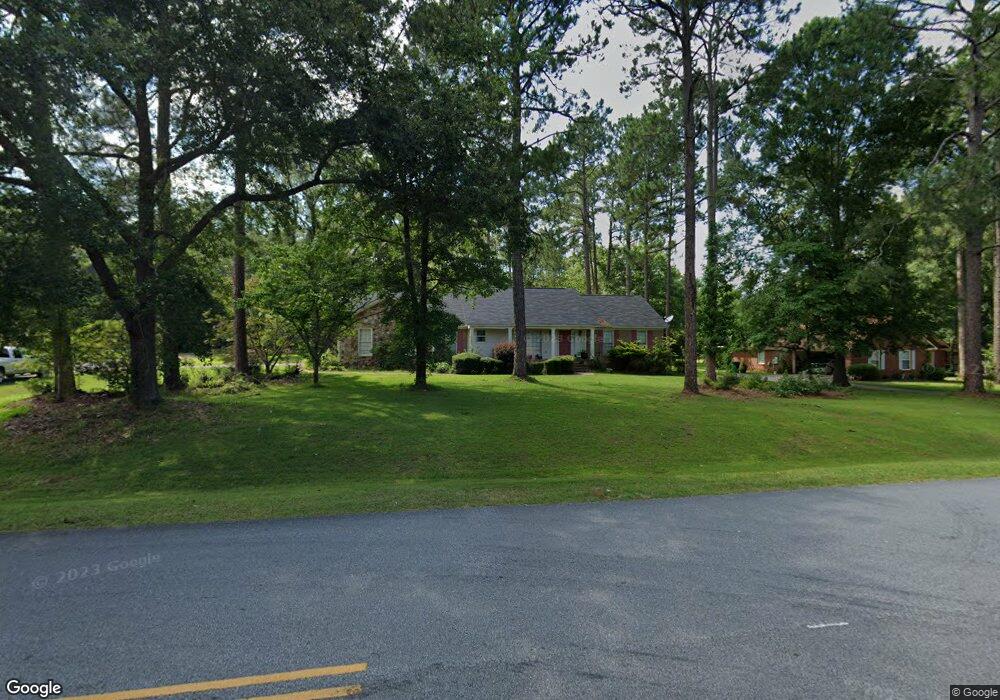
2315 E Alberson Dr Albany, GA 31721
Saint Andrews NeighborhoodEstimated Value: $246,271 - $277,000
4
Beds
3
Baths
2,334
Sq Ft
$113/Sq Ft
Est. Value
About This Home
This home is located at 2315 E Alberson Dr, Albany, GA 31721 and is currently estimated at $262,818, approximately $112 per square foot. 2315 E Alberson Dr is a home located in Dougherty County with nearby schools including Live Oak Elementary School, Merry Acres Middle School, and Westover High School.
Ownership History
Date
Name
Owned For
Owner Type
Purchase Details
Closed on
May 16, 2001
Sold by
Brock William E
Bought by
Richardson Brentic L and Richardson Mary L
Current Estimated Value
Purchase Details
Closed on
Jun 28, 1994
Sold by
Brock Dalene M By Exec Of Will
Bought by
Brock William E
Purchase Details
Closed on
May 30, 1990
Sold by
Merck Erwin C
Bought by
Brock Wm E and Brock Dalene M
Purchase Details
Closed on
Dec 14, 1979
Sold by
Bacon Stephen
Bought by
Merck Erwin C
Create a Home Valuation Report for This Property
The Home Valuation Report is an in-depth analysis detailing your home's value as well as a comparison with similar homes in the area
Home Values in the Area
Average Home Value in this Area
Purchase History
| Date | Buyer | Sale Price | Title Company |
|---|---|---|---|
| Richardson Brentic L | $155,000 | -- | |
| Brock William E | -- | -- | |
| Brock Wm E | $97,500 | -- | |
| Merck Erwin C | -- | -- |
Source: Public Records
Tax History Compared to Growth
Tax History
| Year | Tax Paid | Tax Assessment Tax Assessment Total Assessment is a certain percentage of the fair market value that is determined by local assessors to be the total taxable value of land and additions on the property. | Land | Improvement |
|---|---|---|---|---|
| 2024 | $2,561 | $55,680 | $4,400 | $51,280 |
| 2023 | $2,594 | $55,680 | $4,400 | $51,280 |
| 2022 | $2,604 | $55,680 | $4,400 | $51,280 |
| 2021 | $2,414 | $55,680 | $4,400 | $51,280 |
| 2020 | $2,420 | $55,680 | $4,400 | $51,280 |
| 2019 | $2,429 | $55,680 | $4,400 | $51,280 |
| 2018 | $2,439 | $55,680 | $4,400 | $51,280 |
| 2017 | $2,272 | $55,680 | $4,400 | $51,280 |
| 2016 | $2,273 | $55,680 | $4,400 | $51,280 |
| 2015 | $2,280 | $55,680 | $4,400 | $51,280 |
| 2014 | $2,461 | $60,880 | $9,600 | $51,280 |
Source: Public Records
Map
Nearby Homes
- 2305 E Alberson Dr
- 3422 Plantation Dr
- 2421 E Alberson Dr
- 2423 E Alberson Dr
- 2532 E Alberson Dr
- 2212 Arrowwood Dr
- 3424 Bellingham Ln
- 2207 Vineyard Ct
- 2221 Bedford Ct
- 2509 E Alberson Dr
- 2303 Saddlebrook Ct
- 2504 W Alberson Dr
- 2514 E Doublegate Dr
- 2600 E Doublegate Dr
- 2530 E Alberson Dr
- 2202 Trowbridge Rd
- 3203 Wexford Dr
- 2107 Cumberland Ln
- 2115 Cumberland Ln
- 2600 Shannon Rd
- 2317 E Alberson Dr
- 2311 E Alberson Dr
- 2316 E Alberson Dr
- 2314 E Alberson Dr
- 2319 E Alberson Dr
- 3602 Club Dr
- 2318 E Alberson Dr
- 2333 Andrews Garden Ct
- 2309 E Alberson Dr
- 2301 W Gordon Ave
- 2303 Jim Stokes Ct
- 3604 Club Dr
- 2302 Jim Stokes Ct
- 2320 E Alberson Dr
- 2313 Jim Stokes Ct
- 2315 Jim Stokes Ct
- 2305 Jim Stokes Ct
- 2405 E Alberson Dr
- 2307 E Alberson Dr
- 2403 E Alberson Dr