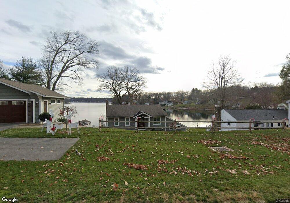
2315 Main St Coventry, CT 06238
Estimated Value: $708,000 - $784,599
4
Beds
2
Baths
1,243
Sq Ft
$603/Sq Ft
Est. Value
About This Home
This home is located at 2315 Main St, Coventry, CT 06238 and is currently estimated at $749,650, approximately $603 per square foot. 2315 Main St is a home located in Tolland County with nearby schools including Coventry Grammar School, George Hersey Robertson School, and Capt. Nathan Hale School.
Ownership History
Date
Name
Owned For
Owner Type
Purchase Details
Closed on
Jun 24, 2013
Sold by
Burgess Peter N and Burgess Sally H
Bought by
Motta James and Motta Christine
Current Estimated Value
Purchase Details
Closed on
Sep 15, 2000
Sold by
Kearns Michael
Bought by
Burgess Peter and Burgess Sally
Purchase Details
Closed on
Feb 4, 1993
Sold by
Hill Catherine
Bought by
Kearns Michael
Create a Home Valuation Report for This Property
The Home Valuation Report is an in-depth analysis detailing your home's value as well as a comparison with similar homes in the area
Home Values in the Area
Average Home Value in this Area
Purchase History
| Date | Buyer | Sale Price | Title Company |
|---|---|---|---|
| Motta James | $457,500 | -- | |
| Burgess Peter | $245,000 | -- | |
| Kearns Michael | $170,000 | -- | |
| Motta James | $457,500 | -- | |
| Burgess Peter | $245,000 | -- | |
| Kearns Michael | $170,000 | -- |
Source: Public Records
Mortgage History
| Date | Status | Borrower | Loan Amount |
|---|---|---|---|
| Previous Owner | Kearns Michael | $200,000 | |
| Previous Owner | Kearns Michael | $184,250 |
Source: Public Records
Tax History
| Year | Tax Paid | Tax Assessment Tax Assessment Total Assessment is a certain percentage of the fair market value that is determined by local assessors to be the total taxable value of land and additions on the property. | Land | Improvement |
|---|---|---|---|---|
| 2025 | $12,448 | $523,900 | $281,100 | $242,800 |
| 2024 | $12,165 | $365,200 | $188,400 | $176,800 |
| 2023 | $11,591 | $365,200 | $188,400 | $176,800 |
| 2022 | $11,376 | $365,200 | $188,400 | $176,800 |
| 2021 | $11,376 | $365,200 | $188,400 | $176,800 |
| 2020 | $10,395 | $333,500 | $188,400 | $145,100 |
| 2019 | $10,745 | $333,700 | $188,400 | $145,300 |
| 2018 | $9,100 | $282,600 | $171,300 | $111,300 |
| 2017 | $7,712 | $241,000 | $171,300 | $69,700 |
| 2016 | $7,519 | $241,000 | $171,300 | $69,700 |
| 2015 | $7,519 | $241,000 | $171,300 | $69,700 |
| 2014 | $7,146 | $251,000 | $173,700 | $77,300 |
Source: Public Records
Map
Nearby Homes
- 0 Daly Rd Unit 24146464
- 2478 Main St
- 152 Cheney Ln
- 109 Sam Green Rd
- 27 Fox Trail
- 864 Boston Turnpike
- 0 Hinkel Mae Dr
- 17 Ireland Dr
- 0 Woodland Rd
- 316 Shore Dr
- 198 Forest Rd
- 498 Root Rd
- 499 Woodmont Dr
- 55 Whites Hill Rd
- 0 Skinner Hill Rd Unit 24077239
- 97 Armstrong Rd
- 550 High St
- 25 Wolf Hill Rd
- 37 Wolf Hill Lot (#40) Rd
- 37 Wolf Hill Rd Unit Lot 40
- 2307 Main St
- 2323 Main St
- 2297 Main St
- 2293 Main St
- 2283 Main St
- 2304 Main St
- 2346 Main St
- 2288 Main St
- 2350 Main St
- 2273 Main St
- 24 Buena Vista Rd
- 2354 Main St
- 0 Buena Vista Rd Unit 170038904
- 0 Buena Vista Rd Unit G502819
- 0 Buena Vista Rd Unit G620103
- 0 Buena Vista Rd Unit G646080
- 30 Ridgewood Trail
- 38 Buena Vista Rd
- 38 Ridgewood Trail
- 24 Ridgewood Trail
Your Personal Tour Guide
Ask me questions while you tour the home.