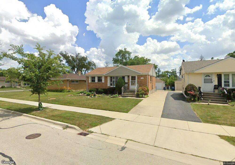
2315 S Scott St Des Plaines, IL 60018
Estimated Value: $316,633 - $373,000
2
Beds
2
Baths
956
Sq Ft
$361/Sq Ft
Est. Value
About This Home
This home is located at 2315 S Scott St, Des Plaines, IL 60018 and is currently estimated at $344,658, approximately $360 per square foot. 2315 S Scott St is a home located in Cook County with nearby schools including South Elementary School, Algonquin Middle School, and Maine West High School.
Ownership History
Date
Name
Owned For
Owner Type
Purchase Details
Closed on
Feb 28, 2011
Sold by
Lane Daniel T and Lane Barbara Ann
Bought by
Peters Karen P
Current Estimated Value
Home Financials for this Owner
Home Financials are based on the most recent Mortgage that was taken out on this home.
Original Mortgage
$100,000
Outstanding Balance
$69,001
Interest Rate
4.88%
Mortgage Type
New Conventional
Estimated Equity
$275,657
Purchase Details
Closed on
Aug 1, 2000
Sold by
Lane Janet M
Bought by
Lane Daniel T
Home Financials for this Owner
Home Financials are based on the most recent Mortgage that was taken out on this home.
Original Mortgage
$124,000
Interest Rate
8.15%
Purchase Details
Closed on
Oct 10, 1993
Sold by
Lane Daniel T
Bought by
Lane Janet M
Create a Home Valuation Report for This Property
The Home Valuation Report is an in-depth analysis detailing your home's value as well as a comparison with similar homes in the area
Home Values in the Area
Average Home Value in this Area
Purchase History
| Date | Buyer | Sale Price | Title Company |
|---|---|---|---|
| Peters Karen P | $186,000 | Chicago Title Insurance Co | |
| Lane Daniel T | $155,000 | Professional National Title | |
| Lane Janet M | -- | -- |
Source: Public Records
Mortgage History
| Date | Status | Borrower | Loan Amount |
|---|---|---|---|
| Open | Peters Karen P | $100,000 | |
| Previous Owner | Lane Daniel T | $124,000 |
Source: Public Records
Tax History Compared to Growth
Tax History
| Year | Tax Paid | Tax Assessment Tax Assessment Total Assessment is a certain percentage of the fair market value that is determined by local assessors to be the total taxable value of land and additions on the property. | Land | Improvement |
|---|---|---|---|---|
| 2024 | $3,232 | $24,001 | $4,538 | $19,463 |
| 2023 | $3,255 | $24,001 | $4,538 | $19,463 |
| 2022 | $3,255 | $24,001 | $4,538 | $19,463 |
| 2021 | $3,581 | $18,310 | $3,781 | $14,529 |
| 2020 | $3,658 | $18,310 | $3,781 | $14,529 |
| 2019 | $3,691 | $20,574 | $3,781 | $16,793 |
| 2018 | $5,327 | $21,247 | $3,327 | $17,920 |
| 2017 | $5,250 | $21,247 | $3,327 | $17,920 |
| 2016 | $5,210 | $21,247 | $3,327 | $17,920 |
| 2015 | $4,621 | $17,908 | $2,873 | $15,035 |
| 2014 | $4,540 | $17,908 | $2,873 | $15,035 |
| 2013 | $4,409 | $17,908 | $2,873 | $15,035 |
Source: Public Records
Map
Nearby Homes
- 38 E Touhy Ave
- 1966 Laura Ln
- 2500 Maple St
- 2609 Eisenhower Dr
- 1706 Buckingham Dr
- 2126 David Dr
- 1641 E Touhy Ave
- 2646 Maple St
- 1629 E Touhy Ave
- 1757 Farwell Ave
- 22 Park Ln Unit 203
- 44 Park Ln Unit 435
- 1928 Kennicott Ct
- 2993 Curtis St Unit C41
- 300 Boardwalk Place Unit T300
- 200 Thames Pkwy Unit 1
- 1721 Linden St
- 1640 S River Rd
- 201 Thames Pkwy Unit 2F
- 2017 Pine St Unit B
- 2303 S Scott St
- 2323 S Scott St
- 2333 S Scott St
- 2320 Magnolia St
- 2328 Magnolia St
- 2304 Magnolia St
- 2337 S Scott St
- 2338 Magnolia St
- 2322 S Scott St
- 2314 S Scott St
- 2293 S Scott St
- 2332 S Scott St
- 2302 S Scott St
- 2342 Magnolia St
- 2347 S Scott St
- 2336 S Scott St
- 2296 Magnolia St
- 2298 S Scott St
- 2289 S Scott St
- 2356 Magnolia St