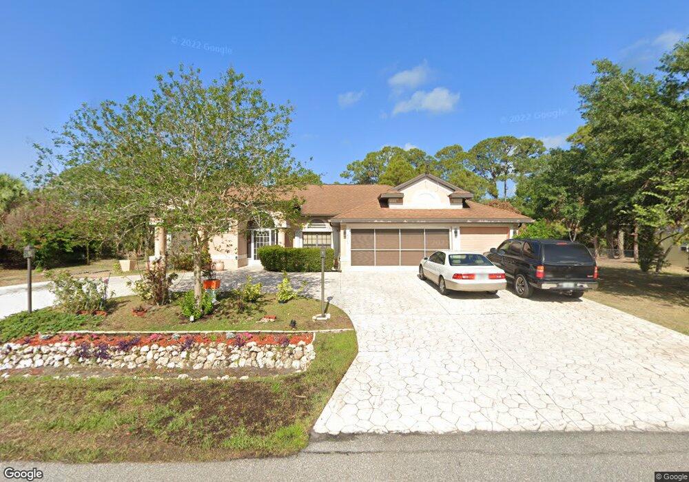
2315 Tamarind St Port Charlotte, FL 33948
Estimated Value: $453,752 - $502,000
4
Beds
3
Baths
2,487
Sq Ft
$191/Sq Ft
Est. Value
About This Home
This home is located at 2315 Tamarind St, Port Charlotte, FL 33948 and is currently estimated at $476,188, approximately $191 per square foot. 2315 Tamarind St is a home located in Charlotte County with nearby schools including Liberty Elementary School, Murdock Middle School, and Port Charlotte High School.
Ownership History
Date
Name
Owned For
Owner Type
Purchase Details
Closed on
Apr 23, 2019
Sold by
Felix Randolf Thomas
Bought by
Stroude Andrew D
Current Estimated Value
Purchase Details
Closed on
Apr 27, 2006
Sold by
Mercedes Homes Inc
Bought by
Stroude Andrew and Boyke Doreen
Home Financials for this Owner
Home Financials are based on the most recent Mortgage that was taken out on this home.
Original Mortgage
$185,200
Interest Rate
6.28%
Mortgage Type
Fannie Mae Freddie Mac
Purchase Details
Closed on
Oct 6, 2003
Sold by
Harris Alfred V
Bought by
Boyke Doreen
Create a Home Valuation Report for This Property
The Home Valuation Report is an in-depth analysis detailing your home's value as well as a comparison with similar homes in the area
Home Values in the Area
Average Home Value in this Area
Purchase History
| Date | Buyer | Sale Price | Title Company |
|---|---|---|---|
| Stroude Andrew D | -- | Attorney | |
| Stroude Andrew | $370,700 | B D R Title | |
| Boyke Doreen | $8,000 | -- |
Source: Public Records
Mortgage History
| Date | Status | Borrower | Loan Amount |
|---|---|---|---|
| Previous Owner | Stroude Andrew | $185,200 |
Source: Public Records
Tax History Compared to Growth
Tax History
| Year | Tax Paid | Tax Assessment Tax Assessment Total Assessment is a certain percentage of the fair market value that is determined by local assessors to be the total taxable value of land and additions on the property. | Land | Improvement |
|---|---|---|---|---|
| 2023 | $3,772 | $230,216 | $0 | $0 |
| 2022 | $3,645 | $223,511 | $0 | $0 |
| 2021 | $3,647 | $217,001 | $0 | $0 |
| 2020 | $3,587 | $214,005 | $0 | $0 |
| 2019 | $3,481 | $209,194 | $0 | $0 |
| 2018 | $3,224 | $205,293 | $0 | $0 |
| 2017 | $3,196 | $201,071 | $0 | $0 |
| 2016 | $3,182 | $196,935 | $0 | $0 |
| 2015 | $3,186 | $195,566 | $0 | $0 |
| 2014 | $3,155 | $194,014 | $0 | $0 |
Source: Public Records
Map
Nearby Homes
- 2272 Auburn Blvd
- 2256 Auburn Blvd
- 17513 Marcy Ave
- 17504 Granby Ave
- 17512 Marcy Ave
- 17497 Granby Ave
- 17513 Clover Ave
- 17505 Clover Ave
- 2212 Bendway Dr
- 2055 Bendway Dr
- 2063 Bendway Dr
- 2120 Bendway Dr
- 18055 Dublin Ave
- 17497 Clover Ave
- 18087 Clanton Ave
- 17472 Granby Ave
- 2387 Tamarind St
- 17489 Clover Ave
- 18103 Shirley Ave
- 18095 Shirley Ave
- 2307 Tamarind St
- 2308 Tamarind St
- Tamarind St
- 2316 Collingswood Blvd
- 2339 Tamarind St
- 2324 Collingswood Blvd
- 2299 Tamarind St
- 2332 Collingswood Blvd
- 2308 Collingswood Blvd
- 2284 Tamarind St
- 2300 Tamarind St
- 18039 Clanton Ave
- 18039 Clanton Ave
- 2317 Summit St
- 2340 Collingswood Blvd
- 2309 Summit St
- 2291 Tamarind St
- 18047 Clanton Ave
- 2301 Summit St
- 2348 Collingswood Blvd