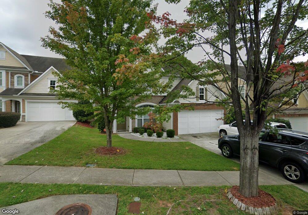
2316 Worrall Hill Dr Duluth, GA 30096
Estimated Value: $501,342 - $527,000
4
Beds
3
Baths
2,390
Sq Ft
$214/Sq Ft
Est. Value
About This Home
This home is located at 2316 Worrall Hill Dr, Duluth, GA 30096 and is currently estimated at $511,086, approximately $213 per square foot. 2316 Worrall Hill Dr is a home located in Gwinnett County with nearby schools including M. H. Mason Elementary School, Hull Middle School, and Peachtree Ridge High School.
Ownership History
Date
Name
Owned For
Owner Type
Purchase Details
Closed on
Aug 17, 2011
Sold by
Chung Ki S
Bought by
Ladak Rahim
Current Estimated Value
Home Financials for this Owner
Home Financials are based on the most recent Mortgage that was taken out on this home.
Original Mortgage
$161,600
Outstanding Balance
$110,721
Interest Rate
4.5%
Mortgage Type
FHA
Estimated Equity
$400,365
Purchase Details
Closed on
Mar 17, 2005
Sold by
Bowen Family Homes Inc
Bought by
Chung Ki S
Home Financials for this Owner
Home Financials are based on the most recent Mortgage that was taken out on this home.
Original Mortgage
$191,300
Interest Rate
5.62%
Mortgage Type
New Conventional
Create a Home Valuation Report for This Property
The Home Valuation Report is an in-depth analysis detailing your home's value as well as a comparison with similar homes in the area
Home Values in the Area
Average Home Value in this Area
Purchase History
| Date | Buyer | Sale Price | Title Company |
|---|---|---|---|
| Ladak Rahim | $170,000 | -- | |
| Chung Ki S | $212,600 | -- |
Source: Public Records
Mortgage History
| Date | Status | Borrower | Loan Amount |
|---|---|---|---|
| Open | Ladak Rahim | $161,600 | |
| Closed | Ladak Rahim | $7,500 | |
| Previous Owner | Chung Ki S | $191,300 |
Source: Public Records
Tax History Compared to Growth
Tax History
| Year | Tax Paid | Tax Assessment Tax Assessment Total Assessment is a certain percentage of the fair market value that is determined by local assessors to be the total taxable value of land and additions on the property. | Land | Improvement |
|---|---|---|---|---|
| 2025 | $5,143 | $201,520 | $30,240 | $171,280 |
| 2024 | $4,943 | $184,440 | $37,200 | $147,240 |
| 2023 | $4,943 | $184,440 | $37,200 | $147,240 |
| 2022 | $4,084 | $144,360 | $28,000 | $116,360 |
| 2021 | $3,585 | $117,320 | $20,000 | $97,320 |
| 2020 | $3,612 | $117,320 | $20,000 | $97,320 |
| 2019 | $3,526 | $117,320 | $20,000 | $97,320 |
| 2018 | $3,405 | $111,480 | $20,000 | $91,480 |
| 2016 | $2,958 | $89,840 | $18,400 | $71,440 |
| 2015 | $2,859 | $84,080 | $18,400 | $65,680 |
| 2014 | $2,519 | $68,000 | $16,000 | $52,000 |
Source: Public Records
Map
Nearby Homes
- 2816 Staunton Dr
- 2578 Worrall Hill Way
- 2539 Larson Creek Cove
- 2822 Salem Oak Way
- 2437 Staunton Dr
- 2491 Cannon Farm Ln
- 2747 Mount Pleasant Trail
- 2568 Gadsen Walk
- 2502 Oak Hill Overlook
- 2515 Gadsen Walk
- 2893 Thurleston Ln
- 2646 Ridge Run Trail
- 2820 Bluebird Cir NW
- 2883 Thurleston Ln
- 2741 Willowstone Dr
- 2818 Willowstone Dr
- 2061 Meadow Peak Rd
- 2207 Landing Walk Dr
- 2098 Meadow Peak Rd
- 2199 Landing Walk Dr
- 2326 Worrall Hill Dr
- 2266 Worrall Hill Dr
- 2236 Worrall Hill Dr
- 2197 Staunton Dr
- 2187 Staunton Dr
- 2346 Worrall Hill Dr
- 2226 Worrall Hill Dr
- 2177 Staunton Dr
- 2167 Staunton Dr
- 2313 Worrall Hill Dr
- 2303 Worrall Hill Dr
- 2216 Worrall Hill Dr
- 2323 Worrall Hill Dr
- 2293 Worrall Hill Dr
- 2333 Worrall Hill Dr
- 2253 Worrall Hill Dr
- 2243 Worrall Hill Dr
- 2206 Worrall Hill Dr
- 2283 Worrall Hill Dr
- 2263 Worrall Hill Dr