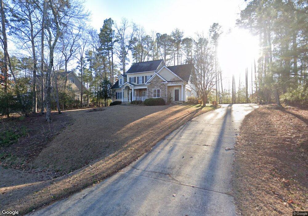
2317 Brownstone Rd Sanford, NC 27330
Estimated Value: $462,000 - $483,000
4
Beds
3
Baths
2,597
Sq Ft
$181/Sq Ft
Est. Value
About This Home
This home is located at 2317 Brownstone Rd, Sanford, NC 27330 and is currently estimated at $470,598, approximately $181 per square foot. 2317 Brownstone Rd is a home located in Lee County with nearby schools including Benjamin T. Bullock Elementary School, West Lee Middle School, and Lee County High School.
Ownership History
Date
Name
Owned For
Owner Type
Purchase Details
Closed on
Aug 23, 2006
Sold by
Forbes Real Estate Corporation
Bought by
Maddox Billy D and Maddox Alice G
Current Estimated Value
Home Financials for this Owner
Home Financials are based on the most recent Mortgage that was taken out on this home.
Original Mortgage
$68,250
Outstanding Balance
$5,488
Interest Rate
6.67%
Mortgage Type
New Conventional
Estimated Equity
$465,110
Purchase Details
Closed on
Aug 21, 1987
Bought by
Forbes Real Estate Corp
Create a Home Valuation Report for This Property
The Home Valuation Report is an in-depth analysis detailing your home's value as well as a comparison with similar homes in the area
Home Values in the Area
Average Home Value in this Area
Purchase History
| Date | Buyer | Sale Price | Title Company |
|---|---|---|---|
| Maddox Billy D | $299,000 | None Available | |
| Forbes Real Estate Corp | -- | -- |
Source: Public Records
Mortgage History
| Date | Status | Borrower | Loan Amount |
|---|---|---|---|
| Open | Maddox Billy D | $68,250 |
Source: Public Records
Tax History Compared to Growth
Tax History
| Year | Tax Paid | Tax Assessment Tax Assessment Total Assessment is a certain percentage of the fair market value that is determined by local assessors to be the total taxable value of land and additions on the property. | Land | Improvement |
|---|---|---|---|---|
| 2025 | $5,607 | $441,900 | $50,000 | $391,900 |
| 2024 | $5,587 | $441,900 | $50,000 | $391,900 |
| 2023 | $5,577 | $441,900 | $50,000 | $391,900 |
| 2022 | $4,563 | $314,300 | $37,500 | $276,800 |
| 2021 | $4,647 | $314,300 | $37,500 | $276,800 |
| 2020 | $4,632 | $314,300 | $37,500 | $276,800 |
| 2019 | $4,592 | $314,300 | $37,500 | $276,800 |
| 2018 | $4,582 | $307,900 | $45,000 | $262,900 |
| 2017 | $4,520 | $307,900 | $45,000 | $262,900 |
| 2016 | $4,495 | $307,900 | $45,000 | $262,900 |
| 2014 | $4,264 | $307,900 | $45,000 | $262,900 |
Source: Public Records
Map
Nearby Homes
- 2839 Bristol Way
- 2648 Buckingham Dr
- 618 Contento Ct
- 631 Contento Ct
- 2215 Southern Rd
- 2600 Buckingham Dr
- 308 Brookfield Cir
- 110 Hickory Grove Dr
- Wayland Plan at Hickory Grove
- Ashford Plan at Hickory Grove
- Hamilton Plan at Hickory Grove
- Andrews Plan at Hickory Grove
- Bedford Plan at Hickory Grove
- Sheridan Plan at Hickory Grove
- 2523 Victory Dr
- 0 Cool Springs Rd Unit 744558
- 401 Bridgewater Dr
- 0 Lot B Carbonton Rd
- 2313 Brownstone Rd
- 2321 Brownstone Rd
- 2313 Brownstone Dr
- 0 Brownstone Dr Unit 460808
- 2724 Bristol Way
- 2720 Bristol Way
- 2325 Brownstone Rd
- 2325 Brownstone Rd
- 2314 Brownstone Dr
- 2318 Brownstone Rd
- 2322 Brownstone Dr
- 2716 Bristol Way
- 2314 Brownstone Rd
- 2310 Brownstone Dr
- 2322 Brownstone Rd
- 2326 Brownstone Dr
- 2310 Brownstone Rd
- 2305 Brownstone Rd
- 2326 Brownstone Rd
- 2712 Bristol Way