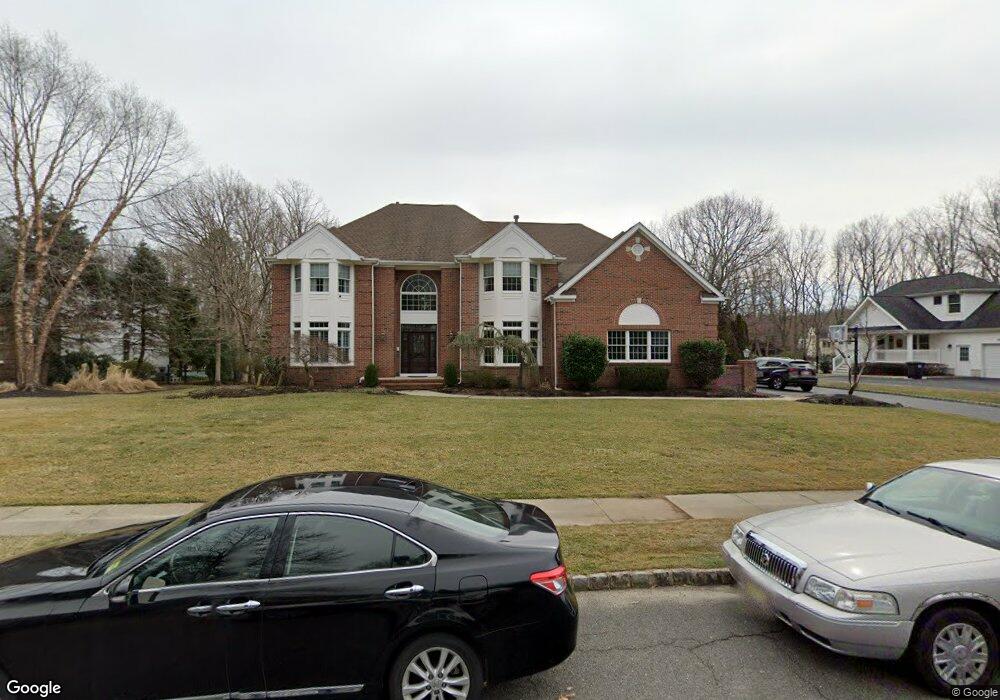
2317 Orchard Crest Blvd Manasquan, NJ 08736
Estimated Value: $1,499,177 - $1,633,000
4
Beds
2
Baths
3,680
Sq Ft
$425/Sq Ft
Est. Value
About This Home
This home is located at 2317 Orchard Crest Blvd, Manasquan, NJ 08736 and is currently estimated at $1,563,544, approximately $424 per square foot. 2317 Orchard Crest Blvd is a home located in Monmouth County with nearby schools including Wall High School and The Brookside School.
Ownership History
Date
Name
Owned For
Owner Type
Purchase Details
Closed on
May 12, 1995
Sold by
Lions Head Holding Corp
Bought by
Domenick Jeff and Domenick Michelle
Current Estimated Value
Home Financials for this Owner
Home Financials are based on the most recent Mortgage that was taken out on this home.
Original Mortgage
$200,000
Interest Rate
8.21%
Create a Home Valuation Report for This Property
The Home Valuation Report is an in-depth analysis detailing your home's value as well as a comparison with similar homes in the area
Home Values in the Area
Average Home Value in this Area
Purchase History
| Date | Buyer | Sale Price | Title Company |
|---|---|---|---|
| Domenick Jeff | $378,564 | -- |
Source: Public Records
Mortgage History
| Date | Status | Borrower | Loan Amount |
|---|---|---|---|
| Closed | Domenick Jeff | $200,000 |
Source: Public Records
Tax History Compared to Growth
Tax History
| Year | Tax Paid | Tax Assessment Tax Assessment Total Assessment is a certain percentage of the fair market value that is determined by local assessors to be the total taxable value of land and additions on the property. | Land | Improvement |
|---|---|---|---|---|
| 2025 | $15,776 | $747,700 | $256,400 | $491,300 |
| 2024 | $15,305 | $747,700 | $256,400 | $491,300 |
| 2023 | $15,305 | $747,700 | $256,400 | $491,300 |
| 2022 | $14,932 | $747,700 | $256,400 | $491,300 |
| 2021 | $14,932 | $747,700 | $256,400 | $491,300 |
| 2020 | $14,752 | $747,700 | $256,400 | $491,300 |
| 2019 | $14,573 | $747,700 | $256,400 | $491,300 |
| 2018 | $14,446 | $747,700 | $256,400 | $491,300 |
| 2017 | $14,161 | $747,700 | $256,400 | $491,300 |
| 2016 | $13,862 | $747,700 | $256,400 | $491,300 |
| 2015 | $15,744 | $533,700 | $177,400 | $356,300 |
| 2014 | $15,242 | $528,500 | $172,200 | $356,300 |
Source: Public Records
Map
Nearby Homes
- 1919 Atlantic Ave Unit 26
- 1919 Atlantic Ave Unit 15
- 1412 Winesap Dr
- 2338 Ramshorn Dr
- 2378 Orchard Crest Blvd
- 1551 Holly Blvd
- 1590 Holly Blvd
- 2101 Friar Ct
- 1908 Sherwood Dr
- 2412 Greentree Dr
- 1347 Winter View Rd
- 1422 Lakewood Rd
- 1215 Church St
- 11 Tarpon Dr Unit 1001
- 1442 Garrett Dr
- 2511 Morningstar Rd
- 2174 Begonia Ave
- 2311 Camden Ave
- 1210 Bayberry Rd
- 737 Paramount Way
- 2315 Orchard Crest Blvd
- 2319 Orchard Crest Blvd
- 1424 Cortland Dr
- 2318 Orchard Crest Blvd
- 1426 Cortland Dr
- 2313 Orchard Crest Blvd
- 2316 Orchard Crest Blvd
- 2321 Orchard Crest Blvd
- 2320 Orchard Crest Blvd
- 1422 Cortland Dr
- 1428 Winesap Dr
- 2314 Orchard Crest Blvd
- 1420 Cortland Dr
- 2327 Orchard Crest Blvd
- 2311 Orchard Crest Blvd
- 2312 Orchard Crest Blvd
- 1425 Cortland Dr
- 2324 Orchard Crest Blvd
- 2329 Orchard Crest Blvd
- 1433 Winesap Dr