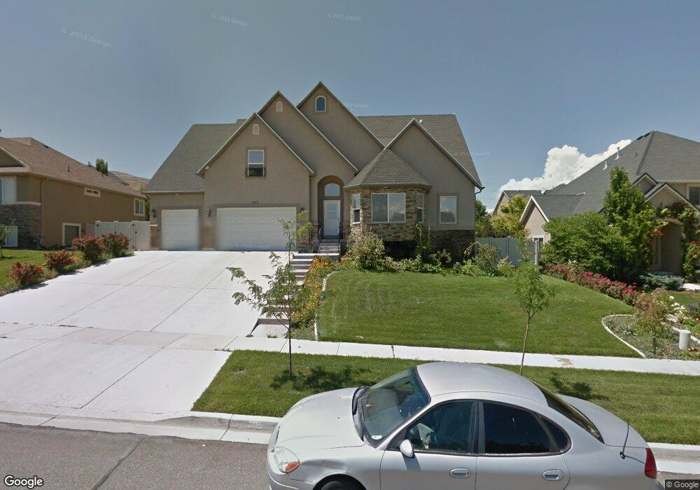
2317 S Wesson Dr Unit 634 Saratoga Springs, UT 84045
Estimated Value: $765,000 - $810,000
7
Beds
4
Baths
4,533
Sq Ft
$173/Sq Ft
Est. Value
About This Home
This home is located at 2317 S Wesson Dr Unit 634, Saratoga Springs, UT 84045 and is currently estimated at $785,724, approximately $173 per square foot. 2317 S Wesson Dr Unit 634 is a home located in Utah County with nearby schools including Sage Hills Elementary School, Lake Mountain Middle School, and Westlake High School.
Ownership History
Date
Name
Owned For
Owner Type
Purchase Details
Closed on
Nov 4, 2020
Sold by
Barlow Dane G and Barlow Kellie Ann
Bought by
Robinson Cameron and Robinson Holly
Current Estimated Value
Home Financials for this Owner
Home Financials are based on the most recent Mortgage that was taken out on this home.
Original Mortgage
$391,000
Outstanding Balance
$348,559
Interest Rate
2.9%
Mortgage Type
New Conventional
Estimated Equity
$437,165
Purchase Details
Closed on
Sep 4, 2014
Sold by
Hendricks Richard Wayne and Barlow Kellie A
Bought by
Barlow Dane G and Barlow Kellie Ann
Home Financials for this Owner
Home Financials are based on the most recent Mortgage that was taken out on this home.
Original Mortgage
$185,999
Interest Rate
3.37%
Mortgage Type
FHA
Purchase Details
Closed on
Aug 28, 2014
Sold by
Hendricks Richard Wayne and Barlow Kellie Ann
Bought by
Barlow Dane G and Barlow Kellie Ann
Home Financials for this Owner
Home Financials are based on the most recent Mortgage that was taken out on this home.
Original Mortgage
$185,999
Interest Rate
3.37%
Mortgage Type
FHA
Purchase Details
Closed on
Feb 12, 2009
Sold by
Wilson Joshua P and Wilson Tracy
Bought by
Hendricks Richard Wayne and Hendricks Kellie A
Home Financials for this Owner
Home Financials are based on the most recent Mortgage that was taken out on this home.
Original Mortgage
$190,000
Interest Rate
4.91%
Mortgage Type
Purchase Money Mortgage
Purchase Details
Closed on
Mar 9, 2006
Sold by
Cox Steven P
Bought by
Wilson Joshua P and Wilson Tracy
Home Financials for this Owner
Home Financials are based on the most recent Mortgage that was taken out on this home.
Original Mortgage
$296,630
Interest Rate
6.25%
Mortgage Type
VA
Purchase Details
Closed on
May 20, 2005
Sold by
Land Rock Development Lc
Bought by
Cox Steven P
Home Financials for this Owner
Home Financials are based on the most recent Mortgage that was taken out on this home.
Original Mortgage
$227,200
Interest Rate
5.74%
Mortgage Type
Construction
Create a Home Valuation Report for This Property
The Home Valuation Report is an in-depth analysis detailing your home's value as well as a comparison with similar homes in the area
Home Values in the Area
Average Home Value in this Area
Purchase History
| Date | Buyer | Sale Price | Title Company |
|---|---|---|---|
| Robinson Cameron | -- | Investors Title Ins Agency | |
| Barlow Dane G | -- | True Concept Title | |
| Barlow Dane G | -- | True Concept Title | |
| Hendricks Richard Wayne | -- | Cache Title Company Salt L | |
| Wilson Joshua P | -- | Horizon Title Insurance | |
| Cox Steven P | -- | Title West Title Company |
Source: Public Records
Mortgage History
| Date | Status | Borrower | Loan Amount |
|---|---|---|---|
| Open | Robinson Cameron | $391,000 | |
| Previous Owner | Barlow Dane G | $185,999 | |
| Previous Owner | Barlow Dane G | $185,999 | |
| Previous Owner | Hendricks Richard Wayne | $190,000 | |
| Previous Owner | Wilson Joshua P | $296,630 | |
| Previous Owner | Cox Steven P | $227,200 |
Source: Public Records
Tax History Compared to Growth
Tax History
| Year | Tax Paid | Tax Assessment Tax Assessment Total Assessment is a certain percentage of the fair market value that is determined by local assessors to be the total taxable value of land and additions on the property. | Land | Improvement |
|---|---|---|---|---|
| 2025 | $3,132 | $716,100 | $242,400 | $473,700 |
| 2024 | $3,132 | $376,310 | $0 | $0 |
| 2023 | $2,927 | $378,015 | $0 | $0 |
| 2022 | $3,294 | $414,975 | $0 | $0 |
| 2021 | $2,853 | $536,400 | $136,800 | $399,600 |
| 2020 | $2,513 | $464,000 | $122,100 | $341,900 |
| 2019 | $2,272 | $434,400 | $118,400 | $316,000 |
| 2018 | $2,169 | $391,500 | $111,000 | $280,500 |
| 2017 | $2,109 | $203,610 | $0 | $0 |
| 2016 | $2,169 | $194,370 | $0 | $0 |
| 2015 | $2,258 | $191,950 | $0 | $0 |
| 2014 | $2,225 | $186,945 | $0 | $0 |
Source: Public Records
Map
Nearby Homes
- 2274 S Browning Dr
- 2199 S Morgan Rd
- 2238 S Western Dr
- 2237 S Maverick Rd
- 153 W Honeysuckle Dr
- 2226 S Maverick Rd
- 2262 S Maverick Rd
- 127 W Honeysuckle Dr Unit 221
- 2559 S Colt Dr
- 2387 S Maverick Rd W
- 7323 N Long Dr Unit 607
- 2162 S Ruger Dr
- 79 E Watson Dr
- 83 E Watson Dr
- 89 E Watson Dr
- 103 E Palmer Ln
- 78 Watson Dr
- 107 E Palmer Ln
- 111 E Palmer Ln
- 107 E Watson Dr
- 2317 S Wesson Dr
- 2317 Wesson Dr
- 2327 Wesson Dr
- 2297 S Wesson Dr
- 2297 Wesson Dr
- 2312 S Browning Dr
- 2312 Browning Dr
- 2326 S Browning Dr
- 2326 Browning Dr
- 2302 S Browning Dr
- 2302 S Browning Dr
- 2339 Wesson Dr
- 2298 Wesson Dr
- 2318 Wesson Dr
- 2318 S Wesson Dr
- 2342 Browning Dr
- 2287 S Wesson Dr
- 2287 Wesson Dr
- 2328 Wesson Dr
- 2328 S Wesson Dr