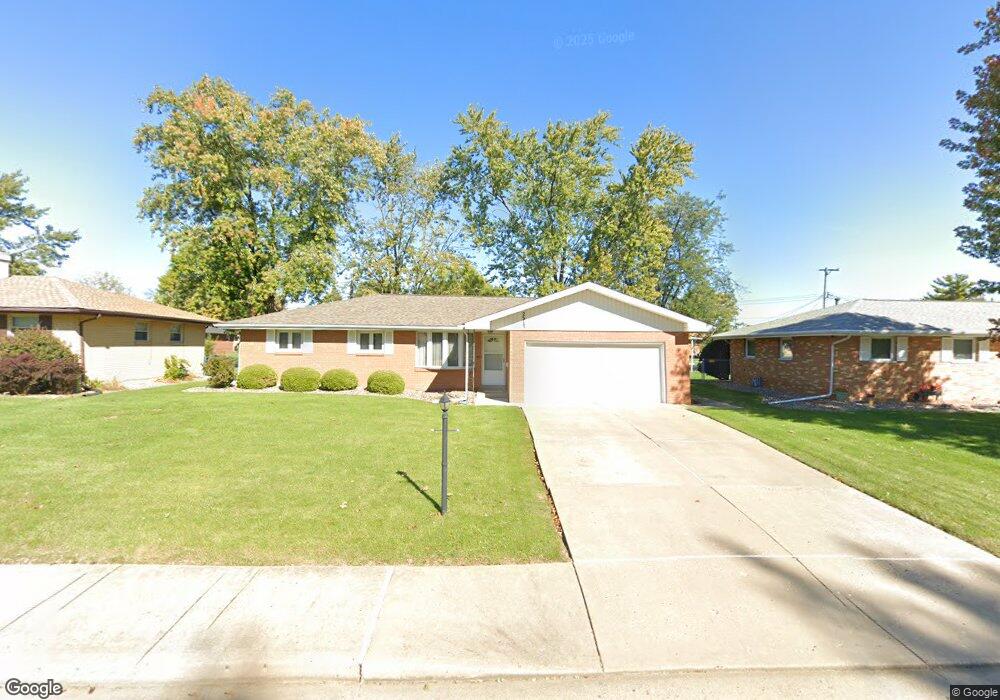
2317 W Overhill Rd Peoria, IL 61615
North Peoria NeighborhoodEstimated Value: $152,376 - $162,000
2
Beds
2
Baths
1,571
Sq Ft
$99/Sq Ft
Est. Value
About This Home
This home is located at 2317 W Overhill Rd, Peoria, IL 61615 and is currently estimated at $155,594, approximately $99 per square foot. 2317 W Overhill Rd is a home located in Peoria County with nearby schools including Dr Maude A Sanders Primary School, Sterling Middle School, and Peoria High School.
Ownership History
Date
Name
Owned For
Owner Type
Purchase Details
Closed on
Apr 3, 2025
Sold by
Junetta E Sanders Revocable Trust and Mcmillan Suzanne L
Bought by
Hoffman Carole and Hoffman Roger L
Current Estimated Value
Home Financials for this Owner
Home Financials are based on the most recent Mortgage that was taken out on this home.
Original Mortgage
$105,000
Outstanding Balance
$103,924
Interest Rate
6.55%
Mortgage Type
New Conventional
Estimated Equity
$51,670
Create a Home Valuation Report for This Property
The Home Valuation Report is an in-depth analysis detailing your home's value as well as a comparison with similar homes in the area
Home Values in the Area
Average Home Value in this Area
Purchase History
| Date | Buyer | Sale Price | Title Company |
|---|---|---|---|
| Hoffman Carole | $157,000 | None Listed On Document |
Source: Public Records
Mortgage History
| Date | Status | Borrower | Loan Amount |
|---|---|---|---|
| Open | Hoffman Carole | $105,000 |
Source: Public Records
Tax History Compared to Growth
Tax History
| Year | Tax Paid | Tax Assessment Tax Assessment Total Assessment is a certain percentage of the fair market value that is determined by local assessors to be the total taxable value of land and additions on the property. | Land | Improvement |
|---|---|---|---|---|
| 2024 | $1,344 | $45,530 | $6,950 | $38,580 |
| 2023 | $1,398 | $41,770 | $6,380 | $35,390 |
| 2022 | $1,433 | $39,540 | $6,060 | $33,480 |
| 2021 | $1,477 | $37,660 | $5,770 | $31,890 |
| 2020 | $1,489 | $37,280 | $5,710 | $31,570 |
| 2019 | $1,480 | $38,040 | $5,830 | $32,210 |
| 2018 | $1,447 | $39,130 | $5,890 | $33,240 |
| 2017 | $1,433 | $39,530 | $5,950 | $33,580 |
| 2016 | $1,421 | $39,530 | $5,950 | $33,580 |
| 2015 | $1,368 | $38,750 | $5,830 | $32,920 |
| 2014 | $1,352 | $39,400 | $5,790 | $33,610 |
| 2013 | -- | $39,880 | $5,860 | $34,020 |
Source: Public Records
Map
Nearby Homes
- 2214 W Bainter Ln
- 4011 N Sterling Ave
- 3720 N Saint Michael Ave
- 3623 N Sterling Ave Unit b-17
- 2705 W Millbrook Ct
- 3423 N El Vista Ave
- 3808 N Walround Ln
- 2221 W Tripp Ave
- 2036 W Richwoods Blvd
- 2011 W Richwoods Blvd
- 2910 W Westport Rd
- 2318 W Albany Ave
- 2922 W Larchmont Ln
- 2315 W Hudson St
- 3010 W Brookside Dr
- 4426 N Wilco Dr
- 2029 W Forrest Hill Ave
- 4036 N Westport Ct
- 3114 N Elmcroft Terrace
- 2724 W Scenic Dr
- 2313 W Overhill Rd
- 2323 W Overhill Rd
- 2316 W Bainter Ln
- 2322 W Bainter Ln
- 2403 W Overhill Rd
- 2307 W Overhill Rd
- 2312 W Bainter Ln
- 2316 W Overhill Rd
- 2326 W Bainter Ln
- 2312 W Overhill Rd
- 2322 W Overhill Rd
- 2306 W Bainter Ln
- 2303 W Overhill Rd
- 2308 W Overhill Rd
- 2402 W Overhill Rd
- 2402 W Bainter Ln
- 2302 W Bainter Ln
- 2302 W Overhill Rd
- 2408 W Overhill Rd
- 2413 W Overhill Rd