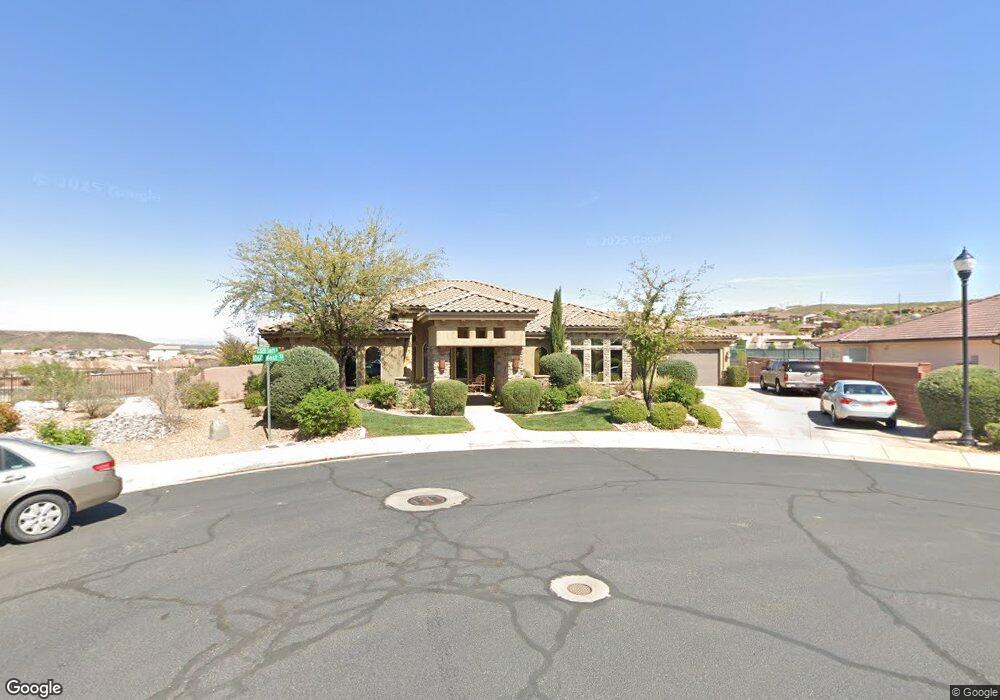
2319 S 1060 W Saint George, UT 84770
Estimated Value: $861,000 - $1,208,000
3
Beds
4
Baths
3,015
Sq Ft
$340/Sq Ft
Est. Value
About This Home
This home is located at 2319 S 1060 W, Saint George, UT 84770 and is currently estimated at $1,024,182, approximately $339 per square foot. 2319 S 1060 W is a home located in Washington County with nearby schools including Bloomington Elementary School, Dixie Intermediate School, and Dixie Middle School.
Ownership History
Date
Name
Owned For
Owner Type
Purchase Details
Closed on
Sep 12, 2013
Sold by
Small Neil F and Small Laura Britt
Bought by
Neil & Laura Small Family Trust
Current Estimated Value
Purchase Details
Closed on
Jul 30, 2007
Sold by
Jessop Doug
Bought by
Small Neil F and Small Laura Britt
Home Financials for this Owner
Home Financials are based on the most recent Mortgage that was taken out on this home.
Original Mortgage
$679,900
Outstanding Balance
$435,076
Interest Rate
6.87%
Mortgage Type
Purchase Money Mortgage
Estimated Equity
$589,106
Purchase Details
Closed on
Feb 7, 2006
Sold by
Quality Excavation Inc
Bought by
Jessop Doug
Home Financials for this Owner
Home Financials are based on the most recent Mortgage that was taken out on this home.
Original Mortgage
$580,000
Interest Rate
6.2%
Mortgage Type
Purchase Money Mortgage
Create a Home Valuation Report for This Property
The Home Valuation Report is an in-depth analysis detailing your home's value as well as a comparison with similar homes in the area
Home Values in the Area
Average Home Value in this Area
Purchase History
| Date | Buyer | Sale Price | Title Company |
|---|---|---|---|
| Neil & Laura Small Family Trust | -- | None Available | |
| Small Neil F | -- | Guardian Title Co | |
| Jessop Doug | -- | Southern Utah Title Co |
Source: Public Records
Mortgage History
| Date | Status | Borrower | Loan Amount |
|---|---|---|---|
| Open | Small Neil F | $679,900 | |
| Previous Owner | Jessop Doug | $580,000 |
Source: Public Records
Tax History Compared to Growth
Tax History
| Year | Tax Paid | Tax Assessment Tax Assessment Total Assessment is a certain percentage of the fair market value that is determined by local assessors to be the total taxable value of land and additions on the property. | Land | Improvement |
|---|---|---|---|---|
| 2025 | $3,681 | $565,345 | $132,000 | $433,345 |
| 2023 | $3,611 | $539,495 | $112,200 | $427,295 |
| 2022 | $3,848 | $540,650 | $112,200 | $428,450 |
| 2021 | $3,369 | $705,900 | $143,800 | $562,100 |
| 2020 | $3,215 | $634,500 | $109,300 | $525,200 |
| 2019 | $3,053 | $588,600 | $97,800 | $490,800 |
| 2018 | $2,920 | $290,675 | $0 | $0 |
| 2017 | $2,941 | $284,240 | $0 | $0 |
| 2016 | $2,943 | $263,010 | $0 | $0 |
| 2015 | $2,993 | $256,685 | $0 | $0 |
| 2014 | $2,976 | $256,795 | $0 | $0 |
Source: Public Records
Map
Nearby Homes
- 989 W Dover Way
- 2440 S 1200 W
- 2261 S Tonaquint Dr Unit 31
- 2661 Tonaquint Dr
- 2661 Tonaquint Dr Unit 13
- 1168 W 2440 S
- 844 W Hampton Rd
- 853 W Hampton Rd
- 2356 S 1300 W
- 1065 W Albertine Ln
- 1111 W Kolob Dr
- 2169 S Legacy Dr
- 728 W Sir Monte Dr
- 767 W Uxbridge Dr
- 697 W Windsor Dr
- 646 W Verde Ridge Rd
- 639 W Uxbridge Dr
- 0 W Top Rope Cir
- 1062 W 2320 S
- 1060 W 2320 S
- 2331 S 1060 W
- 1069 W 2320 S
- 1074 W 2320 S
- 2355 S 1060 W
- 2450 Tonaquint Dr
- 1080 W 2320 S
- 1000 W 2370 S
- 1060 W 2370 S
- 2352 S 1060 W Unit 25
- 1081 W 2320 S
- 1081 W 2320 S Unit 23
- 0 Tonaquint Dr Unit 14-161692
- 0 Tonaquint Dr Unit 14-156344
- 0 Tonaquint Dr Unit 9-112796
- 0 Tonaquint Dr Unit 8-97807
- 0 Tonaquint Dr Unit 7-91433
- 0 Tonaquint Dr Unit 162
- Lot 152 Tonaquint Dr