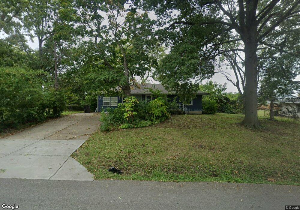
2319 S Ellison Way Independence, MO 64055
Glendale NeighborhoodEstimated Value: $181,000 - $219,000
3
Beds
1
Bath
1,222
Sq Ft
$162/Sq Ft
Est. Value
About This Home
This home is located at 2319 S Ellison Way, Independence, MO 64055 and is currently estimated at $197,888, approximately $161 per square foot. 2319 S Ellison Way is a home located in Jackson County with nearby schools including Glendale Elementary School, Bridger Middle School, and Pioneer Ridge Middle School.
Ownership History
Date
Name
Owned For
Owner Type
Purchase Details
Closed on
May 26, 2015
Sold by
Adrales Luis Morales and Adrales Lydia Rolda
Bought by
Dufoe Larry W and Dufoe Lucy A
Current Estimated Value
Home Financials for this Owner
Home Financials are based on the most recent Mortgage that was taken out on this home.
Original Mortgage
$10,000
Outstanding Balance
$7,712
Interest Rate
3.71%
Mortgage Type
New Conventional
Estimated Equity
$190,176
Create a Home Valuation Report for This Property
The Home Valuation Report is an in-depth analysis detailing your home's value as well as a comparison with similar homes in the area
Home Values in the Area
Average Home Value in this Area
Purchase History
| Date | Buyer | Sale Price | Title Company |
|---|---|---|---|
| Dufoe Larry W | -- | None Available |
Source: Public Records
Mortgage History
| Date | Status | Borrower | Loan Amount |
|---|---|---|---|
| Open | Dufoe Larry W | $10,000 |
Source: Public Records
Tax History Compared to Growth
Tax History
| Year | Tax Paid | Tax Assessment Tax Assessment Total Assessment is a certain percentage of the fair market value that is determined by local assessors to be the total taxable value of land and additions on the property. | Land | Improvement |
|---|---|---|---|---|
| 2025 | $1,407 | $18,343 | $5,204 | $13,139 |
| 2024 | $1,407 | $20,313 | $3,534 | $16,779 |
| 2023 | $1,375 | $20,313 | $2,753 | $17,560 |
| 2022 | $1,025 | $13,870 | $2,642 | $11,228 |
| 2021 | $1,024 | $13,870 | $2,642 | $11,228 |
| 2020 | $1,049 | $13,808 | $2,642 | $11,166 |
| 2019 | $1,032 | $13,808 | $2,642 | $11,166 |
| 2018 | $941 | $12,018 | $2,299 | $9,719 |
| 2017 | $941 | $12,018 | $2,299 | $9,719 |
| 2016 | $827 | $10,450 | $3,523 | $6,927 |
| 2014 | -- | $15,676 | $3,420 | $12,256 |
Source: Public Records
Map
Nearby Homes
- 2530 Queen Ridge Dr
- 2100 & 2105 S Ellison Way
- 2501 S R D Mize Rd
- 1909 S Ellison Way
- 2100 James Downey Rd
- 2008 S Lees Summit Rd
- 17813 Aqueduct Dr
- 2608 Baker Rd
- 2822 Baker Rd
- 1525 E Sea Ave Unit B
- 2714 S Brentwood Dr S
- 2737 S Breckenridge Dr
- 1109 S Woodbury St
- 16805 Sunset Dr
- 17824 Greentree Ave
- 1800 S M 291 Hwy
- 16808 E 29th St S
- 2820 Berry Ln
- 16809 E 29th St S
- 1425 S Kings Hwy
- 2315 S Ellison Way
- 2401 S Ellison Way
- 2400 S Ellison Way
- 2313 S Ellison Way
- 2405 S Ellison Way
- 2402 S Ellison Way
- 2316 S Ellison Way
- 2404 S Ellison Way
- 2312 S Ellison Way
- 2311 S Ellison Way
- 2409 S Ellison Way
- 2408 S Ellison Way
- 2308 S Ellison Way
- 2401 Queen Ridge Dr
- 2405 Queen Ridge Dr
- 2321 Queen Ridge Dr
- 2417 S Ellison Way
- 2409 Queen Ridge Dr
- 2305 S Ellison Way
- 2315 Queen Ridge Dr