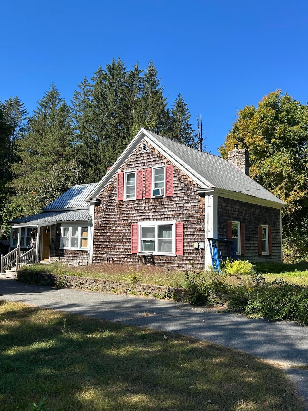
232 Campground Rd Livermore Falls, ME 04254
Estimated payment $1,022/month
Highlights
- View of Trees or Woods
- Wooded Lot
- New Englander Architecture
- 2.33 Acre Lot
- Wood Flooring
- No HOA
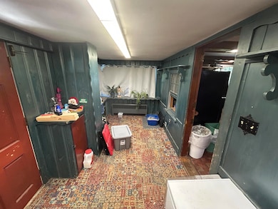
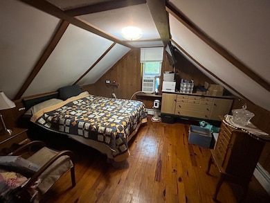
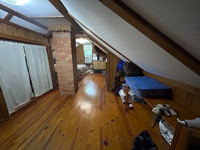
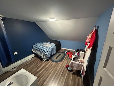
About This Home
DON'T MISS YOUR CHANCE! seller highly motivated. home is being sold as is. Endless opportunity with this cozy family home in a quiet area of Livermore Falls. Only fifteen minutes away from downtown Livermore Falls, and only forty minutes from Auburn.

Home Details
Home Type
- Single Family
Est. Annual Taxes
- $1,825
Year Built
- Built in 1850
Lot Details
- 2.33 Acre Lot
- Rural Setting
- Wooded Lot
- Property is zoned town
Home Design
- New Englander Architecture
- Stone Foundation
- Wood Frame Construction
- Metal Roof
- Shingle Siding
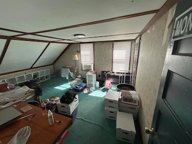
Interior Spaces
- 2,500 Sq Ft Home
- Multi-Level Property
- Family Room
- Views of Woods
Flooring
- Wood
- Carpet
- Vinyl
Bedrooms and Bathrooms
- 3 Bedrooms
- 1 Full Bathroom
Unfinished Basement
- Basement Fills Entire Space Under The House
- Interior Basement Entry
Parking
- Driveway
- Paved Parking
Utilities
- No Cooling
- Heating System Uses Oil
- Heating System Uses Wood
- Baseboard Heating
- Natural Gas Not Available
- Private Water Source
- Septic System
Community Details
- No Home Owners Association
Listing and Financial Details
- Tax Lot 31
- Assessor Parcel Number LVMF-000005-000000-000031-B000000
Map
Home Values in the Area
Average Home Value in this Area
Tax History
| Year | Tax Paid | Tax Assessment Tax Assessment Total Assessment is a certain percentage of the fair market value that is determined by local assessors to be the total taxable value of land and additions on the property. | Land | Improvement |
|---|---|---|---|---|
| 2024 | $2,343 | $90,300 | $22,600 | $67,700 |
| 2023 | $2,190 | $90,300 | $22,600 | $67,700 |
| 2022 | $2,077 | $90,300 | $22,600 | $67,700 |
| 2021 | $2,095 | $90,300 | $22,600 | $67,700 |
| 2020 | $2,095 | $90,300 | $22,600 | $67,700 |
| 2019 | $2,041 | $90,300 | $22,600 | $67,700 |
| 2018 | $1,950 | $90,300 | $22,600 | $67,700 |
| 2017 | $1,950 | $90,300 | $22,600 | $67,700 |
| 2016 | $1,887 | $90,300 | $22,600 | $67,700 |
| 2015 | $1,905 | $90,300 | $22,600 | $67,700 |
Property History
| Date | Event | Price | List to Sale | Price per Sq Ft |
|---|---|---|---|---|
| 09/18/2025 09/18/25 | For Sale | $165,000 | -- | $66 / Sq Ft |
Purchase History
| Date | Type | Sale Price | Title Company |
|---|---|---|---|
| Warranty Deed | -- | -- | |
| Warranty Deed | -- | -- | |
| Personal Reps Deed | -- | -- | |
| Personal Reps Deed | -- | -- |
Mortgage History
| Date | Status | Loan Amount | Loan Type |
|---|---|---|---|
| Open | $80,000 | New Conventional |
Source: Maine Listings
MLS Number: 1638178
APN: LVMF-000005-000000-000031-B000000
Disclaimer: Certain information contained herein is derived from information provided by parties other than Homes.com. All information provided is deemed reliable, but is not guaranteed to be accurate and should be independently verified.
![]() Listing data is derived in whole or in part from Maine Real Estate Information System, Inc. (d/b/a Maine Listings) and is for consumers' personal, noncommercial use only. Dimensions are approximate and not guaranteed. All data should be independently verified.
Listing data is derived in whole or in part from Maine Real Estate Information System, Inc. (d/b/a Maine Listings) and is for consumers' personal, noncommercial use only. Dimensions are approximate and not guaranteed. All data should be independently verified.
© 2025 Maine Real Estate Information System, Inc. All Rights Reserved. Equal Housing Opportunity.
Homes.com, LLC, 17600 Laguna Canyon Rd Irvine, CA 92618 (888)-952-6393
![]()
- M 7 L 34 Campground Rd
- 1076 Park St
- Lot 48-4 Baldwin Hill Rd
- 0 Baldwin Hill Rd Unit 1624053
- 122 Tucker Rd
- 88 Piddock Ln
- 64 Paddleford Rd
- 881 River Rd
- 0 Fayette Ridge Rd Unit 1634764
- 950 Main St
- 3079 Main St
- 146 Karn Rd
- 39 Tilton Pond Rd
- Lot 9B Pulsifer Rd
- 9 Pulsifer Rd
- 309 Strickland Ferry Rd
- 49 Pomeroy Hill Rd
- 286 Pond Rd
- 782 Main St
- 171 Park St
- 1699 Main St
- 70 Church St
- 104 Main St Unit 2
- 1506 Federal Rd Unit 1
- 2 Howes Corner Rd
- 11 Fire Rd W24a
- 7 Fire Rd W24a
- 220 Me-133
- 100 Woods Grove Ln Unit ID1255650P
- 25 Welchs Point Rd
- 19 Pond View Rd
- 2 Cloverleaf St
- 38 Heron Cove Ln
- 63 Williamson Rd
- 1020 Summerhaven Rd
- 316 Redcedar Ln
- 61 Darin Dr
- 80 Eight Rod Rd Unit 2
- 210 Mount Vernon Ave Unit 2
- 138 High St Unit C