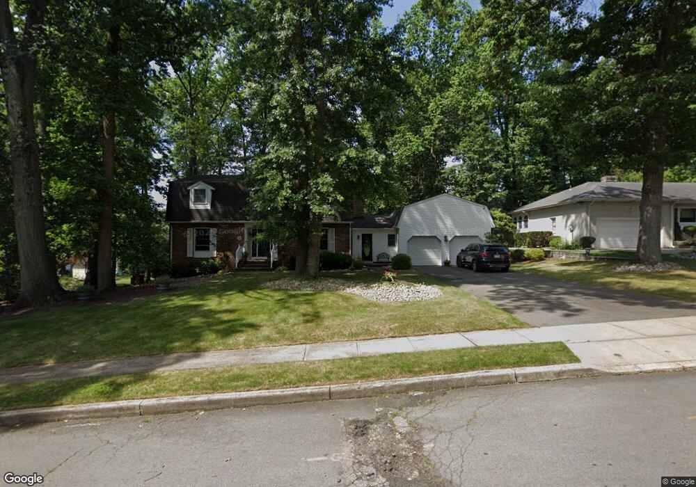
232 Dawes Rd North Brunswick, NJ 08902
Estimated Value: $754,000 - $823,000
--
Bed
--
Bath
2,434
Sq Ft
$321/Sq Ft
Est. Value
About This Home
This home is located at 232 Dawes Rd, North Brunswick, NJ 08902 and is currently estimated at $780,492, approximately $320 per square foot. 232 Dawes Rd is a home located in Middlesex County with nearby schools including Arthur M. Judd Elementary School, Linwood Middle School, and North Brunswick Twp High School.
Ownership History
Date
Name
Owned For
Owner Type
Purchase Details
Closed on
Jul 30, 2002
Sold by
Robinson Robert
Bought by
Lewis John and Lewis Mary
Current Estimated Value
Home Financials for this Owner
Home Financials are based on the most recent Mortgage that was taken out on this home.
Original Mortgage
$300,700
Outstanding Balance
$127,241
Interest Rate
6.55%
Estimated Equity
$653,251
Purchase Details
Closed on
Dec 1, 1999
Sold by
Grossi John
Bought by
Robinson Robert and Robinson Carolyn
Home Financials for this Owner
Home Financials are based on the most recent Mortgage that was taken out on this home.
Original Mortgage
$230,000
Interest Rate
7.83%
Create a Home Valuation Report for This Property
The Home Valuation Report is an in-depth analysis detailing your home's value as well as a comparison with similar homes in the area
Home Values in the Area
Average Home Value in this Area
Purchase History
| Date | Buyer | Sale Price | Title Company |
|---|---|---|---|
| Lewis John | $405,000 | -- | |
| Robinson Robert | $305,000 | -- |
Source: Public Records
Mortgage History
| Date | Status | Borrower | Loan Amount |
|---|---|---|---|
| Open | Lewis John | $300,700 | |
| Previous Owner | Robinson Robert | $230,000 |
Source: Public Records
Tax History Compared to Growth
Tax History
| Year | Tax Paid | Tax Assessment Tax Assessment Total Assessment is a certain percentage of the fair market value that is determined by local assessors to be the total taxable value of land and additions on the property. | Land | Improvement |
|---|---|---|---|---|
| 2025 | $16,347 | $258,000 | $102,800 | $155,200 |
| 2024 | $16,053 | $258,000 | $102,800 | $155,200 |
| 2023 | $16,053 | $258,000 | $102,800 | $155,200 |
| 2022 | $15,506 | $258,000 | $102,800 | $155,200 |
| 2021 | $11,298 | $258,000 | $102,800 | $155,200 |
| 2020 | $14,928 | $258,000 | $102,800 | $155,200 |
| 2019 | $14,623 | $258,000 | $102,800 | $155,200 |
| 2018 | $14,324 | $258,000 | $102,800 | $155,200 |
| 2017 | $14,071 | $258,000 | $102,800 | $155,200 |
| 2016 | $13,777 | $258,000 | $102,800 | $155,200 |
| 2015 | $13,542 | $258,000 | $102,800 | $155,200 |
| 2014 | $13,390 | $258,000 | $102,800 | $155,200 |
Source: Public Records
Map
Nearby Homes
- 7 Pershing Ct
- 1660 Us Highway 130
- 2 Silver Hollow
- 346 Wood Ave
- 457 Barrymore Place
- 430 Wood Ave
- 38 Louise Dr
- 41 Lynn Ct
- 2 Louise Dr
- 174 Hardenburg Ln
- 1290 Barkley Place N
- 3 Garden Terrace
- 1827 Oak Rd
- 1584 Holly Rd
- 26 Mare Haven Ct
- 81 Connolly Dr
- 422 Franklin Rd
- 9 Denise Ave
- 386 Franklin Rd
- 695 Spruce Rd
- 242 Dawes Rd
- 1643 Van Buren Rd
- 235 Dawes Rd
- 1659 Van Buren Dr
- 245 Dawes Rd
- 1659 Van Buren Rd
- 1623 Van Buren Rd
- 233 Hamlin Rd
- 252 Dawes Rd
- 245 Hamlin Rd
- 255 Hamlin Rd
- 1616 Miriam Dr
- 1611 Van Buren Rd
- 1630 Van Buren Rd
- 1642 Van Buren Rd
- 1654 Van Buren Rd
- 260 Dawes Rd
- 240 Hamlin Rd
- 1660 Van Buren Rd
- 265 Hamlin Rd