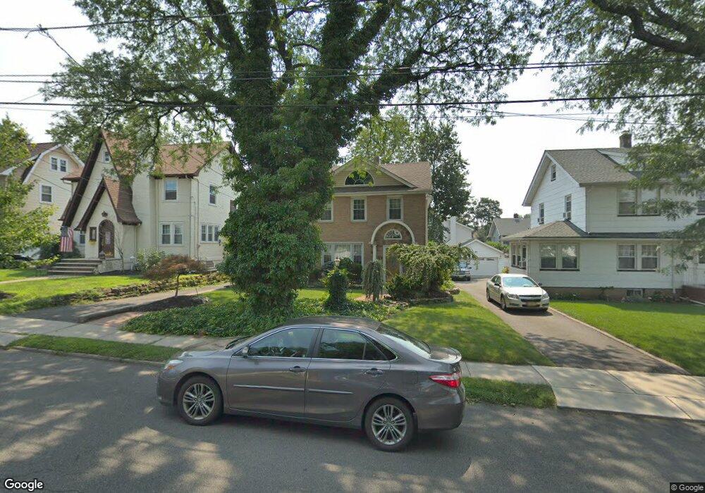
232 Division Ave Hasbrouck Heights, NJ 07604
Estimated Value: $859,000 - $1,108,000
5
Beds
4
Baths
2,838
Sq Ft
$344/Sq Ft
Est. Value
About This Home
This home is located at 232 Division Ave, Hasbrouck Heights, NJ 07604 and is currently estimated at $975,171, approximately $343 per square foot. 232 Division Ave is a home located in Bergen County with nearby schools including Hasbrouck Heights High School and Corpus Christi School.
Ownership History
Date
Name
Owned For
Owner Type
Purchase Details
Closed on
Dec 18, 2020
Sold by
Miller April M
Bought by
Pena Alex
Current Estimated Value
Home Financials for this Owner
Home Financials are based on the most recent Mortgage that was taken out on this home.
Original Mortgage
$536,000
Outstanding Balance
$477,285
Interest Rate
2.71%
Mortgage Type
New Conventional
Estimated Equity
$497,886
Purchase Details
Closed on
Oct 10, 1997
Sold by
Foley Blossom and Foley Frank M
Bought by
Miller Philip and Miller April M
Home Financials for this Owner
Home Financials are based on the most recent Mortgage that was taken out on this home.
Original Mortgage
$105,000
Interest Rate
7.87%
Create a Home Valuation Report for This Property
The Home Valuation Report is an in-depth analysis detailing your home's value as well as a comparison with similar homes in the area
Home Values in the Area
Average Home Value in this Area
Purchase History
| Date | Buyer | Sale Price | Title Company |
|---|---|---|---|
| Pena Alex | $670,000 | Shepherd Title Agency | |
| Pena Alex | $670,000 | New Title Company Name | |
| Miller Philip | $180,000 | -- |
Source: Public Records
Mortgage History
| Date | Status | Borrower | Loan Amount |
|---|---|---|---|
| Open | Pena Alex | $536,000 | |
| Closed | Pena Alex | $536,000 | |
| Previous Owner | Miller Philip | $105,000 |
Source: Public Records
Tax History
| Year | Tax Paid | Tax Assessment Tax Assessment Total Assessment is a certain percentage of the fair market value that is determined by local assessors to be the total taxable value of land and additions on the property. | Land | Improvement |
|---|---|---|---|---|
| 2025 | $19,027 | $744,700 | $231,200 | $513,500 |
| 2024 | $18,418 | $744,700 | $231,200 | $513,500 |
| 2023 | $18,004 | $714,700 | $221,200 | $493,500 |
| 2022 | $18,004 | $668,800 | $201,200 | $467,600 |
| 2021 | $17,664 | $625,500 | $188,700 | $436,800 |
| 2020 | $15,979 | $555,600 | $178,700 | $376,900 |
| 2019 | $15,517 | $545,400 | $176,200 | $369,200 |
| 2018 | $14,970 | $524,900 | $173,700 | $351,200 |
| 2017 | $14,706 | $514,900 | $171,200 | $343,700 |
| 2016 | $14,793 | $487,400 | $161,200 | $326,200 |
| 2015 | $14,554 | $487,400 | $161,200 | $326,200 |
| 2014 | $14,154 | $487,400 | $161,200 | $326,200 |
Source: Public Records
Map
Nearby Homes
- 270 Hamilton Ave
- 221 Passaic Ave
- 125 Henry St
- 145 Cleveland Ave
- 417 Franklin Ave
- 224 Cleveland Ave
- 50 Henry St
- 14 Passaic Ave
- 74 Kipp Ave
- 8800 Boulevard Unit 4B
- 212 Burton Ave
- 14 Jefferson Ave Unit 16
- 183 Terhune Ave Unit 3
- 25 Roosevelt Dr
- 183c Terhune Ave Unit C
- 4 Wesmont Dr Unit 1102
- 288 Sussex Rd
- 43 Wesmont Dr Unit 1712
- 129 Eisenhower Ln Unit 2109
- 73 Wesmont Dr Unit 1811
- 236 Division Ave
- 228 Division Ave
- 224 Division Ave
- 240 Division Ave
- 231 Raymond St
- 235 Raymond St
- 227 Raymond St
- 220 Division Ave
- 244 Division Ave
- 241 Raymond St
- 223 Raymond St
- 231 Division Ave
- 237 Division Ave
- 245 Raymond St
- 227 Division Ave
- 216 Division Ave
- 223 Division Ave
- 248 Division Ave
- 241 Division Ave
- 217 Raymond St
Your Personal Tour Guide
Ask me questions while you tour the home.