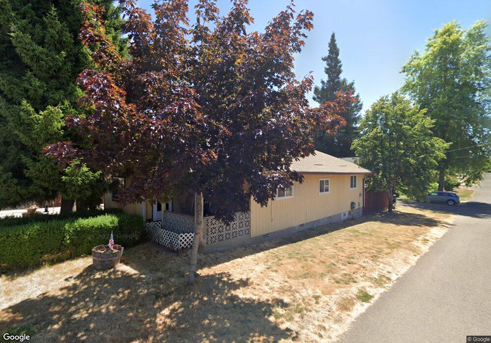
232 Grant Carlton, OR 97111
Estimated Value: $284,000 - $424,772
3
Beds
1
Bath
1,447
Sq Ft
$259/Sq Ft
Est. Value
About This Home
This home is located at 232 Grant, Carlton, OR 97111 and is currently estimated at $374,443, approximately $258 per square foot. 232 Grant is a home located in Yamhill County with nearby schools including Yamhill Carlton Elementary School, Yamhill Carlton Intermediate School, and Yamhill Carlton High School.
Ownership History
Date
Name
Owned For
Owner Type
Purchase Details
Closed on
May 9, 2024
Sold by
Paramount Dev Properties Llc
Bought by
Whitelaw Travis and Whitelaw Ashley
Current Estimated Value
Home Financials for this Owner
Home Financials are based on the most recent Mortgage that was taken out on this home.
Original Mortgage
$412,250
Outstanding Balance
$405,634
Interest Rate
6.82%
Mortgage Type
New Conventional
Estimated Equity
-$31,191
Purchase Details
Closed on
Sep 6, 2023
Sold by
Olson Linda L
Bought by
Paramount Development Properties Llc
Home Financials for this Owner
Home Financials are based on the most recent Mortgage that was taken out on this home.
Original Mortgage
$267,000
Interest Rate
7.23%
Mortgage Type
Credit Line Revolving
Create a Home Valuation Report for This Property
The Home Valuation Report is an in-depth analysis detailing your home's value as well as a comparison with similar homes in the area
Home Values in the Area
Average Home Value in this Area
Purchase History
| Date | Buyer | Sale Price | Title Company |
|---|---|---|---|
| Whitelaw Travis | $425,000 | Fidelity National Title | |
| Paramount Development Properties Llc | $180,000 | Fidelity National Title |
Source: Public Records
Mortgage History
| Date | Status | Borrower | Loan Amount |
|---|---|---|---|
| Open | Whitelaw Travis | $412,250 | |
| Previous Owner | Paramount Development Properties Llc | $267,000 |
Source: Public Records
Tax History Compared to Growth
Tax History
| Year | Tax Paid | Tax Assessment Tax Assessment Total Assessment is a certain percentage of the fair market value that is determined by local assessors to be the total taxable value of land and additions on the property. | Land | Improvement |
|---|---|---|---|---|
| 2025 | $3,076 | $188,313 | -- | -- |
| 2024 | $2,244 | $137,748 | -- | -- |
| 2023 | $2,034 | $148,713 | $0 | $0 |
| 2022 | $1,971 | $144,382 | $0 | $0 |
| 2021 | $1,927 | $140,177 | $0 | $0 |
| 2020 | $1,986 | $136,094 | $0 | $0 |
| 2019 | $1,931 | $132,130 | $0 | $0 |
| 2018 | $1,894 | $128,282 | $0 | $0 |
| 2017 | $1,850 | $124,546 | $0 | $0 |
| 2016 | $1,797 | $100,760 | $0 | $0 |
| 2015 | $1,612 | $97,826 | $0 | $0 |
| 2014 | $1,503 | $94,978 | $0 | $0 |
Source: Public Records
Map
Nearby Homes
- Lot 8 Block 7 W Washington St
- Lot 8 Block 6 W Washington St
- Lot 7 Block 6 W Washington St
- Lot 5 Block 7 W Washington St
- Lot 5 Block 6 W Washington St
- Lot 7 Block 7 W Washington St
- Lot 6 Block 6 W Washington St
- Lot 6 Block 7 W Washington St
- 420 W Grant St
- 258 S 7th St
- 210 S 2nd St
- Lot 1 Block 7 W Grant St
- Lot 3 Block 7 W Grant St
- Lot 4 Block 7 W Grant St
- Lot 2 Block 6 W Grant St
- Lot 4 Block 6 W Grant St
- Lot 2 Block 7 W Grant St
- Lot 3 Block 6 W Grant St
- Lot 1 Block 6 W Grant St
- 440 N Yamhill St
- 232 W Grant St
- 224 Grant
- 224 W Grant St
- 224 S Kutch St
- 316 W Grant St
- 211 S Park St
- 221 S Park St
- 231 S Park St
- 212 S Kutch St
- 332 W Grant St
- 155 S Park St
- 241 S Park St
- 201 W Washington St
- 342 W Grant St
- 133 S Park St
- 158 S Park St
- 221 W Washington St
- 230 S Park St
- 250 S Park St
- 219 W Washington St