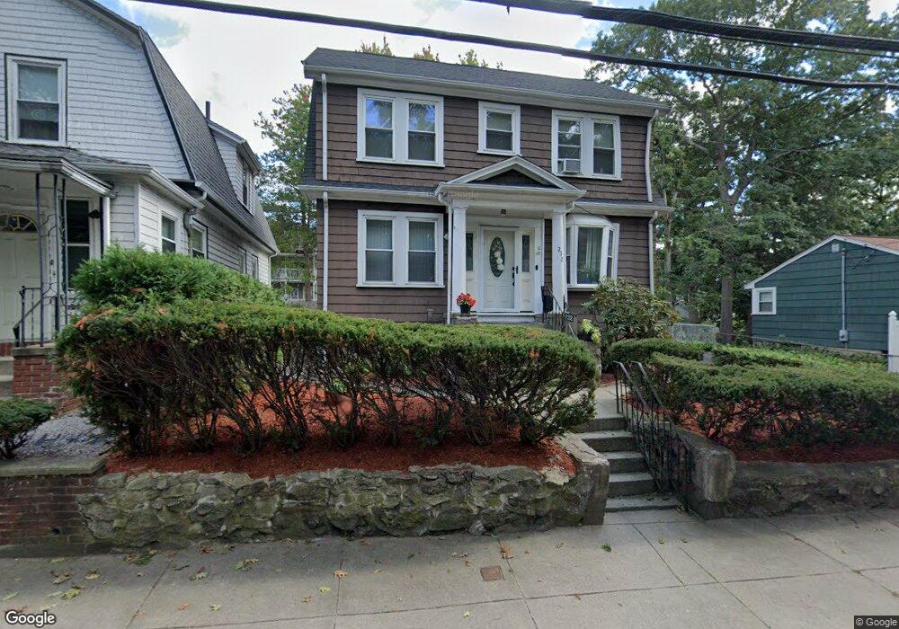
232 Itasca St Mattapan, MA 02126
Southern Mattapan NeighborhoodEstimated Value: $551,000 - $612,000
3
Beds
2
Baths
1,248
Sq Ft
$473/Sq Ft
Est. Value
About This Home
This home is located at 232 Itasca St, Mattapan, MA 02126 and is currently estimated at $590,090, approximately $472 per square foot. 232 Itasca St is a home located in Suffolk County with nearby schools including KIPP Academy Boston Charter School and Berea Seventh-day Adventist Academy.
Ownership History
Date
Name
Owned For
Owner Type
Purchase Details
Closed on
Dec 31, 2002
Sold by
Williams Gloy E
Bought by
Spriggs Bessie M
Current Estimated Value
Home Financials for this Owner
Home Financials are based on the most recent Mortgage that was taken out on this home.
Original Mortgage
$271,600
Outstanding Balance
$115,868
Interest Rate
6.02%
Mortgage Type
Purchase Money Mortgage
Estimated Equity
$474,222
Create a Home Valuation Report for This Property
The Home Valuation Report is an in-depth analysis detailing your home's value as well as a comparison with similar homes in the area
Home Values in the Area
Average Home Value in this Area
Purchase History
| Date | Buyer | Sale Price | Title Company |
|---|---|---|---|
| Spriggs Bessie M | $280,000 | -- |
Source: Public Records
Mortgage History
| Date | Status | Borrower | Loan Amount |
|---|---|---|---|
| Open | Spriggs Bessie M | $34,000 | |
| Open | Spriggs Bessie M | $271,600 | |
| Previous Owner | Spriggs Bessie M | $153,648 | |
| Previous Owner | Spriggs Bessie M | $87,000 |
Source: Public Records
Tax History Compared to Growth
Tax History
| Year | Tax Paid | Tax Assessment Tax Assessment Total Assessment is a certain percentage of the fair market value that is determined by local assessors to be the total taxable value of land and additions on the property. | Land | Improvement |
|---|---|---|---|---|
| 2025 | $5,620 | $485,300 | $153,200 | $332,100 |
| 2024 | $4,833 | $443,400 | $150,700 | $292,700 |
| 2023 | $4,534 | $422,200 | $143,500 | $278,700 |
| 2022 | $4,252 | $390,800 | $132,800 | $258,000 |
| 2021 | $3,796 | $355,800 | $126,500 | $229,300 |
| 2020 | $3,760 | $356,100 | $129,400 | $226,700 |
| 2019 | $3,591 | $340,700 | $105,800 | $234,900 |
| 2018 | $3,337 | $318,400 | $105,800 | $212,600 |
| 2017 | $3,093 | $292,100 | $105,800 | $186,300 |
| 2016 | $2,921 | $265,500 | $105,800 | $159,700 |
| 2015 | $2,801 | $231,300 | $94,800 | $136,500 |
| 2014 | $2,668 | $212,100 | $94,800 | $117,300 |
Source: Public Records
Map
Nearby Homes
- 231 Itasca St
- 839-843 Cummins Hwy
- 72 Livermore St
- 179 Hebron St
- 100 Itasca St
- 10 Brockton St
- 770 Cummins Hwy Unit 1
- 770 Cummins Hwy Unit 22
- 20 Monterey Ave
- 14-14R Kennebec St
- 60 and 64 Monterey Ave
- 34 Ridlon Rd
- 95 Woodhaven St
- 116 Almont St
- 265 Hebron St
- 90 Hollingsworth St
- 49 Fottler Rd
- 10 Itasca St
- 1465 Blue Hill Ave
- 58 Mattapan St
- 228 Itasca St
- 242 Itasca St
- 226 Itasca St
- 189 Savannah Ave
- 185 Savannah Ave Unit 187
- 246 Itasca St
- 197 Savannah Ave
- 231 Itasca St Unit 1
- 235 Itasca St
- 224 Itasca St
- 183 Savannah Ave Unit 1
- 250 Itasca St
- 199 Savannah Ave Unit 201
- 243 Itasca St
- 243 Itasca St Unit 2
- 181 Savannah Ave
- 217 Itasca St
- 258 Itasca St
- 203 Savannah Ave
- 203 Savannah Ave Unit 1