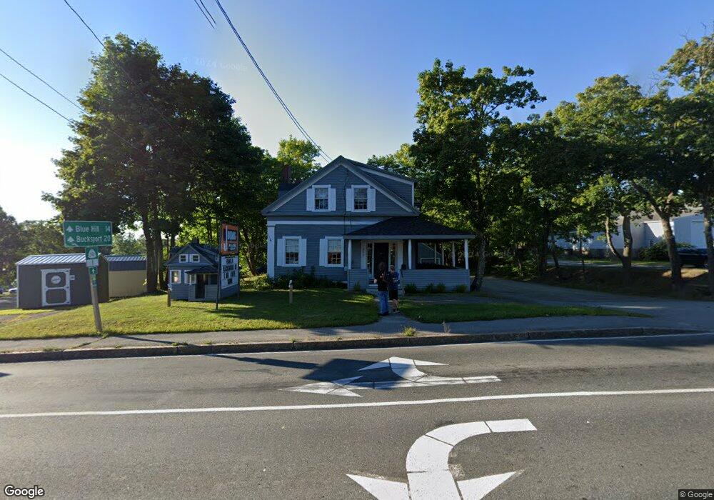
232 Main St Ellsworth, ME 04605
--
Bed
--
Bath
1,501
Sq Ft
0.6
Acres
About This Home
This home is located at 232 Main St, Ellsworth, ME 04605. 232 Main St is a home located in Hancock County with nearby schools including Sumner Memorial High School, Kidspeace National Centers of New England, and Graham Lake School.
Ownership History
Date
Name
Owned For
Owner Type
Purchase Details
Closed on
Nov 9, 2023
Sold by
232 Main St Prop T and Jones
Bought by
Jrea Llc
Purchase Details
Closed on
Aug 14, 2023
Sold by
Hsj Re Title Hldg T and Jones
Bought by
Jrea Llc
Purchase Details
Closed on
Apr 7, 2023
Sold by
H S Jones 3Rd T and Jones
Bought by
Jrea Llc
Purchase Details
Closed on
Jul 22, 2014
Sold by
Linscott Florence C Est and Clemons
Bought by
Hsj Re Title Hold T
Purchase Details
Closed on
Apr 11, 2014
Sold by
Hsj Re Title Hold T and Jones
Bought by
Jones Emilie
Purchase Details
Closed on
Aug 29, 2013
Sold by
Black Ann R Est and Black
Bought by
Jones 3Rd Harry S
Create a Home Valuation Report for This Property
The Home Valuation Report is an in-depth analysis detailing your home's value as well as a comparison with similar homes in the area
Home Values in the Area
Average Home Value in this Area
Purchase History
| Date | Buyer | Sale Price | Title Company |
|---|---|---|---|
| Jrea Llc | -- | None Available | |
| Jrea Llc | -- | None Available | |
| Jrea Llc | -- | None Available | |
| Hsj Re Title Hold T | -- | -- | |
| Jones Emilie | -- | -- | |
| Jones 3Rd Harry S | -- | -- |
Source: Public Records
Tax History Compared to Growth
Tax History
| Year | Tax Paid | Tax Assessment Tax Assessment Total Assessment is a certain percentage of the fair market value that is determined by local assessors to be the total taxable value of land and additions on the property. | Land | Improvement |
|---|---|---|---|---|
| 2024 | $4,041 | $231,550 | $72,490 | $159,060 |
| 2023 | $3,608 | $208,530 | $69,195 | $139,335 |
| 2022 | $3,274 | $208,530 | $69,195 | $139,335 |
| 2021 | $3,581 | $198,600 | $65,900 | $132,700 |
| 2020 | $3,728 | $198,600 | $65,900 | $132,700 |
| 2019 | $3,736 | $198,600 | $65,900 | $132,700 |
| 2018 | $3,622 | $198,600 | $65,900 | $132,700 |
| 2017 | $3,547 | $197,400 | $65,900 | $131,500 |
| 2016 | $3,490 | $197,400 | $65,900 | $131,500 |
| 2015 | $3,494 | $197,400 | $65,900 | $131,500 |
| 2014 | $3,247 | $197,400 | $65,900 | $131,500 |
| 2012 | $2,971 | $192,300 | $65,900 | $126,400 |
Source: Public Records
Map
Nearby Homes
- 4 Union St
- 35 Church St
- 25 Lincoln St
- 89 & 93 State St
- 80 State St
- 30 Water St
- 8 Sterling St
- 28 Central St
- 58 Laurel St
- 23 Chapel St
- 14 Chapel St
- 14 Jude Ln
- 162 Maddocks Ave
- 35 Maple St
- 44 Tinker Meadow Way Unit 40
- 43 Tinker Meadow Way Unit 19
- 42 Tinker Meadow Way Unit 38
- 41 Tinker Meadow Way Unit 17
- Lot #13-1 Shore Rd
- 14 Westwood Dr
- 232 Main St
- 232 Main St
- Lot 10 Blanchard Way
- 230 Main St
- 0 Main & Oak Streets
- 6 Oak St
- LOT 6 Oakhill Subdivision Black Bear Dr
- 69 Church St
- LOT 4 N of Oak Hill Division Rd
- 241 Main St
- 1 High St
- 3 High St Unit 958459
- 3 High St Unit 1280044
- 3 High St Unit 1375529
- 49 Church St
- 68 Church St
- 56A/ Church St
- 210 Main St
- 64 Church St
- 11 High St