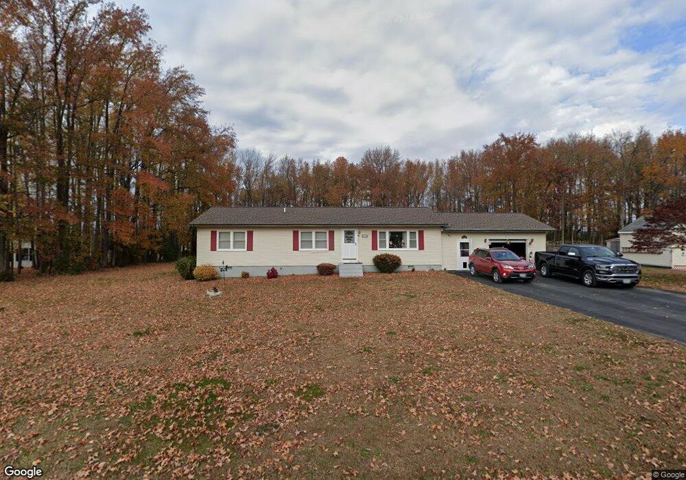
232 Maryland Rd Stevensville, MD 21666
Romancoke NeighborhoodEstimated Value: $464,091 - $533,000
--
Bed
2
Baths
1,952
Sq Ft
$257/Sq Ft
Est. Value
About This Home
This home is located at 232 Maryland Rd, Stevensville, MD 21666 and is currently estimated at $501,523, approximately $256 per square foot. 232 Maryland Rd is a home located in Queen Anne's County with nearby schools including Matapeake Elementary School, Matapeake Middle School, and Kent Island High School.
Ownership History
Date
Name
Owned For
Owner Type
Purchase Details
Closed on
Nov 22, 2024
Sold by
Fooks Frances E and Fooks Robert A
Bought by
Frances Elizabeth Fooks Trust and Fooks
Current Estimated Value
Purchase Details
Closed on
Nov 20, 2007
Sold by
Fooks Robert A
Bought by
Fooks Robert A and Fooks Frances E
Purchase Details
Closed on
Nov 16, 2007
Sold by
Fooks Robert A
Bought by
Fooks Robert A and Fooks Frances E
Purchase Details
Closed on
Oct 24, 1994
Sold by
Chester Edward A and Chester Frances
Bought by
Fooks Robert A and Fooks Frances E
Create a Home Valuation Report for This Property
The Home Valuation Report is an in-depth analysis detailing your home's value as well as a comparison with similar homes in the area
Home Values in the Area
Average Home Value in this Area
Purchase History
| Date | Buyer | Sale Price | Title Company |
|---|---|---|---|
| Frances Elizabeth Fooks Trust | -- | None Listed On Document | |
| Frances Elizabeth Fooks Trust | -- | None Listed On Document | |
| Fooks Robert A | -- | -- | |
| Fooks Robert A | -- | -- | |
| Fooks Robert A | -- | -- |
Source: Public Records
Tax History Compared to Growth
Tax History
| Year | Tax Paid | Tax Assessment Tax Assessment Total Assessment is a certain percentage of the fair market value that is determined by local assessors to be the total taxable value of land and additions on the property. | Land | Improvement |
|---|---|---|---|---|
| 2025 | $3,157 | $352,533 | $0 | $0 |
| 2024 | $2,997 | $327,167 | $0 | $0 |
| 2023 | $2,843 | $301,800 | $156,100 | $145,700 |
| 2022 | $2,780 | $295,133 | $0 | $0 |
| 2021 | $2,763 | $288,467 | $0 | $0 |
| 2020 | $2,763 | $281,800 | $137,100 | $144,700 |
| 2019 | $2,736 | $278,967 | $0 | $0 |
| 2018 | $2,708 | $276,133 | $0 | $0 |
| 2017 | $2,681 | $273,300 | $0 | $0 |
| 2016 | -- | $273,300 | $0 | $0 |
| 2015 | $2,517 | $273,300 | $0 | $0 |
| 2014 | $2,517 | $325,400 | $0 | $0 |
Source: Public Records
Map
Nearby Homes
- 101 Oak St
- 321 Oregon Rd
- 122 S Carolina Rd
- 306 N Lake Rd
- 116 Talbot Rd
- 224 Wicomico Rd
- 300 Talbot Rd
- 116 Mallard Dr
- 122 Mallard Dr
- 412 Five Farms Dr
- 312 Columbia Ln
- 410 5 Farms Dr
- 303 Queen Anne Club Dr
- 227 Queen Anne Club Dr
- 118 N Lake Dr
- 8905 Romancoke Rd
- Lot 1 - E/Kent Point Romancoke
- 114 N Lake Dr
- 206 Columbia Ln
- 303 Queens Colony High Rd
- 226 Maryland Rd
- 226 Maryland Rd Unit 1
- 242 Maryland Rd
- 227 Maryland Rd
- 101 Elm St
- 12 Elm St
- 64 Elm St
- 224 Maryland Rd
- 221 Maryland Rd
- 104 Elm St
- 222 Maryland Rd
- 0 Elm St Unit 1000151724
- 0 Elm St Unit 1007145966
- 0 Elm St Unit MDQA140442
- 217 Maryland Rd
- 107 Elm St
- 224 New Jersey Rd
- Lot 64, 65, 66 Bay Dr Elm St
- 222 New Jersey Rd
- 218 Maryland Rd