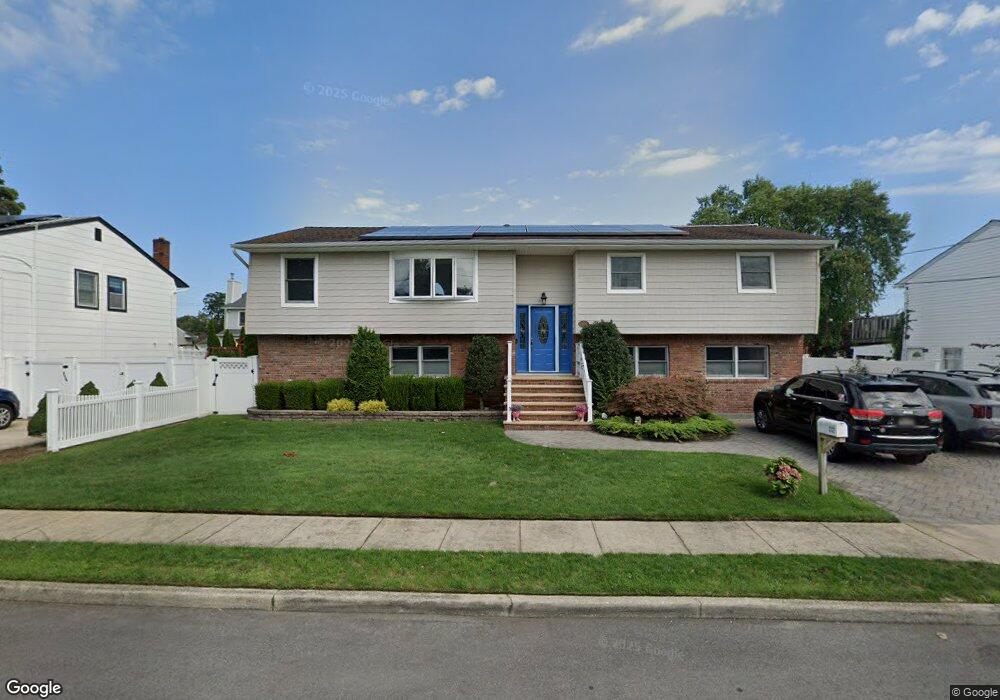
232 N Broome Ave Lindenhurst, NY 11757
Estimated Value: $604,283 - $895,000
--
Bed
--
Bath
2,167
Sq Ft
$346/Sq Ft
Est. Value
About This Home
This home is located at 232 N Broome Ave, Lindenhurst, NY 11757 and is currently estimated at $749,821, approximately $346 per square foot. 232 N Broome Ave is a home located in Suffolk County with nearby schools including Daniel Street School, Lindenhurst Middle School, and Lindenhurst Senior High School.
Ownership History
Date
Name
Owned For
Owner Type
Purchase Details
Closed on
Aug 15, 2000
Sold by
Gagliano Richard and Gagliano Esther
Bought by
Lanza Lawrence and Lanza Carol
Current Estimated Value
Home Financials for this Owner
Home Financials are based on the most recent Mortgage that was taken out on this home.
Original Mortgage
$190,000
Outstanding Balance
$68,308
Interest Rate
8.1%
Mortgage Type
Purchase Money Mortgage
Estimated Equity
$681,513
Purchase Details
Closed on
Jul 31, 1997
Sold by
Gagliano Esther and Tomasi Esther
Bought by
Gagliano Esther and Gagliano Richard
Create a Home Valuation Report for This Property
The Home Valuation Report is an in-depth analysis detailing your home's value as well as a comparison with similar homes in the area
Home Values in the Area
Average Home Value in this Area
Purchase History
| Date | Buyer | Sale Price | Title Company |
|---|---|---|---|
| Lanza Lawrence | $260,000 | -- | |
| Gagliano Esther | -- | First American Title Ins Co |
Source: Public Records
Mortgage History
| Date | Status | Borrower | Loan Amount |
|---|---|---|---|
| Open | Lanza Lawrence | $190,000 |
Source: Public Records
Tax History Compared to Growth
Tax History
| Year | Tax Paid | Tax Assessment Tax Assessment Total Assessment is a certain percentage of the fair market value that is determined by local assessors to be the total taxable value of land and additions on the property. | Land | Improvement |
|---|---|---|---|---|
| 2024 | $20,398 | $5,440 | $280 | $5,160 |
| 2023 | $17,999 | $5,440 | $280 | $5,160 |
| 2022 | $15,136 | $5,440 | $280 | $5,160 |
| 2021 | $15,136 | $5,440 | $280 | $5,160 |
| 2020 | $16,070 | $5,440 | $280 | $5,160 |
| 2019 | $18,188 | $0 | $0 | $0 |
| 2018 | $15,176 | $5,440 | $280 | $5,160 |
| 2017 | $15,176 | $5,440 | $280 | $5,160 |
| 2016 | $14,978 | $5,440 | $280 | $5,160 |
| 2015 | -- | $5,440 | $280 | $5,160 |
| 2014 | -- | $5,440 | $280 | $5,160 |
Source: Public Records
Map
Nearby Homes
- 247 N Greene Ave
- 52 Dover St
- 405 N Clinton Ave
- 13 N Fulton Ave
- 181 S Alleghany Ave
- 196 S Broome Ave
- 22 Bristol St
- 220 S Clinton Ave
- 261 E Hoffman Ave
- 260 S Broome Ave
- 7 Gary St
- 144 N Jefferson Ave
- 216 S Delaware Ave
- 468 N Greene Ave
- 449 N Indiana Ave
- 177 Texas St
- 22 Lenox St
- 417 N Monroe Ave
- 37 Newark St
- 457 N Monroe Ave
- 240 N Broome Ave
- 214 N Broome Ave
- 243 N Clinton Ave
- 235 N Clinton Ave
- 221 N Clinton Ave
- 221 N Broome Ave
- 229 N Broome Ave
- 215 N Broome Ave
- 213 N Clinton Ave
- 166 E John St
- 257 N Clinton Ave
- 245 N Broome Ave
- 207 N Broome Ave
- 260 N Broome Ave
- 255 N Broome Ave
- 154 E John St
- 228 N Alleghany Ave
- 236 N Clinton Ave
- 220 N Alleghany Ave
- 234 N Clinton Ave