Estimated Value: $207,000 - $315,000
5
Beds
2
Baths
1,720
Sq Ft
$154/Sq Ft
Est. Value
About This Home
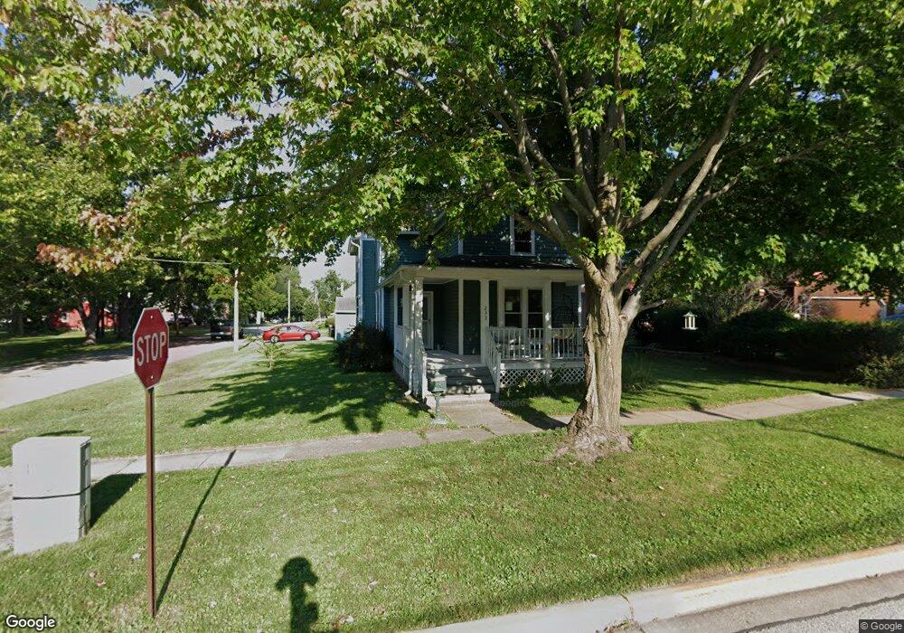
This home is located at 232 N State St, Genoa, IL 60135 and is currently estimated at $265,256, approximately $154 per square foot. 232 N State St is a home located in DeKalb County with nearby schools including Kingston Elementary School, Genoa Elementary School, and Genoa-Kingston Middle School.
Ownership History
Date
Name
Owned For
Owner Type
Purchase Details
Closed on
Aug 4, 2015
Sold by
Jarog Andrew C and Jarog Brenda S
Bought by
Harjung Jason K and Harjung Gwendolyn M
Current Estimated Value
Home Financials for this Owner
Home Financials are based on the most recent Mortgage that was taken out on this home.
Original Mortgage
$156,750
Outstanding Balance
$123,701
Interest Rate
4.13%
Mortgage Type
New Conventional
Estimated Equity
$141,555
Purchase Details
Closed on
Aug 24, 2006
Sold by
Richter Joseph C
Bought by
Jarog Andrew C and Jarog Brenda S
Create a Home Valuation Report for This Property
The Home Valuation Report is an in-depth analysis detailing your home's value as well as a comparison with similar homes in the area
Home Values in the Area
Average Home Value in this Area
Purchase History
| Date | Buyer | Sale Price | Title Company |
|---|---|---|---|
| Harjung Jason K | $170,000 | -- | |
| Jarog Andrew C | $110,000 | -- |
Source: Public Records
Mortgage History
| Date | Status | Borrower | Loan Amount |
|---|---|---|---|
| Open | Harjung Jason K | $156,750 |
Source: Public Records
Tax History
| Year | Tax Paid | Tax Assessment Tax Assessment Total Assessment is a certain percentage of the fair market value that is determined by local assessors to be the total taxable value of land and additions on the property. | Land | Improvement |
|---|---|---|---|---|
| 2024 | $6,127 | $69,465 | $11,769 | $57,696 |
| 2023 | $5,505 | $64,607 | $10,946 | $53,661 |
| 2022 | $5,505 | $55,714 | $10,586 | $45,128 |
| 2021 | $5,205 | $52,714 | $10,016 | $42,698 |
| 2020 | $5,401 | $53,817 | $9,911 | $43,906 |
| 2019 | $5,244 | $50,651 | $9,328 | $41,323 |
| 2018 | $5,099 | $48,354 | $8,905 | $39,449 |
| 2017 | $4,998 | $46,454 | $8,555 | $37,899 |
| 2016 | $5,044 | $46,347 | $8,535 | $37,812 |
| 2015 | -- | $45,234 | $8,330 | $36,904 |
| 2014 | -- | $44,461 | $8,188 | $36,273 |
| 2013 | -- | $50,494 | $8,176 | $42,318 |
Source: Public Records
Map
Nearby Homes
- 109 S Washington St
- 120 Monroe St
- 105 S Sycamore St
- 111 S Sycamore St
- 118 N Locust St
- 408 Stearn Dr Unit 408
- 404 S Stott St
- 4.00 acres Illinois 23
- 437 Stearn Dr Unit 437
- 0000 Walnut St
- 508 Winding Trail
- 427 Riverbend Dr
- 621 Stearn Dr
- 734 Watson Dr
- 561 Stearn Dr Unit 561
- 563 Stearn Dr Unit 563
- 214 Winding Trail
- 14025 Il Route 72
- 408 Preserve Dr
- 430 Preserve Dr
- 228 N State St
- 224 N State St
- 222 N State St
- 216 N State St
- 229 N State St Unit 23
- 229 N State St
- 219 N State St
- 210 N State St
- 503 W 1st St
- 215 N State St
- 517 W 1st St
- 202 N State St
- 207 N State St
- 409 W 1st St
- 405 W 1st St
- 520 W 1st St
- 524 W 1st St
- 401 W 1st St
- 223 N Washington St
- 219 N Washington St
Your Personal Tour Guide
Ask me questions while you tour the home.