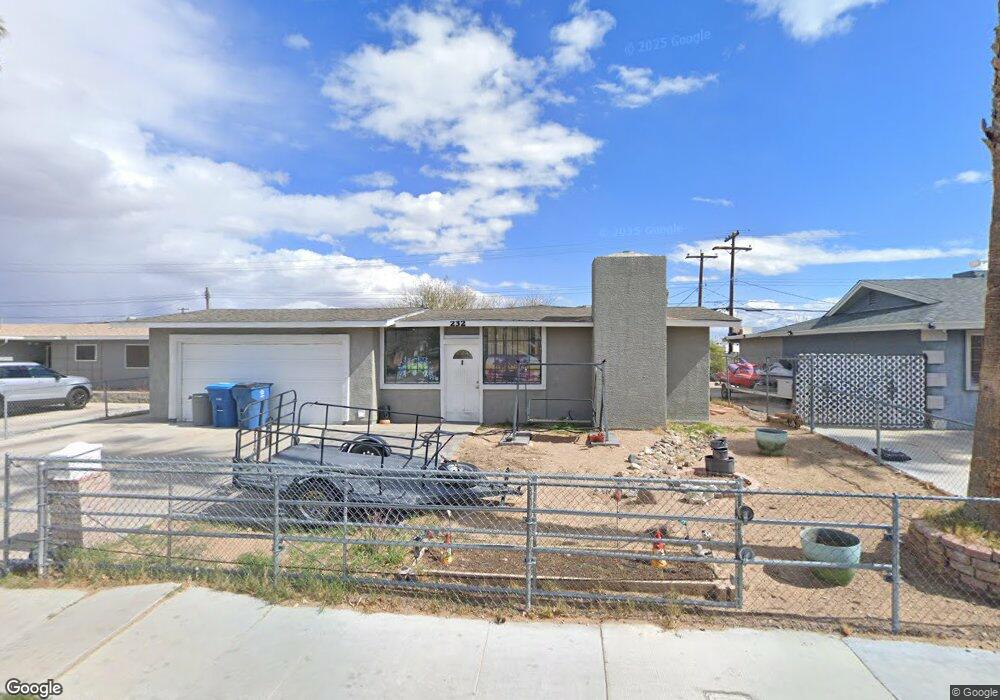
232 N Wallace Dr Las Vegas, NV 89107
Pittman NeighborhoodEstimated Value: $339,000 - $362,000
3
Beds
2
Baths
1,224
Sq Ft
$285/Sq Ft
Est. Value
About This Home
This home is located at 232 N Wallace Dr, Las Vegas, NV 89107 and is currently estimated at $348,410, approximately $284 per square foot. 232 N Wallace Dr is a home located in Clark County with nearby schools including Vail Pittman Elementary School, Frank F Garside Junior High School, and Western High School.
Ownership History
Date
Name
Owned For
Owner Type
Purchase Details
Closed on
Feb 7, 2018
Sold by
Herringrton Robert M
Bought by
Herrington Robert and The Herrington Trust
Current Estimated Value
Purchase Details
Closed on
Jun 30, 2006
Sold by
Condor Equities Inc
Bought by
Herrington Robert M
Home Financials for this Owner
Home Financials are based on the most recent Mortgage that was taken out on this home.
Original Mortgage
$152,000
Interest Rate
7.87%
Mortgage Type
Unknown
Purchase Details
Closed on
May 24, 2006
Sold by
Osborn Shirley and Austin Ada J
Bought by
Condor Equities Inc
Home Financials for this Owner
Home Financials are based on the most recent Mortgage that was taken out on this home.
Original Mortgage
$152,000
Interest Rate
7.87%
Mortgage Type
Unknown
Purchase Details
Closed on
Mar 6, 2002
Sold by
Austin Robert A
Bought by
Austin Ada J
Create a Home Valuation Report for This Property
The Home Valuation Report is an in-depth analysis detailing your home's value as well as a comparison with similar homes in the area
Home Values in the Area
Average Home Value in this Area
Purchase History
| Date | Buyer | Sale Price | Title Company |
|---|---|---|---|
| Herrington Robert | -- | None Available | |
| Herrington Robert M | $190,000 | Ticor Title Of Nevada Inc | |
| Condor Equities Inc | $116,200 | Ticor Title Of Nevada Inc | |
| Austin Ada J | -- | United Title |
Source: Public Records
Mortgage History
| Date | Status | Borrower | Loan Amount |
|---|---|---|---|
| Previous Owner | Herrington Robert M | $152,000 | |
| Previous Owner | Condor Equities Inc | $116,447 |
Source: Public Records
Tax History Compared to Growth
Tax History
| Year | Tax Paid | Tax Assessment Tax Assessment Total Assessment is a certain percentage of the fair market value that is determined by local assessors to be the total taxable value of land and additions on the property. | Land | Improvement |
|---|---|---|---|---|
| 2025 | $700 | $47,727 | $29,750 | $17,977 |
| 2024 | $680 | $47,727 | $29,750 | $17,977 |
| 2023 | $554 | $47,312 | $31,150 | $16,162 |
| 2022 | $660 | $40,732 | $26,250 | $14,482 |
| 2021 | $641 | $37,246 | $23,800 | $13,446 |
| 2020 | $619 | $34,412 | $21,350 | $13,062 |
| 2019 | $601 | $30,473 | $17,850 | $12,623 |
| 2018 | $584 | $26,896 | $15,050 | $11,846 |
| 2017 | $878 | $26,786 | $15,050 | $11,736 |
| 2016 | $554 | $22,549 | $11,200 | $11,349 |
| 2015 | $552 | $20,110 | $9,100 | $11,010 |
| 2014 | $536 | $15,855 | $5,250 | $10,605 |
Source: Public Records
Map
Nearby Homes
- 6112 Denver Cir
- 6121 Fawn Cir
- 6100 Fawn Cir
- 6244 Rassler Ave
- 704 N Wallace Dr
- 6261 Rassler Ave
- 6224 Fargo Ave
- 5924 Iris Ave
- 304 Orland St Unit 53
- 304 Orland St Unit 56
- 304 Orland St Unit 39
- 304 Orland St Unit 38
- 304 Orland St Unit 47
- 304 Orland St Unit 43
- 212 Orland St Unit 23
- 212 Orland St Unit 28
- 212 Orland St Unit 22
- 212 Orland St Unit 19
- 212 Orland St Unit 17
- 208 Orland St Unit 10
- 300 N Wallace Dr
- 228 N Wallace Dr
- 6125 Denver Cir
- 304 N Wallace Dr
- 224 N Wallace Dr
- 6201 Parsifal Place
- 6201 Parsifal Place Unit N
- 6124 Denver Cir
- 6124 Chelsea Cir
- 6200 Parsifal Place
- 6120 Chelsea Cir
- 308 N Wallace Dr
- 220 N Wallace Dr
- 6200 Lawton Ave
- 6117 Denver Cir
- 6201 Hobart Ave
- 312 N Wallace Dr
- 216 N Wallace Dr
- 6116 Chelsea Cir
- 6125 Chelsea Cir