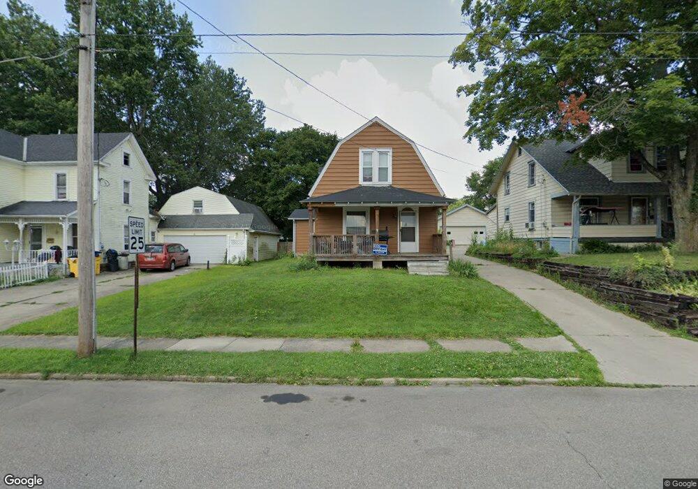
232 Poplar St Mansfield, OH 44903
Estimated Value: $86,000 - $102,000
3
Beds
1
Bath
1,402
Sq Ft
$67/Sq Ft
Est. Value
About This Home
This home is located at 232 Poplar St, Mansfield, OH 44903 and is currently estimated at $94,175, approximately $67 per square foot. 232 Poplar St is a home located in Richland County with nearby schools including St. Peter's High School/Junior High, St. Peter's Elementary/Montessori School, and Discovery School.
Ownership History
Date
Name
Owned For
Owner Type
Purchase Details
Closed on
Apr 30, 1999
Sold by
Eyster Travis C
Bought by
Clinton Clyde G and Clinton April A
Current Estimated Value
Home Financials for this Owner
Home Financials are based on the most recent Mortgage that was taken out on this home.
Original Mortgage
$56,050
Interest Rate
7.05%
Mortgage Type
New Conventional
Purchase Details
Closed on
Jul 5, 1995
Sold by
Leonard Julie
Bought by
Eyster Travis C and Cinadr Elizabeth M
Home Financials for this Owner
Home Financials are based on the most recent Mortgage that was taken out on this home.
Original Mortgage
$40,950
Interest Rate
7.9%
Mortgage Type
New Conventional
Purchase Details
Closed on
Jul 23, 1991
Sold by
White John I
Bought by
Leonard Julie F
Create a Home Valuation Report for This Property
The Home Valuation Report is an in-depth analysis detailing your home's value as well as a comparison with similar homes in the area
Home Values in the Area
Average Home Value in this Area
Purchase History
| Date | Buyer | Sale Price | Title Company |
|---|---|---|---|
| Clinton Clyde G | $59,000 | -- | |
| Eyster Travis C | $45,500 | -- | |
| Leonard Julie F | $36,500 | -- |
Source: Public Records
Mortgage History
| Date | Status | Borrower | Loan Amount |
|---|---|---|---|
| Closed | Clinton Clyde G | $56,050 | |
| Previous Owner | Eyster Travis C | $40,950 |
Source: Public Records
Tax History Compared to Growth
Tax History
| Year | Tax Paid | Tax Assessment Tax Assessment Total Assessment is a certain percentage of the fair market value that is determined by local assessors to be the total taxable value of land and additions on the property. | Land | Improvement |
|---|---|---|---|---|
| 2024 | $449 | $18,280 | $2,880 | $15,400 |
| 2023 | $856 | $18,280 | $2,880 | $15,400 |
| 2022 | $720 | $12,880 | $2,340 | $10,540 |
| 2021 | $725 | $12,880 | $2,340 | $10,540 |
| 2020 | $741 | $12,880 | $2,340 | $10,540 |
| 2019 | $821 | $12,880 | $2,340 | $10,540 |
| 2018 | $810 | $12,880 | $2,340 | $10,540 |
| 2017 | $949 | $12,880 | $2,340 | $10,540 |
| 2016 | $1,109 | $17,580 | $3,110 | $14,470 |
| 2015 | $1,060 | $17,580 | $3,110 | $14,470 |
| 2014 | $1,046 | $17,580 | $3,110 | $14,470 |
| 2012 | $419 | $18,500 | $3,270 | $15,230 |
Source: Public Records
Map
Nearby Homes
- 114 Vennum Ave
- 118 Lind Ave
- 126 Dawson Ave
- 76 Bartley Ave
- 133 Stewart Ave S
- 88 Sherman Ave
- 119 Carpenter Rd
- 257 Wood St
- 135 Wood St
- 37 Baldwin Ave
- 71 Glenwood Blvd
- 78 Glenwood Blvd
- 538 Broadview Ave
- 118 Parkwood Blvd
- 24 Stewart Ave S
- 131 Sturges Ave
- 679 Coleman Rd
- 21 Glenwood Blvd
- 41 Parkwood Blvd
- 353 Sturges Ave
- 226 Poplar St
- 234 Poplar St
- 222 Poplar St
- 218 Poplar St
- 229 Bartley Ave
- 244 Poplar St
- 225 Bartley Ave
- 233 Bartley Ave
- 235 Bartley Ave Unit 237
- 235 Bartley Ave
- 221 Bartley Ave
- 248 Poplar St
- 437 Glessner Ave
- 239 Bartley Ave
- 213 Bartley Ave
- 237 Bartley Ave
- 254 Poplar St
- 441 Glessner Ave
- 251 Bartley Ave
- 445 Glessner Ave