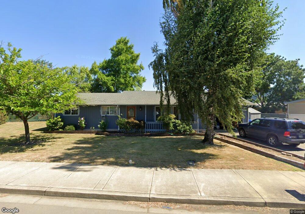
232 S Comstock Ave Sutherlin, OR 97479
Estimated Value: $265,000 - $295,000
3
Beds
2
Baths
1,152
Sq Ft
$245/Sq Ft
Est. Value
About This Home
This home is located at 232 S Comstock Ave, Sutherlin, OR 97479 and is currently estimated at $281,937, approximately $244 per square foot. 232 S Comstock Ave is a home located in Douglas County with nearby schools including East Sutherlin Primary School, West Sutherlin Intermediate School, and Sutherlin Middle School.
Ownership History
Date
Name
Owned For
Owner Type
Purchase Details
Closed on
Mar 17, 2006
Sold by
Martin Rebecca R
Bought by
Martin Robert T
Current Estimated Value
Home Financials for this Owner
Home Financials are based on the most recent Mortgage that was taken out on this home.
Original Mortgage
$132,000
Outstanding Balance
$83,572
Interest Rate
8.5%
Mortgage Type
Fannie Mae Freddie Mac
Estimated Equity
$198,365
Create a Home Valuation Report for This Property
The Home Valuation Report is an in-depth analysis detailing your home's value as well as a comparison with similar homes in the area
Home Values in the Area
Average Home Value in this Area
Purchase History
| Date | Buyer | Sale Price | Title Company |
|---|---|---|---|
| Martin Robert T | -- | Ticor Title |
Source: Public Records
Mortgage History
| Date | Status | Borrower | Loan Amount |
|---|---|---|---|
| Open | Martin Robert T | $132,000 |
Source: Public Records
Tax History Compared to Growth
Tax History
| Year | Tax Paid | Tax Assessment Tax Assessment Total Assessment is a certain percentage of the fair market value that is determined by local assessors to be the total taxable value of land and additions on the property. | Land | Improvement |
|---|---|---|---|---|
| 2025 | $1,779 | $143,700 | -- | -- |
| 2024 | $1,740 | $139,515 | -- | -- |
| 2023 | $1,690 | $135,452 | $0 | $0 |
| 2022 | $1,641 | $131,507 | $0 | $0 |
| 2021 | $1,594 | $127,677 | $0 | $0 |
| 2020 | $1,548 | $123,959 | $0 | $0 |
| 2019 | $1,503 | $120,349 | $0 | $0 |
| 2018 | $1,459 | $33,733 | $0 | $0 |
| 2017 | $1,491 | $113,441 | $0 | $0 |
| 2016 | $1,448 | $110,137 | $0 | $0 |
| 2015 | $1,410 | $106,930 | $0 | $0 |
| 2014 | $1,369 | $103,816 | $0 | $0 |
| 2013 | -- | $100,793 | $0 | $0 |
Source: Public Records
Map
Nearby Homes
- 142 S Comstock Ave
- 165 Robinson St
- 181 SW Hutchins St
- 1688 W Central Ave
- 401 N Comstock Ave
- 226 Miller St
- 220 Miller St
- 324 Dakota St
- 1907 W Duke Rd
- 1660 Scardi Blvd
- 1716 Scardi Blvd Unit 174
- 1878 Trails End Ln
- 135 Elkton St
- 126 Coles Valley St
- 154 Coles Valley St
- 149 Coles Valley St
- 702 Divot Loop
- 575 Cedar St
- 0 N Fourth St Unit 24557651
- 811 Pebble Creek St
- 1379 Sunset Ln
- 1365 Sunset Ln
- 1355 Sunset Ln
- 175 S Comstock Ave
- 213 S Comstock Ave
- 213 S Comstock Rd
- 1378 Sunset Ln
- 161 S Comstock Rd
- 0 Sunset Ave
- 0 Sunset Ave
- 0 Sunset Ave
- 1343 Sunset Ln
- 1366 Sunset Ln
- 235 S Comstock Ave
- 163 S Comstock Ave
- 257 S Comstock Ave
- 1323 Sunset Ln
- 1350 Sunset Ln
- 1333 Hospitality Way
- 1372 Sunset Ln