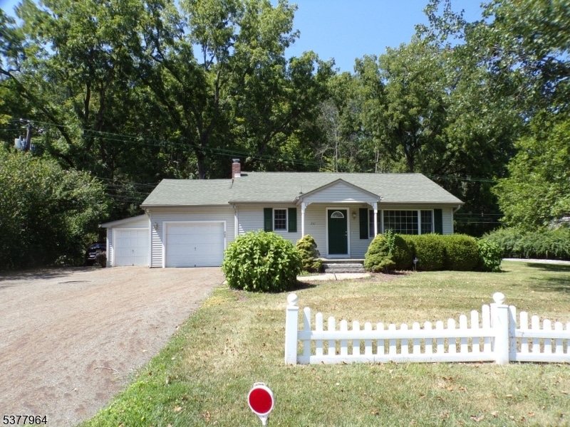
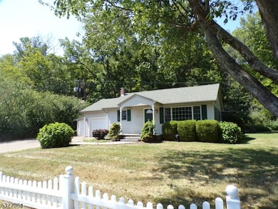
232 State Route 94 Columbia, NJ 07832
Highlights
- Wood Flooring
- 1 Car Direct Access Garage
- Laundry Room
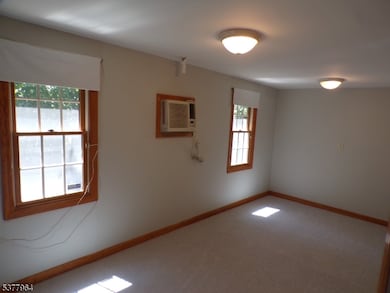
- Home Office
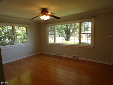
- Living Room
- 1-Story Property
About This Home
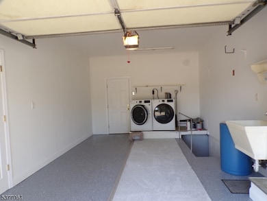
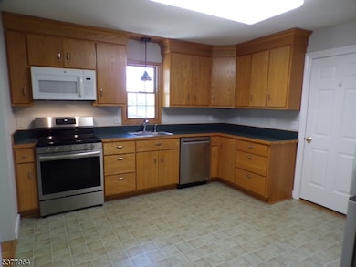
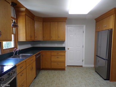
Ready for New Tenant - Renovated 2 Bedroom Ranch home. Wide paved driveway which extends to Democracy road. One car garage. Large Eat in Kitchen w/lots of cabinets and pantry, Living Room w/ wood floors, ceiling fan w/ light, picture window and side windows allowing natural lighting. Bedrooms w/wood flooring. Main Bath w/tub/shower. Laundry and utility sink in garage area. Additional room off garage with electric hear and wall a/c to use as leisure/office. Alarm system in place, tenant responsibility to activate. Tenant must have tenant insurance. No Smoking Permitted. Pet upon approval of Landlord. Two addresses and entrances: 6 Democracy Rd. or 232 State Route 94. Columbia mailing address.
Listing Agent
RE/MAX RIDGE REAL ESTATE Brokerage Phone: 908-362-7200 Listed on: 08/23/2025

Home Details
Home Type
- Single Family
Est. Annual Taxes
- $5,811
Year Built
- Built in 1950 | Remodeled
Lot Details
- 0.27 Acre Lot
- Level Lot
- Open Lot
Parking
- 1 Car Direct Access Garage
- Inside Entrance
- Garage Door Opener
- Additional Parking
Interior Spaces
- 1-Story Property
- Living Room
- Home Office
- Unfinished Basement
- Basement Fills Entire Space Under The House
- Fire and Smoke Detector
- Laundry Room
Kitchen
- Electric Oven or Range
- Microwave
- Dishwasher
Flooring
- Wood
- Wall to Wall Carpet
- Vinyl
Bedrooms and Bathrooms
- 2 Bedrooms
- 1 Full Bathroom
Schools
- Blairstown Elementary School
- No. Warren Middle School
- No. Warren High School
Utilities
- Forced Air Heating and Cooling System
- One Cooling System Mounted To A Wall/Window
- Heating System Uses Oil Above Ground
- Standard Electricity
- Well
- Electric Water Heater
- Septic System
Listing and Financial Details
- Tenant pays for cable t.v., electric, heat, hot water, oil, trash removal
- Assessor Parcel Number 3004-00502-0000-00002-0000-
Community Details
Amenities
- Laundry Facilities
Pet Policy
- Limit on the number of pets
Map
Source: Garden State MLS
MLS Number: 3982985
APN: 04-00502-0000-00002
Disclaimer: Certain information contained herein is derived from information provided by parties other than Homes.com. All information provided is deemed reliable, but is not guaranteed to be accurate and should be independently verified.
![]() The data relating to real estate for sale on this website comes in part from the IDX Program of Garden State Multiple Listing Service, L.L.C. Real estate listings held by other brokerage firms are marked as IDX Listing.
The data relating to real estate for sale on this website comes in part from the IDX Program of Garden State Multiple Listing Service, L.L.C. Real estate listings held by other brokerage firms are marked as IDX Listing.
Information deemed reliable but not guaranteed.
Copyright © 2025 Garden State Multiple Listing Service, L.L.C. All rights reserved.
Notice: The dissemination of listings on this website does not constitute the consent required by N.J.A.C. 11:5.6.1 (n) for the advertisement of listings exclusively for sale by another broker. Any such consent must be obtained in writing from the listing broker.
This information is being provided for Consumers’ personal, non-commercial use and may not be used for any purpose other than to identify prospective properties Consumers may be interested in purchasing.
- 60 Vail Rd
- 20 Polkville Rd
- 0 Mount Vernon Rd
- 18 W Crisman Rd
- 0 Cedar Lake Rd Unit 3936605
- 94 Mount Vernon Rd
- 163 New Jersey 94
- 87 Walnut Valley Rd
- 00 Walnut Valley Rd
- 5 Alice Ct
- 6 Mountain Terrace
- 34 Stony Brook Rd
- 143 Vail Rd
- 3 Hickory Ridge Dr
- 20 Cobblewood Rd
- 17 Bear Cave Rd
- 68 Countryside Rd
- 7 Gap View Dr
- 49 Mount Pleasant Rd
- 115 Route94
- 40 Cleveland Rd
- 23 Main St
- 17 Main St
- 8 High St
- 534 Hope Blairstown Rd
- 13 Susquehanna Ln
- 620 Slateford Rd
- 51 Lower Ridgeview Cir
- 1055 Sky View Dr
- 220 Sage Ln
- 307 Watergap Village
- 19 Mount Nebo Rd
- 116 Kasak
- 26 Hess Rd
- 137 Independence Rd
- 370 Greentree Dr
- 305 Inverness Dr
- 165 E Brown St
- 1049 Alpine Dr
- 48 Stemple St