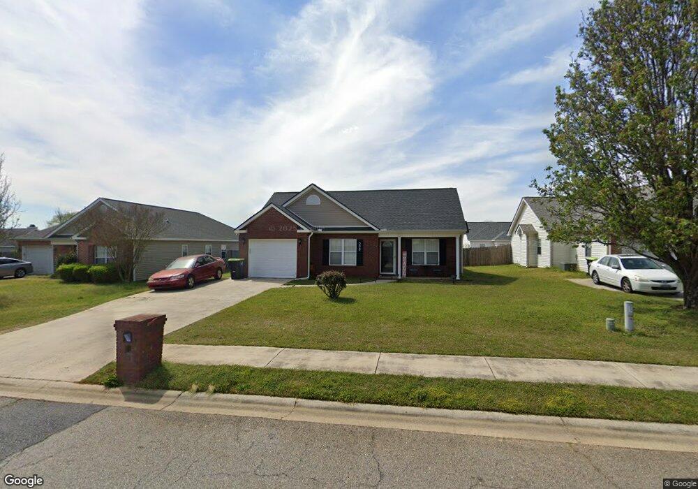
232 Stirling Bridge Dr Warner Robins, GA 31088
Estimated Value: $214,559 - $229,000
3
Beds
2
Baths
1,313
Sq Ft
$169/Sq Ft
Est. Value
About This Home
This home is located at 232 Stirling Bridge Dr, Warner Robins, GA 31088 and is currently estimated at $222,390, approximately $169 per square foot. 232 Stirling Bridge Dr is a home located in Houston County with nearby schools including Lake Joy Primary School, Lake Joy Elementary School, and Feagin Mill Middle School.
Ownership History
Date
Name
Owned For
Owner Type
Purchase Details
Closed on
Nov 12, 2009
Sold by
Cabe Heather C
Bought by
Brooks Joann
Current Estimated Value
Home Financials for this Owner
Home Financials are based on the most recent Mortgage that was taken out on this home.
Original Mortgage
$112,917
Outstanding Balance
$71,918
Interest Rate
4.92%
Mortgage Type
FHA
Estimated Equity
$150,472
Purchase Details
Closed on
Mar 14, 2003
Sold by
Bobby Wright Construction Co
Bought by
Cabe Heather C
Purchase Details
Closed on
Nov 26, 2002
Sold by
Snellgrove Properties Inc
Bought by
Bobby Wright Construction Co
Purchase Details
Closed on
Jun 5, 2002
Sold by
Jerusalem Church Rd Llc
Bought by
Snellgrove Properties Inc
Create a Home Valuation Report for This Property
The Home Valuation Report is an in-depth analysis detailing your home's value as well as a comparison with similar homes in the area
Home Values in the Area
Average Home Value in this Area
Purchase History
| Date | Buyer | Sale Price | Title Company |
|---|---|---|---|
| Brooks Joann | -- | None Available | |
| Cabe Heather C | $83,500 | -- | |
| Bobby Wright Construction Co | $16,500 | -- | |
| Snellgrove Properties Inc | $15,000 | -- |
Source: Public Records
Mortgage History
| Date | Status | Borrower | Loan Amount |
|---|---|---|---|
| Open | Brooks Joann | $112,917 | |
| Closed | Brooks Joann | $75,000 |
Source: Public Records
Tax History
| Year | Tax Paid | Tax Assessment Tax Assessment Total Assessment is a certain percentage of the fair market value that is determined by local assessors to be the total taxable value of land and additions on the property. | Land | Improvement |
|---|---|---|---|---|
| 2025 | $2,141 | $79,080 | $9,600 | $69,480 |
| 2024 | $2,313 | $72,080 | $9,600 | $62,480 |
| 2023 | $1,666 | $51,920 | $8,000 | $43,920 |
| 2022 | $1,068 | $48,440 | $7,800 | $40,640 |
| 2021 | $971 | $44,000 | $7,800 | $36,200 |
| 2020 | $824 | $37,480 | $7,000 | $30,480 |
| 2019 | $824 | $37,480 | $7,000 | $30,480 |
| 2018 | $824 | $37,480 | $7,000 | $30,480 |
| 2017 | $825 | $37,480 | $7,000 | $30,480 |
| 2016 | $826 | $37,480 | $7,000 | $30,480 |
| 2015 | -- | $37,480 | $7,000 | $30,480 |
| 2014 | $374 | $37,480 | $7,000 | $30,480 |
| 2013 | $374 | $37,480 | $7,000 | $30,480 |
Source: Public Records
Map
Nearby Homes
- 303 Sark Dr
- 205 Wembley Dr
- 216 Wembley Dr
- 126 Millbrook Dr
- 232 Jerusalem Church Rd
- 204 Falkirk Dr
- 901 Falkirk Dr
- 0 Lakeview Rd
- 468 Nandina Ct
- 486 Nandina Ct
- 101 Sasanqua Dr
- 109 Sasanqua Dr
- 116 Sasanqua Dr
- 120 Legacy Ct
- 201 Running Creek Dr
- 204 Bridgeway Dr
- 122 Wavertree Dr
- 234 Sedgebrooke Dr
- 114 Wavertree Dr
- 122 Emberly Ln
- 230 Stirling Bridge Dr
- 234 Stirling Bridge Dr
- 228 Stirling Bridge Dr
- 139 Cedarland Dr
- 137 Cedarland Dr
- 141 Cedarland Dr
- 135 Cedarland Dr
- 206 Sark Dr
- 226 Stirling Bridge Dr
- 308 Sark Dr
- 256 Stirling Bridge Dr
- 229 Stirling Bridge Dr
- 133 Cedarland Dr
- 227 Stirling Bridge Dr
- 224 Stirling Bridge Dr
- 301 Sark Dr
- 204 Sark Dr
- 225 Stirling Bridge Dr
- 131 Cedarland Dr
- 305 Sark Dr
Your Personal Tour Guide
Ask me questions while you tour the home.